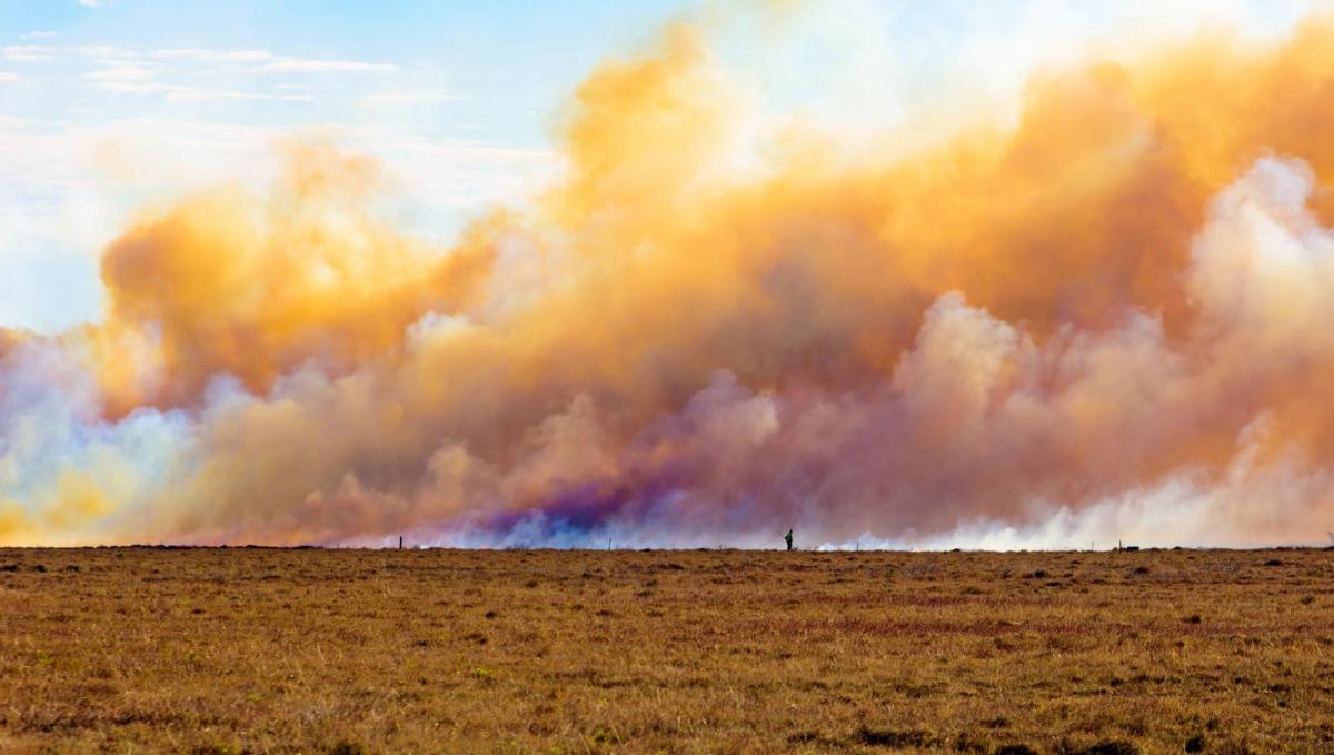
The lack of rain in parts of the UK continues with more water scarcity issues being highlighted and SE Britain is now at Extreme on the Fire Danger index. There have already been incidents this month.
This time last week we were facing heatwave conditions, the likelihood of record-breaking temperatures and the possibility of the first 40+C occurrence here in the UK.
As a complex area of low pressure pulls away towards Norway there is a pull of cooler air from the north or northwest for a time today behind it. Fronts push down eastern Britain today and then high pressure builds in from the Atlantic, settling our weather down towards mid-week. This means more of the mostly dry weather with just the odd shower.
Major incident at Hankley Common, Elstead Surrey
South-eastern Britain should feel comfortably warm with temperatures into the low 20s Celsius, London at 25C today and a light to moderate easterly breeze. That wind direction will be important for those who watched heath fires burn at the weekend and can still see smoke.
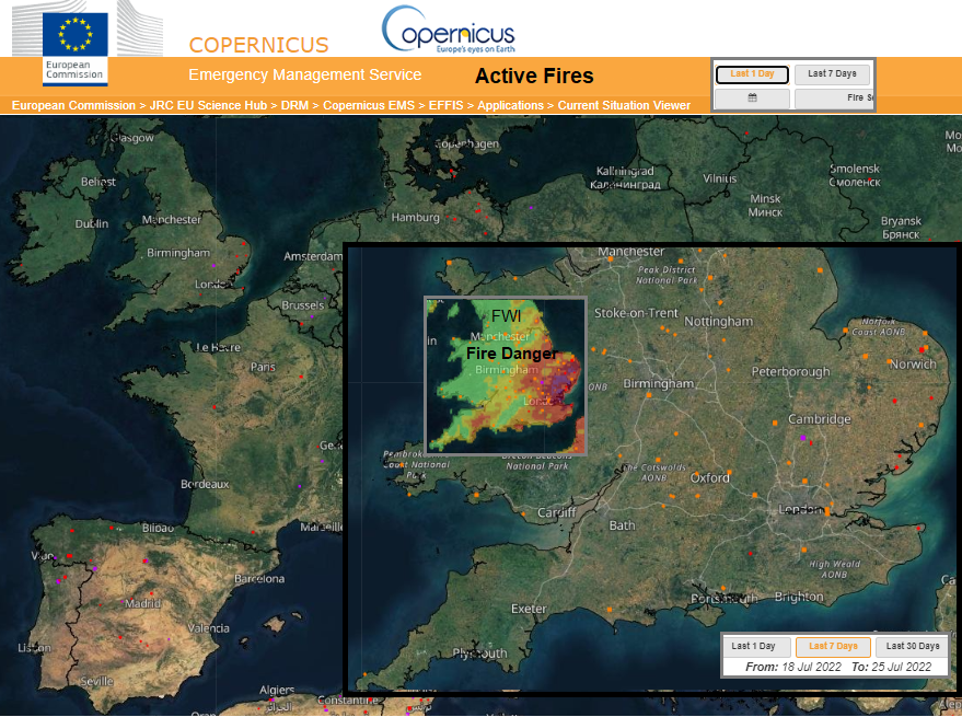
The EFFIS image shows active fires for Europe in one day, England and Wales over past 7 days and the current Fire Danger levels from the FWI, the Fire Weather Index. So, if a fire did start, what are the conditions like, how likely is it that the fire would spread. It’s not a ‘risk of fire’ indicator. The lack of rain, recent hot and dry conditions, the upcoming forecast, time of year and available vegetation all add into the index. Parts of eastern England are at Extreme Danger levels like southern Europe
The Environment Agency for England & Wales is highlighting very low river levels with July being very dry so far.
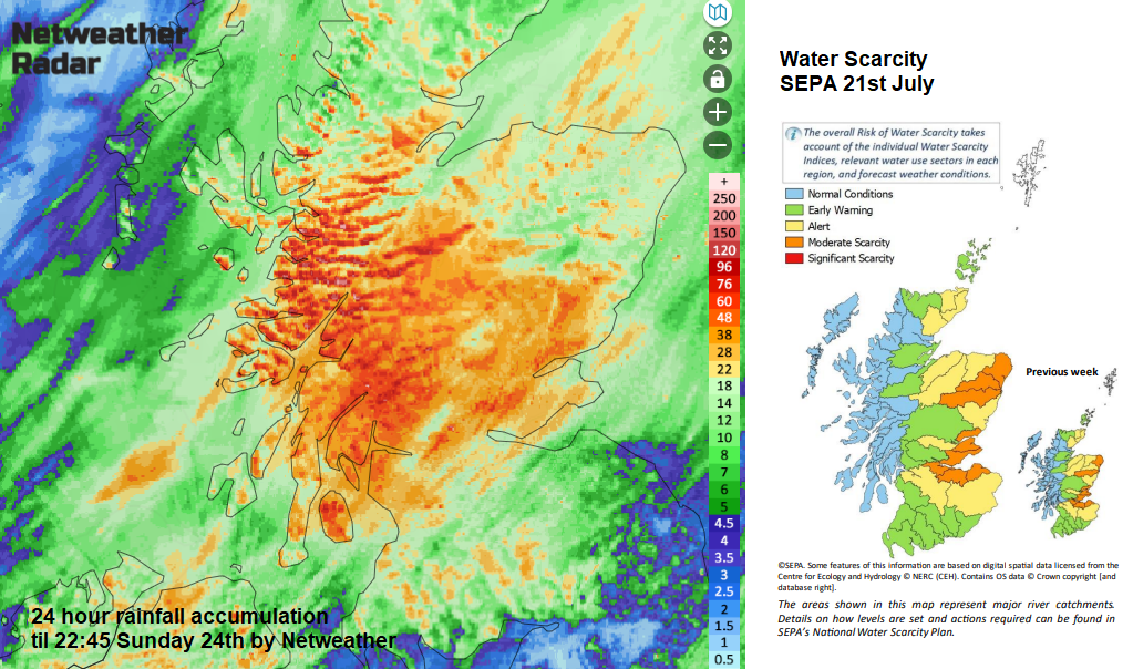
It has been a wet weekend for western and central Scotland but SEPA (the Scottish Environmental Protection Agency) are now highlighting moderate water scarcity for more parts of eastern Scotland due to the long-term situation.
“If dry conditions persist for a period of time, there becomes an urgency to act to protect water resources for critical activities that support Scotland’s communities.” SEPA
So welcome rain this afternoon for SE Scotland and NE England as the frontal bands push southwards but not enough. This main band of heavier rain pushes southwards to the Humber by this evening. However, this is not the time of year to be catching up with water resources. Still, little rain reaching southern Britain away from a few showers for windward coasts. Those water butts will remain empty.
As the high edges our way, the winds fall light and many places will be dry and bright. Still a few showers in the northwest flow for Scotland and north coast of Northern Ireland and the likelihood of more rain this coming weekend for NW UK.
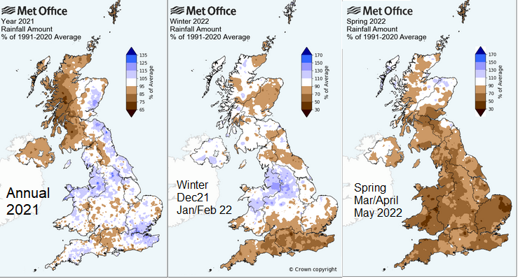
Last winter 2020/21, eastern Britain was very wet compared to average, western and northern Scotland very dry. Last summer (the 3 months Jun/Jul/Aug) south-eastern Britain was very wet but much of the UK drier than average, particularly western & northern Scotland which saw little rainfall compared to average. And after a slightly drier than average autumn 2021 for much of England and Wales, this Winter 2021/22 was drier than average for NE Britain and southern England. Spring 2022 drier than average for nearly all of the UK bar Grampian.
All of these events add to the available water for the next season even next year. Autumn/winter rains are very important.
We’ve just had a record-breaking week for temperatures in England, Wales and Scotland. The UK has passed 40C (provisionally) at several sites for the first time on record. Concerns about water scarcity are growing and, as across Europe, here in the UK some areas are on fire, or just smouldering away.
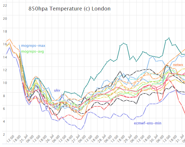
After this cooler start to the week, there are signs that temperatures will be rising as we head towards the start of August. A stronger signal for south-eastern Britain, warming up here, even getting hot (although not a signal to be as hot as last week). The spread of forecast outputs is still quite wide, so we will wait to see where the trend heads. Hot in the south or just warmer than average? Further north and west, Atlantic rain looks to swing in once more for next weekend, so closer to average with the temperatures and breezy at times too.