A look at the next few days UK weather before the extreme heat arrives. A fair start to the weekend as Friday's northern rain clears. Hotting up from Sunday into next week with health concerns.
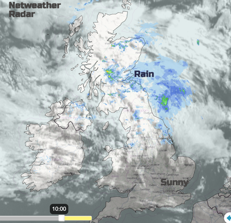
It’s raining this morning in parts of Scotland and northern England. It feels cooler and fresher but this rainband will drift eastwards and turn more showery with bright spells by this afternoon. Not sure St Swithin is on the mark this year for the north but maybe for southern Britain, we'll have to see how your '40 days' progress. "St Swithin’s day if thou dost rain, for forty days it will remain."
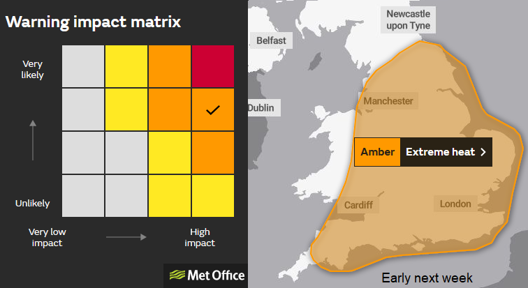
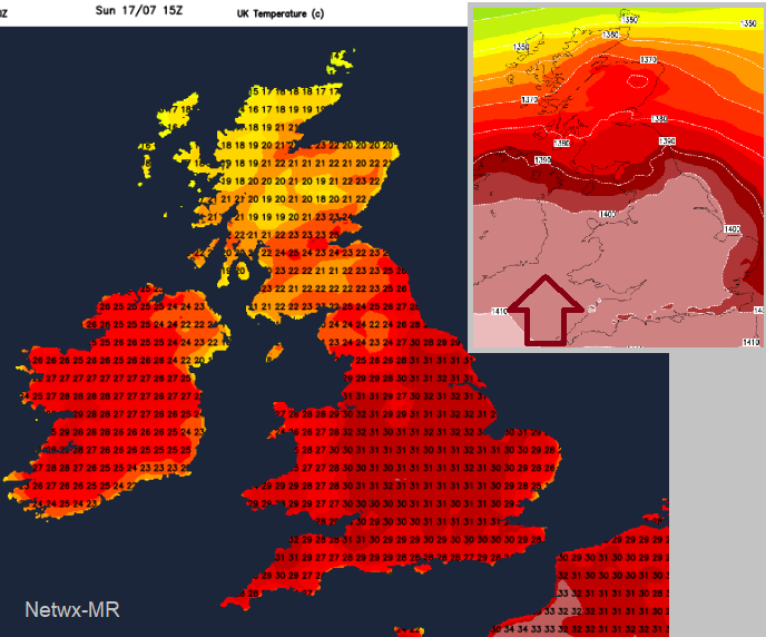
For southern Britain, there is sunshine again with top temperatures of 20 to 28C. There are still major concerns about the heat episode early next week. Still, a strong consistent signal for air temperatures to move up into the 30s C, potentially passing the UK record, even reaching 40C.
Spain and Portugal are already covered in heat warnings with temperatures moving up through the 30s C to 40C. France also has heatwave warnings in the south along with wildfire concerns. This hot air is forecast to move up through western Europe, reaching the UK early next week and bring hot days and very warm nights. This setup will bring health impacts.
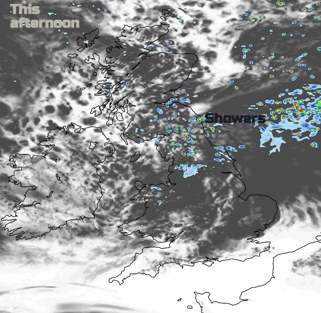
The rain band turns more showery as it clears from Northern Ireland by lunchtime and leaves only the odd shower for northern and western Scotland with brighter skies this afternoon. Temperatures will be 16 to 21C. The showers will reach north Wales, more of northern England with more cloud for Yorkshire by this afternoon. Through the afternoon the focus of any showers will be SE Scotland, over the Pennines and then more for NE England into the evening with the odd hefty downpour.
The showers fade from the west as pressure begins to build in from the Atlantic. This takes its time through the weekend to move across the UK and then across mainland Europe. It is behind this that the hot air will get steered up from France and the heat intensifies.
It will be dry with hardly any breeze. Temperatures fall between 7 and 14C
Another calm, fine day with temperatures in high teens, low 20sC for Scotland and Northern Ireland. Northern England and Wales in the low to mid 20sC. For the rest of southern Britain, the Midlands and eastern England temperatures span the 20sC. Just a bit of an east breeze catching Kent and southern Cornwall.
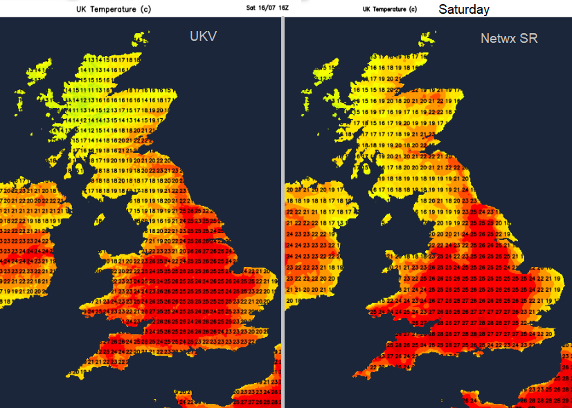
Comparing two computer model outputs of the air temperatures for Saturday 16th July
And a moderate SW wind for the far NW of Scotland as frontal bands brush past with developing rain and cloud later in the day as a cold front slides past this weekend. Showery rain could affect the northern half of mainland Scotland by early Sunday. Even throw a few showery bits a bit further south over Britain.
To the south of this it will be warm overnight at 15 to 19C for central England and inland Wales. With more of a breeze, SE Britain will cool off a bit during Saturday night. Relish this
Then we see the heat beginning to build from the south with a south to south-westerly wind. And more to come next week. There will be a Friday lunchtime update looking at next week’s heat.
“Some exceptionally high temperatures are possible both by day and by night; the cumulative effects of very warm nights (particularly in urbanised areas) and hot days are likely to bring widespread impacts to people and infrastructure. Although most likely less exceptional, it should also be noted that very warm to hot conditions are also probable across the majority of the rest of the UK.” Met Office