There will be warm sunshine at times but western parts will see blustery rain today and then a wider, more showery theme takes hold for the UK, with the threat of thunderstorms this week.
It’s the end of June, Wimbledon has just begun and there is heavy rain and thunderstorms in the forecast. Western Britain and Northern Ireland bear the brunt of the wet weather, swinging in from the Atlantic on low pressures with a warning for Heavy Rain from the Met Office today for SW Scotland as one rain band piles in here. There will be fine, dry and bright weather about too, and the June sunshine is strong and warm. Wimbledon should get away with a full day of play today after yesterday’s interruptions on the outside courts. Midweek, particularly Thursday will see heavy and thundery downpours then a gradual subduing of the showers for the end of the week with high pressure building over France, then Germany. So more so for SE Britain, still unsettled for NW UK.
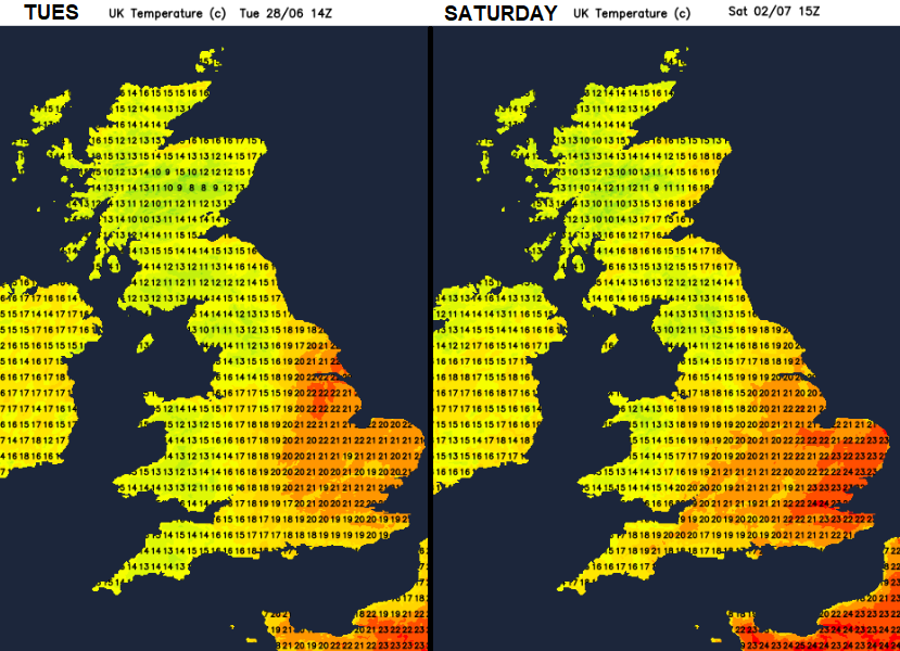
The sun’s rays may be strong but the air isn’t hot this week. Sheltered sunny spots will feel warm and the UV is still moderate to high but temperatures stay in the mid to high teens, just into the low twenties Celsius for the next few days. Then at the weekend, the sunnier eastern and southern parts of Britain could move into the mid-twenties Celsius.
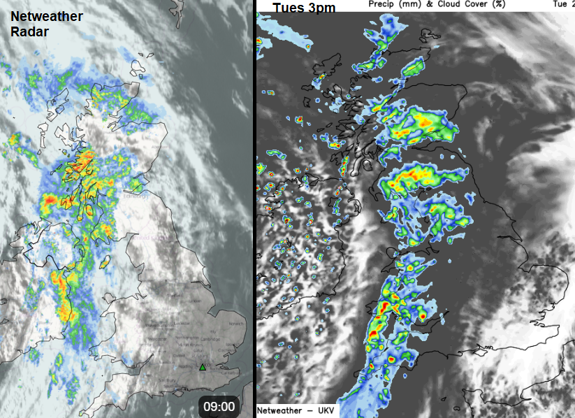
A mature low pressure is stalling out west with a whole collection of occluded fronts wrapped around it. These rain bands feed rain up from the southwest, over Northern Ireland and into western Britain. Northern Ireland will see the main rain and cloud band clearing eastwards this afternoon but there will be sharp showers with the brighter skies. A fresh southerly wind will veer to the SW later in the day but could be strong and gusty for the coasts of Down and Antrim so feeling cool here at lunchtime. It will be windy through the Irish Sea, the North Channel, up the west coast of Scotland. The rain just continues with Dumfries & Galloway and Ayrshire bearing the brunt of the incoming wet weather. There is the risk of flooding here and already Network Rail has introduced speed restrictions on some lines.
The rain will reach Wales and western England today but further east stays dry and bright with a brisk southerly flow. The rain band will work its way to inland southern Britain this evening and overnight, extending to inland northern England as sharp showers appear for Wales.
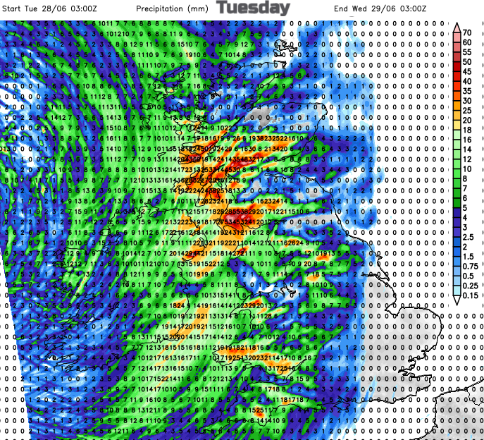
The winds ease off overnight and it will feel cooler. The rain reaches eastern Britain as the sharp showers move over SW Scotland. Northern and western parts of the UK will be prone to some heavy downpours but eastern England will be warm and sunny.
With cold air aloft by Thursday and very light winds, the showers could bring heavy downpours and the risk of localised flooding. There will be thunderstorms, but as always, some places miss them, others get very wet from the slow-moving downpours.
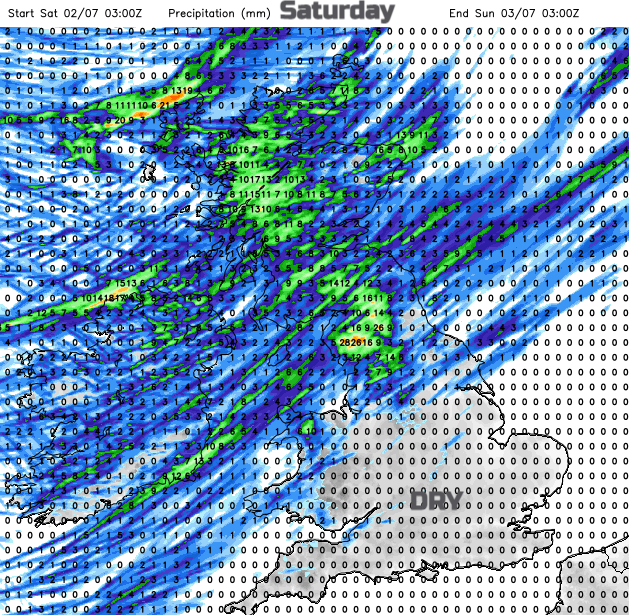
Friday again brings more showers and heavy downpours with a light westerly breeze. And by Saturday the southeastern half of the UK will be seeing more settled conditions, more sunshine, drier and feeling a bit warmer.