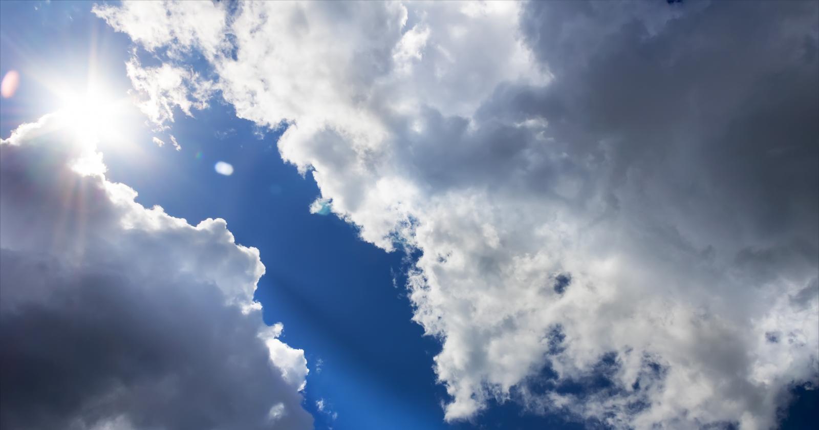
High temperatures, sunshine and heat on the way this week as the UK could see its first 30 Celsius plus days of 2022.
Hotting up this week with 31+ Celsius being mentioned in the south. There will be a lot of fine, dry and sunny weather with very warm air pumping up from southwest Europe. Today, however, temperatures are still stuck at 17 to 21C and it will feel cool tonight away from London and East Anglia.
Today, 13th June isn’t a date for heat. "It is the only date of meteorological summer (Jun/Jul/Aug) that hasn’t recorded 30C somewhere in the UK" says Alex Deakin, Met Office. Records go back to 1875. So far this year the UK temperatures have only had a one-day peak of 27.5C mid-May.
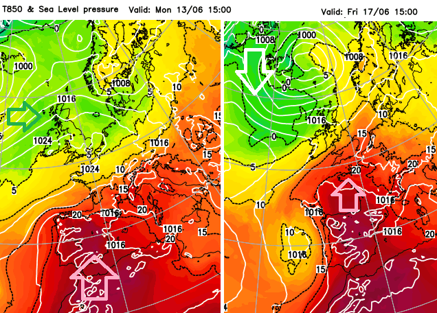
Spain saw 43.0C at the weekend with heat warnings this week. Also an extreme fire risk and Saharan dust is expected in the hot air moving up from north Africa. Very warm air will surge up from Iberia, through France and reach the UK over the next few days.
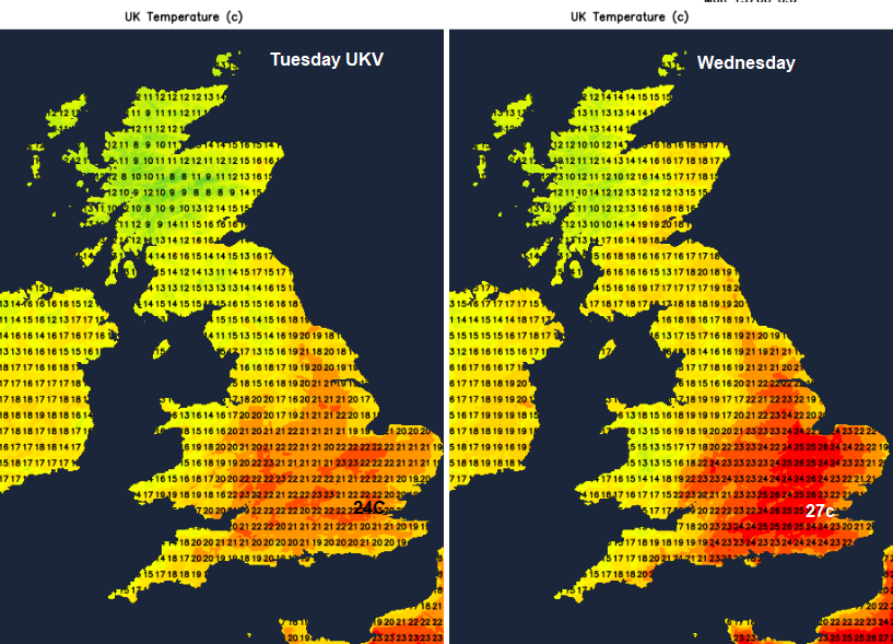
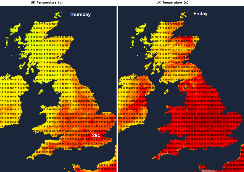
The heat builds towards Friday when temperatures look to tip into the low 30sC for parts of the UK. This would be the very warm, hot category for the UK. Northern Ireland and Scotland stay in the high teens for the next few days with up to 21/22C possible for Glasgow, Aberdeen and the southeast midweek. It could be hotter on Friday; it depends on the front.
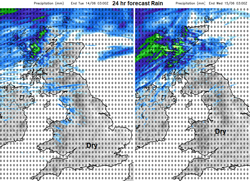
For much of the UK there will be a run of dry weather. High pressure is building in over the UK and this will bring fine, settled weather for most. However frontal bands will still manage to affect the far NW of the UK, more cloud and a few showery bits today reaching Northern Ireland and Scotland. And always more cloud and damp weather heading to western Scotland around the middle of the week.
There could be a shake-up by Friday, IF a cold front manages to work its ways south-eastwards over Britain against the very warm air possibly taking its time through Saturday.
In the UK, three consecutive days over set threshold temperatures are needed. This very warm air will certainly be a change from what we have been seeing in the UK recently. Southeast England might hold onto the heat long enough. Do take care in the higher temperatures.
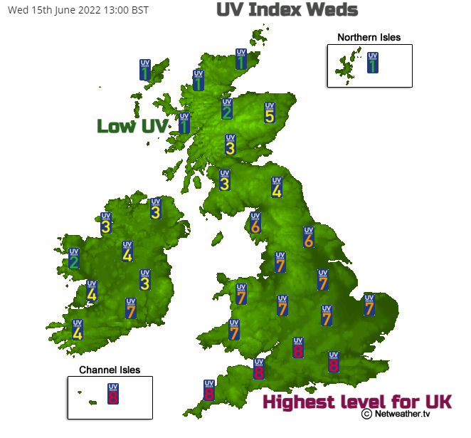
The highest levels of UV are forecast for England and Wales this week, 7s and 8s on the UV index. Take care if out in the sunshine, particularly in the middle of the day. “Slip, Slap, Slop - Slip on a shirt, slop on sunscreen and slap on a hat” as the Aussies say. With the additional Seek and Slide - seek shade and slide on wraparound sunglasses to prevent sun damage.
“The UV index does not exceed 8 in the UK (8 is rare; 7 may occur on exceptional days, mostly in the two weeks towards the end of June). Indices of 9 and 10 are common in the Mediterranean area.” Met office
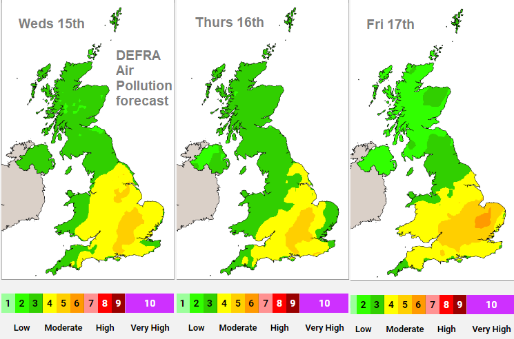
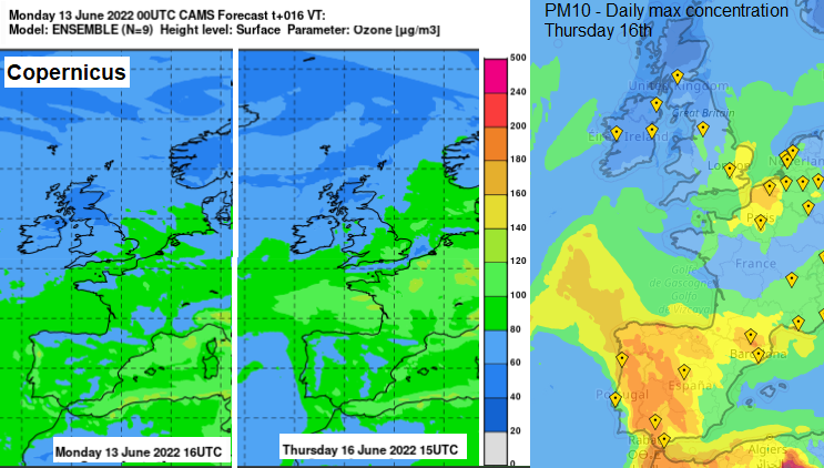
The DEFRA air quality forecast is already showing Moderate levels of air pollution for midweek over Wales and parts of England. This looks set to continue and worsen as the light winds continue under the high pressure with the warm, sunny weather. Ozone levels are forecast to rise and particulates.
We start with a light westerly wind, which backs to the southwest on Tuesday. Highland Scotland and the Western Isles will be blustery throughout. Very light winds across the UK by Wednesday and variable around the high on Thursday. Although more of a southerly wind for Northern Ireland and west coast Scotland on Thursday, reaching northern Scotland by Friday. Depending on the timing of the cold front later this week, the winds will dramatically veer to the N/NW, a much fresher direction.
Midsummer is getting closer and the evenings are so light. London sunset is 21:18 with sun rise 04:43 Edinburgh sunset 21:59 and sunrise 04:27. For Lerwick, it is barely getting dark now with the simmer dim and sunset 22:29 and sunrise 03:40. Plenty of hours of sunshine to add to the very warm air. Middle of next week, no-one wants to hear “that’s the nights drawing in now” No-one.
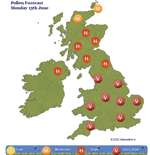
Grass and nettle pollen levels will be high to very high in this very warm, dry weather. Spores are also moderate.
Saturday could be hot as well, but by Sunday it looks like that the fresher North-westerly flow will have taken hold. The ECM model shows the cold front reaching from The Wash down to Cornwall by 18Z on Saturday, so heat continuing for SE Britain ahead of that. Cooler in a NW flow further north. The Netweather NMM has the front over Northern Ireland to Glasgow by Friday evening, stalling over southern Scotland Saturday morning, which could bring heavy rain there. This keeps the heat for England and Wales on Saturday but saves the rain until Sunday. The Met Office model has the frontal band from the Bristol Channel to the Humber by 12Z on Saturday, so southern Britain keeping the heat.
There could be thunderstorms before this breakdown at the weekend and southeast England might keep the heat a bit longer. For most, there is an increase in temperatures in the coming days, peaking on Friday and then fresher air from the northwest.
What is a UK heatwave, the thresholds and heat warning advice