The first hot spell of the summer is on the horizon, with most of the weather models pointing toward a plume of heat pushing up into the UK from the south later this week.
The first hot spell of the summer is on the horizon, with most of the weather models pointing toward a plume of heat pushing up from the south later this week. Ahead of that, with high pressure becoming ever more dominant from the south, many parts of the UK will be turning increasingly warm and sunny - although the far north and northwest will take longer to get in on that action and may keep some unsettled weather at times.
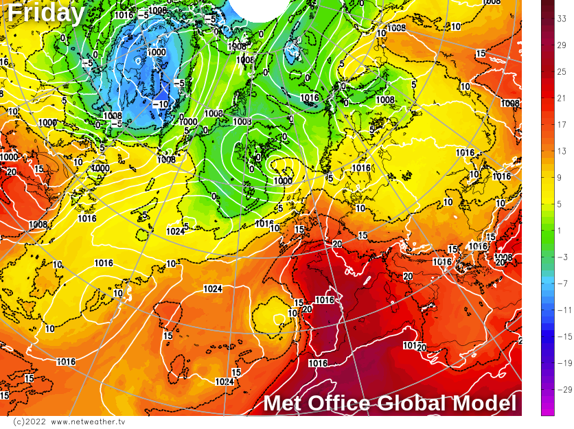
At this range, the difficulties are in pinpointing the level of heat likely - some model runs suggest the June record of 35.6c may be in danger, and others suggest something into the low-thirties may be the peak. The map below, from the Met Office global model, shows the heat moving up from the continent on Friday.
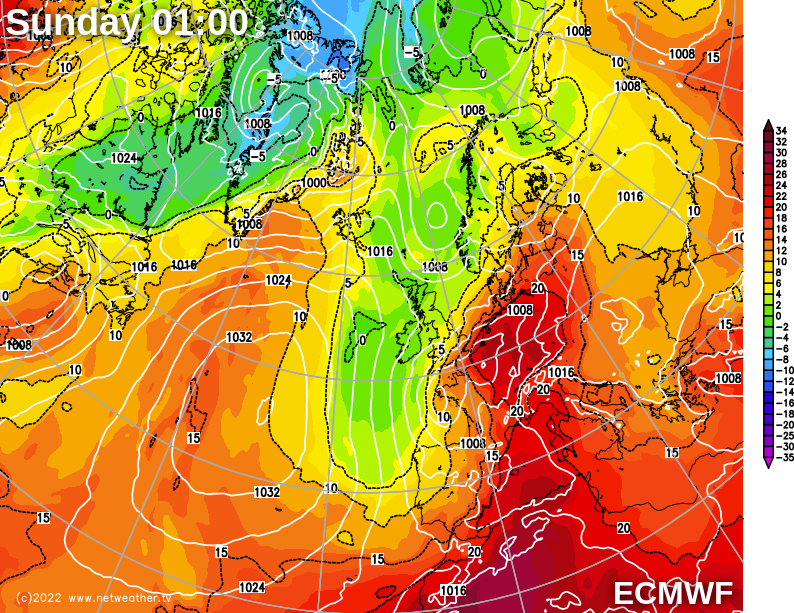
Also, the length of any hotter spell is up for some debate, with a relatively quick and potentially thundery breakdown at some point next weekend looking a fairly likely scenario at the moment. The ECMWF model is currently one of the faster forecasts in terms of breakdown, with the hot air virtually all pushed away from the UK from the northwest by Sunday night.
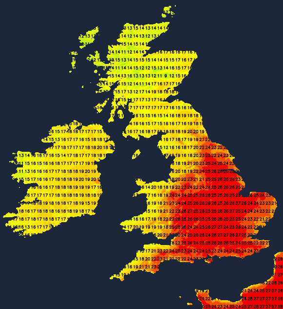
Temperatures-wise, it'll be a slow ramping up of the warmth and later the heat through the week, with England and Wales and particularly southern and central regions seeing the highest temperatures. Monday, the low-twenties will be the peak, by Tuesday that rises into the mid-twenties, Wednesday the high-twenties and perhaps by Thursday (depending on how much sunshine there is) and more likely Friday, we'll be into the thirties.
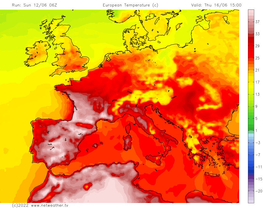
Spare a thought for those in France and Spain this week, as some will be seeing highs into the forties celsius.
In terms of rainfall this week, for most it'll be dry with the majority of any wet weather affecting the far north and particularly northwest of the UK. Any rain will generally be showery away from the far northwest, where there could be some more persistent spells as well. As we head into the weekend, we may see a band of constant rain moving down from the northwest, ultimately bringing a change away from the fine, warm weather, plus we may also need to look out for some thundery rain and storms affecting southern and central at around that time too - but that's very uncertain at this stage.
Looking in a little more detail day to day, Monday will start fine for many in England and Wales but cloudier for Scotland with some showery rain affecting the northwest. As the day moves on, cloud will increase in England and Wales, especially in central and eastern regions. Some showers will also feed into other parts of northern Scotland, with a few feeding further south and into northwest England - but they'll be very few and far between. Temperatures will typically range 14-18c for the northern half of the UK, 17-21c elsewhere.
Tuesday sees some showers again affecting the north and especially northwest of Scotland but elsewhere it's fine, dry and increasingly sunny as high pressure exerts its influence with temperatures of 21-24c widely across England and Wales.
Wednesday will be similar again, with lots of sunshine away from the far north and northwest, where there'll be a scattering of showers. Temperatures are likely to be up a notch again, with maxes of 26-28c likely.
A weak front may bring more cloud across the country on Thursday, but it'll still be very warm, if not hot - particularly in the south and southeast during any sunny spells. By Friday we could see that hot plume of air coming into play - pushing temperatures higher still.