Still a cold north wind with wintry showers but fine sunshine. Frosts by night but a shift to milder air to end the weekend. Warmer next week but unsettled.
A cold northerly flow will continue into the weekend with the windchill remaining longest for eastern Britain. There will be widespread frosts and that north wind will bring wintry showers right down through the UK, most for northern Scotland but a few reaching down into southern Britain. Sheltered sunshine will still feel warm, so what to wear remains confusing and at times annoying. The middle of next week looks warmer for most.
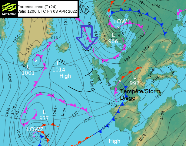
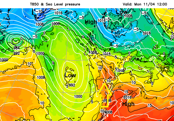
Yesterday’s nearby low pressure (Low1) has moved off over the Baltic sea but continues to steer cold Arctic air towards the UK. High pressure is beginning to build over the UK for the weekend with a lot of settled weather but still chilly. Until the next Atlantic low (Low2 ) moves in. This takes its time but will alter the air mass and flow to come from a milder southerly direction. So fine this weekend but cold by night and then warmer next week but unsettled.
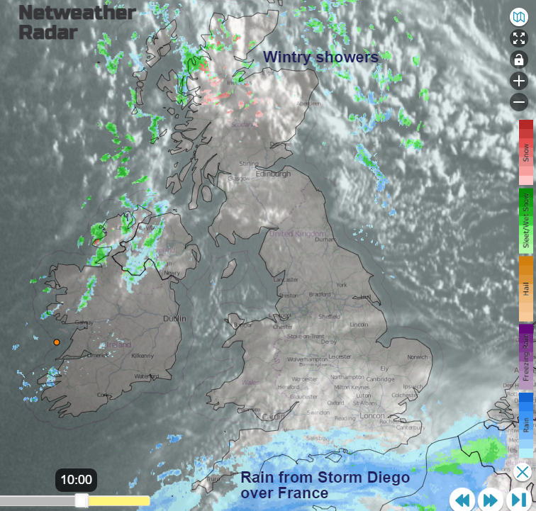
There has been rain brushing southern England this morning and miserable conditions for the Channel Islands as Tempête Diego impacted France. France is covered in warnings today for wind, rain and flood risk, snow & ice, even avalanches. Diego moves across the Alps on Saturday but then the same high pressure settles things down for the rest of the weekend as Easter Holidays really get going.
The rain from Storm Diego is clear on the Netweather Radar this morning, with clear skies and sunshine to the north. There is high cirrus for southern Britain and lumpy shower cloud for Northern Ireland and northern Scotland. These showers feeding in on a north to NW wind are of icy rain, sleet and hill snow although there could be flurries to lower levels at times. As the showers arrive, there will be gusty winds, it will feel much colder and more like winter for ten minutes as it passes by.
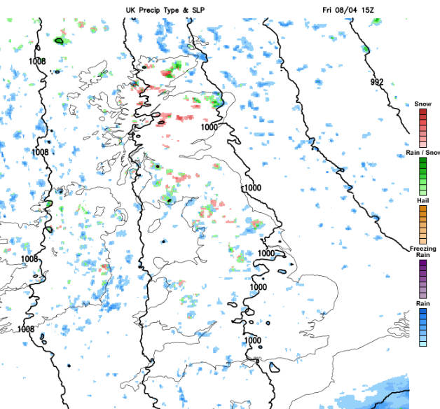
Isolated showers and a few clusters work their way right down through Britain into the evening, fading as rain over SE England around midnight with a slight risk of ice. Snow showers continue for northern and NE Scotland through until morning with temperatures widely around freezing inland across the UK. There will still be a noticeable cold breeze for northern Britain and eastern England on Saturday. For SW England, and south Wales lighter winds and warm sunshine and calm for Northern Ireland with plenty of fine weather. Scotland continues to see wintry showers on a west wind.
Calm and clear overnight with the high over the UK, it will be dry and frosty.
Sunday
Cirrus will soon be over Northern Ireland on Sunday morning as the winds back. Fine and settled with hardly any breeze for Britain. The high cloud will increase from the west through the day but it will feel warmer with plenty of fine weather.
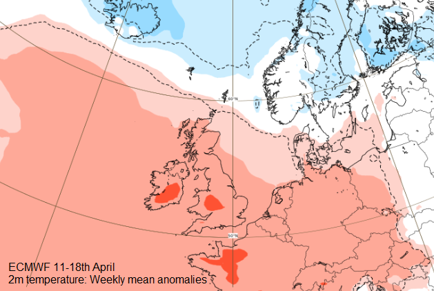
Next week, more cloud, outbreaks of rain, sometimes heavy with blustery winds. There will be a warmer flow of air from the south. Temperatures will shift into the low/mid-teens with some southern areas potentially getting even warmer by the middle of next week. The cold air remains for the Northern Isles and might get caught up just before Easter weekend, pulled onto the east coast of Britain. We await developments. Chilly air but fine this weekend, warm sunshine and a milder end.