Sunshine and blustery showers for many today, turning colder from the north Thursday & Friday, as winds turn northerly, with wintry showers.
There was a big contrast in temperatures between the far north and south yesterday, it was warm in the south with Frittenden in Kent reaching 16.3C, while across northern Scotland it was cold with snow and a high of only 1.4C at Aboyne. Today the cold air will retreat to the Northern Isles and most of the UK will be in the same boat of sunshine and showers for many, with a risk of hail and thunder in places.
Turning colder from the north across all parts later in the week:
The cold arctic air lurking to the north of Scotland will make it’s way south though during Thursday, as winds switch to a northerly direction, bringing a cold end to the week, with sunny spells and wintry showers feeding down across the UK, though most of the showers will be in the north. A return of widespread north Friday night too, so gardeners be aware.
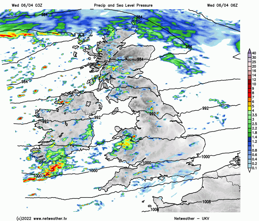
For now, a windy morning for many, cloudy and mild across the south, bright and chilly across the north to start. Heavy showers from the word go piling in across western areas, some patchy drizzle for the southeast, sunniest across northern and eastern areas. Area of heavy showery rain pushing in across Wales at breakfast time will spread eastwards across England through the morning, following will be sunny spells and squally scattered showers, some of which will be heavy with hail and the odd rumble of thunder. Scotland and N. Ireland seeing spells and squally showers, which will be wintry over higher ground.
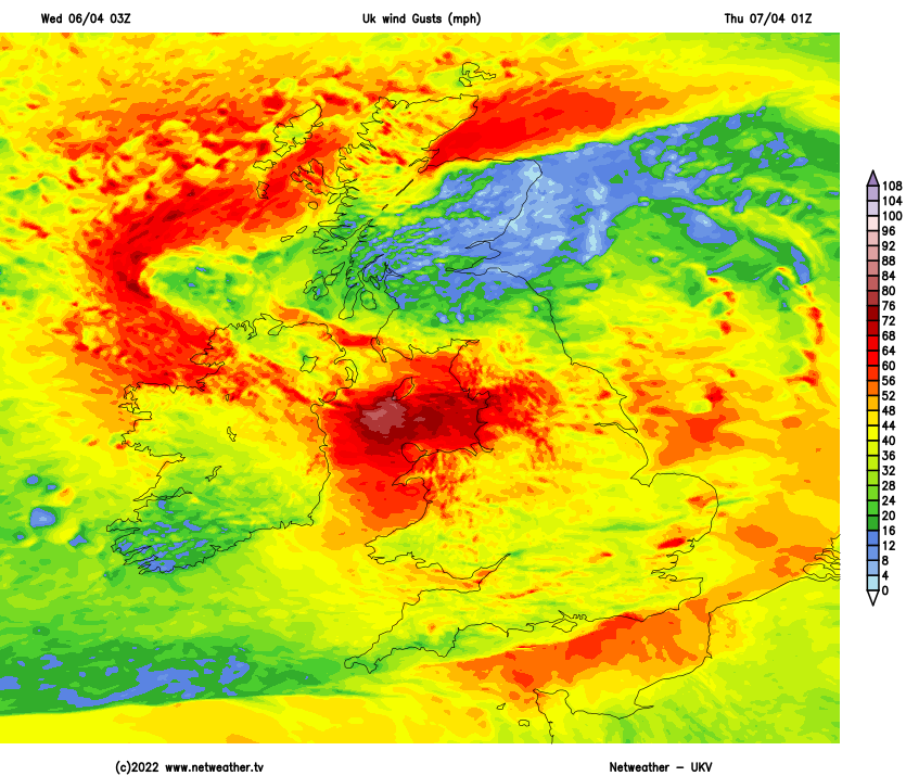
A windy day for most, gusts of 30-40mph possible, particularly around coasts and over hills. Not quite as warm across the south today, a cold front bringing showery rain east across England and Wales clears through, temperatures reaching 11-12C across England and Wales. It won’t be as cold across northern mainland Scotland today though, temperatures reaching 7-10C across Scotland and N. Ireland. Cold across the Northern Isles though.
Still windy tonight, strengthening across the north, with gales developing in the north and northwest – as an area of low pressure arrives from the west. Showers fading across England and Wales, but a spell of persistent and heavy rain spreading east across southern counties of England and the Channel Islands, perhaps clipping the far south of Wales. Blustery showers across Scotland, N. Ireland and northern England – which will turn increasingly wintry. Dry with clear spells in between.
Gales developing tonight across the northwest in particular
Cold air, sunshine and showers, which will be increasingly wintry with snow over hills, will spread south across northern areas through Thursday, as winds turn northerly. Drier and brighter in the south in the morning, though a few scattered showers likely to arrive from the north in the afternoon, as winds veer northwesterly – milder air hanging on here until later in the day. Afternoon temperatures reaching 6-9C across Scotland, N. Ireland, north Wales and northern England. 10-12C across south Wales, southern England and East Anglia.
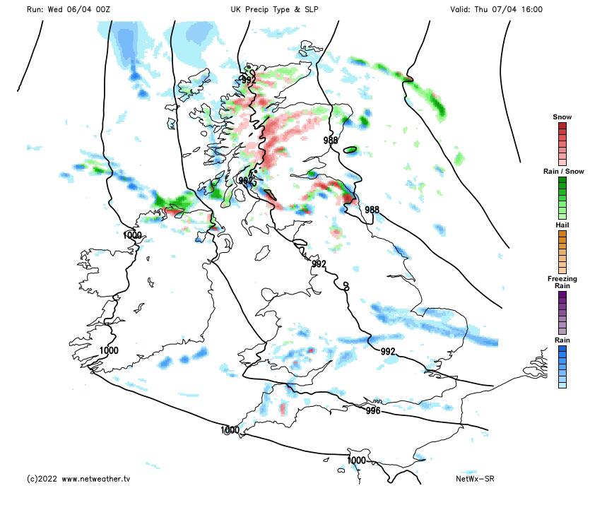
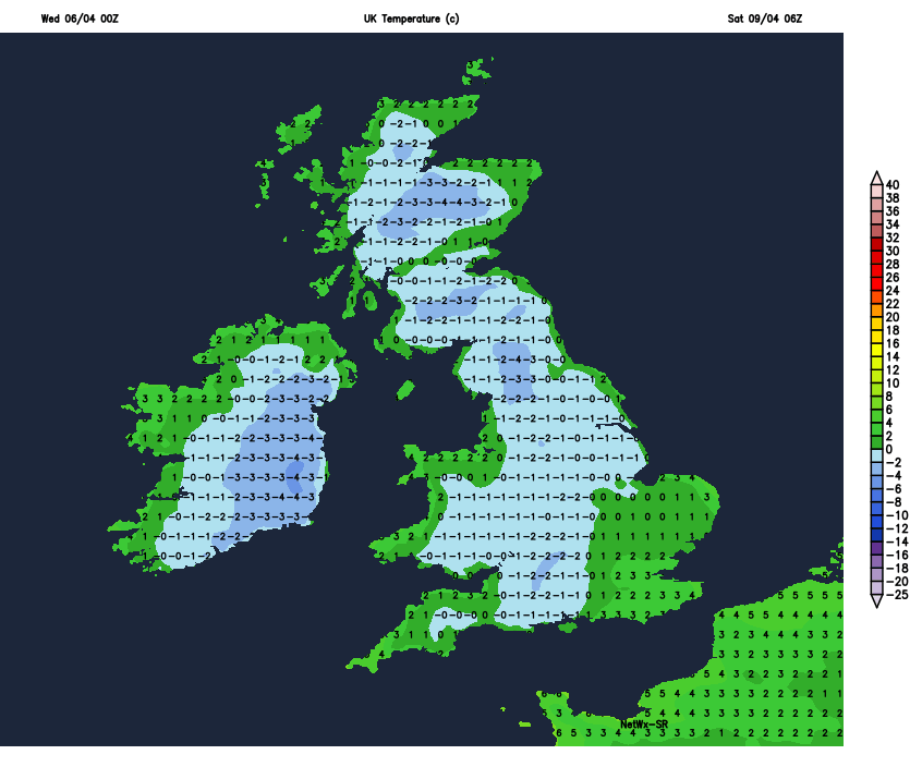
Cold arctic air right the way across the UK for Friday, sunshine and scattered wintry showers for most, cloudier across southern England during the morning, with a risk of some rain across English Channel coastal areas. Temperatures reaching 6-9C.
Widespread frost Friday night
Cold Friday night, with a widespread frost. Then Saturday should see fewer showers and longer sunny spells across most areas – as a ridge of high pressure builds in from the west. Further wintry showers across northern Scotland though. Still on the chilly side out of the sun. Milder, cloudier and windier on Sunday, with outbreaks of rain spreading northeast across many areas, heaviest across the north and west, preceded by snow over Scottish hills for a time. Perhaps little in the way of rain for the southeast.
Some uncertainty for how next week pans out, it will likely continue unsettled but mild early in the week, with further spells of rain or showers, but also some warm sunny spells – especially in the east. Mid-week onwards the uncertainty grows, ECMWF model keeps the UK unsettled, GFS brings in high pressure with dry and fine weather.