Colder air and frost - tick. Scattered snow showers for NE and eastern Britain - tick. A waving frontal band for southern England with rain and snow early Thursday - not sure.
As March ends and April begins there is a strong signal for things to turn colder for the UK. The air mass will change, we have a flow of cold air coming down from the Arctic following a cold front that has just reached Scotland. There will be night-time frosts and daytime temperatures below average. The upper air is easily cold enough to support snow showers by Wednesday night right through the UK and that stays until Friday night. There is already a Snow and Ice warning from the UK Met Office for northern Scotland later Tuesday into early Wednesday from snow and hail showers. Thursday and Thursday night looks the coldest times, and the chill slowly eases through the weekend. Taking its time for eastern Britain but easing off from the northwest during Monday.
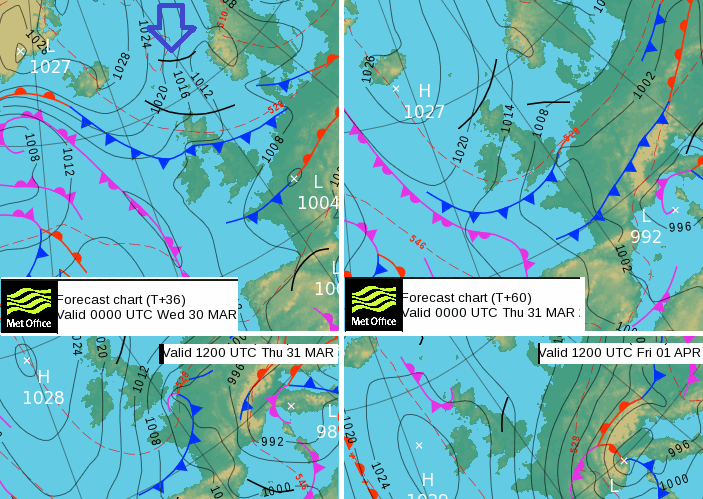
Surface pressure charts -tonight, tomorrow night, Friday and Saturday
The cold front is key to starting all this. Behind that will be a few wintry showers on Tuesday, turning to snow into Wednesday but snow on the back edge of the cold front by dawn on Wednesday over the Pennines and possibly other hills of northern England, maybe flurries elsewhere.
That cold front reaches right down through the UK by Wednesday night, giving snow to Snowdonia as it passes.
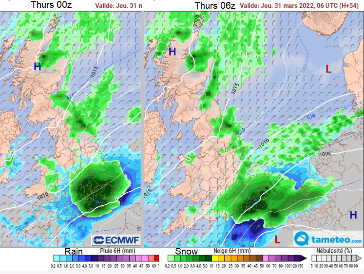
Other things to watch for are a possible wave/low development early Thursday along the front. So, a wave which would keep the precipitation over SE Britain for longer, the cold air digging in behind and it’s night time so colder. This will be the tricky bit. The models have been disagreeing and so hard for forecasters to share that uncertainty.
High pressure begins to build in from the west, but other features could get caught in the flow from the north and draw cloud, rain and snow down through the UK. There is a signal for something moving through Friday night into Saturday.

A cold snap for early April. This happens, think of Easter weather in the UK. It can snow or be a heatwave, as movable as the feast itself. What will be the impacts?
Some parts of the forecast have more certainty, others look to be frustrating but at least it’s not early February. The ground is now warmer, it’s had a long spell of incoming solar radiation. Any falling snow shouldn’t cause many problems. The main focus for the second part of this week for NE Britain is the snow showers coming in off the North Sea. There might be a light covering over the main hills of southern Britain early Thursday to set off social media excitement. However, it is the early Thursday (possible) frontal wave that is causing agitation.
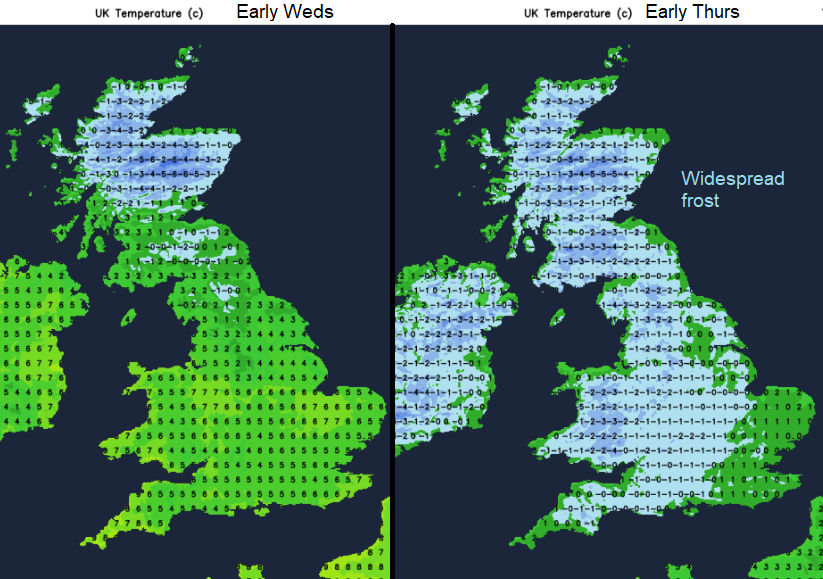
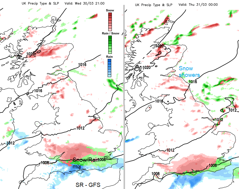
Gardeners and growers face a tricky time. It’s been so dry yet with lovely sunshine. Now, these widespread frosts are forecast. Starting in Scotland as the cold front moves south, then for much of the UK by early Thursday as the cold front clears the English Channel.
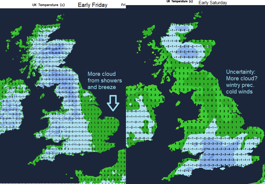
Another widespread frost for Friday morning, sheltered spots in eastern England could also see a frost, depending on the gaps in the cloud cover but there looks to be a bit more breeze stirring the air here. Later on Friday an area of cloud, rain and possibly hill snow looks to move down the UK. That will affect the temperatures, but the positioning could be different.
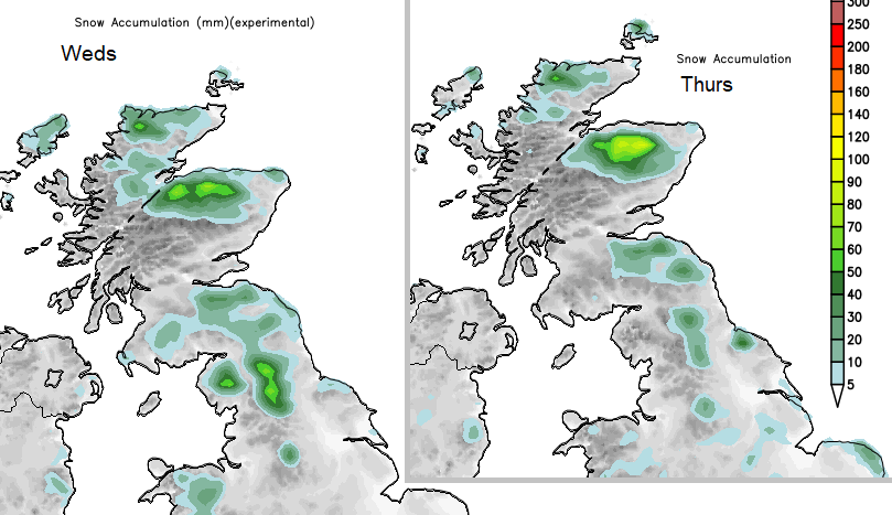
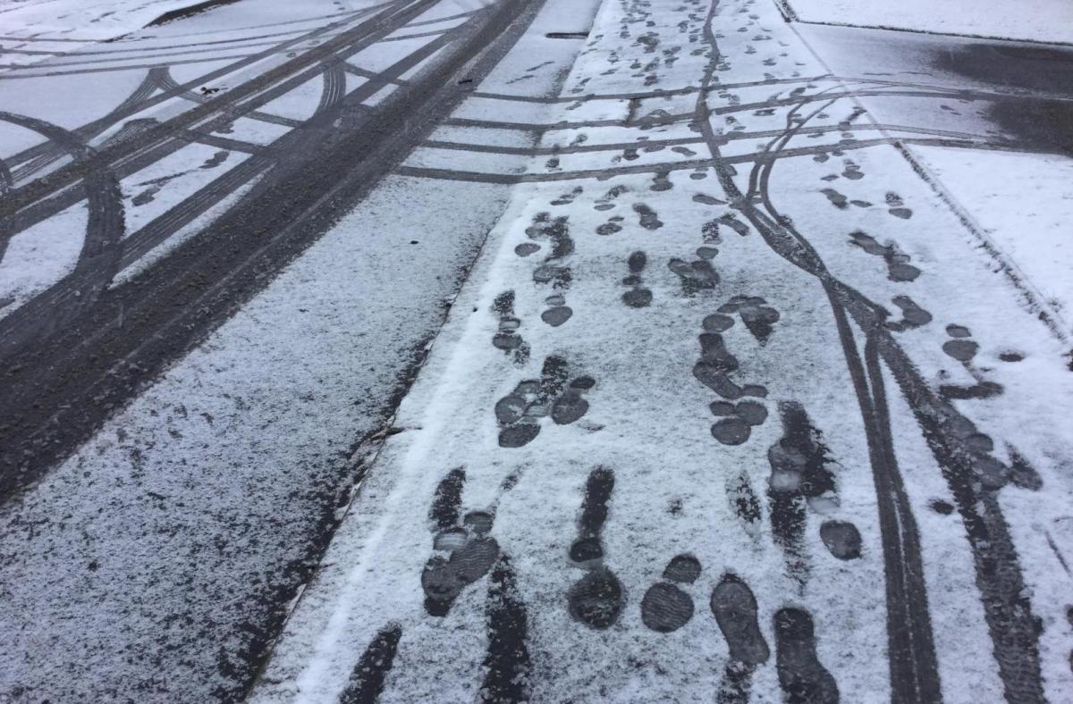
These are the main areas expected to see lying snow from the next few days snow showers and passing frontal band.
By Wednesday morning there will be hail and snow showers for northern Scotland with a cold, blustery north wind.
As the cold front band edges southwards on Wednesday, wintry showers, turning to snow look to reach Scottish Borders, NE England into Yorkshire on a chilly NE wind but well scattered. You might see flurries but not much more. There could by the afternoon be a covering of wet snow up in Peak District as the cold front clears southwards and snow for Snowdonia.
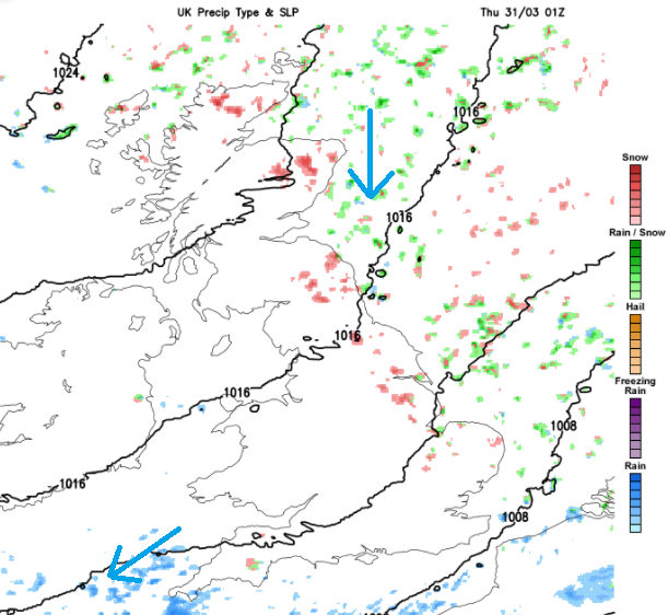
More well scattered snow showers for NE Britain edging down from the north and extending down to East Anglia by Wednesday night. This is the colder air and snow showers dig in off the North Sea early on Thursday for eastern and NE England and NE Scotland. Very little elsewhere on the Met Office UKV model. Just more well scattered snow shwoers working their way further south.
The GFS seems very keen on a rain/snow mix along the frontal boundary earlier in the night, moving over more of southern England. Which could bring some tricky conditions for Wednesday night and leave more areas with a temporary covering of white first thing on Thursday morning. This pulls away across SE England before dawn on Thursday
The EC model, like the GFS is much bolder about more snow, developing the waving front to have heavier rain and snow on the back edge. Northern France including Lille has sleet showing with temperatures of 1 to 3C on the public Meteo France forecast. The ECM is certainly going with the cold air but it does tend to overdo UK snow.
Depending on how the wave/low over SE England/N.France develops there could be strong, gusty north veering NE winds for Thames estuary, Kent and eastern Channel making it feel even colder.
Quite a change coming up, from the settled, fine weather with warm sunshine to a bit of a shocker with the cold air. Frosts, a real chill in the air and some snow. Grampian most likely, east coast Britain also likely to see snow showers, less so further west, not much for Northern Ireland. And uncertainty about Wednesday night/Thursday morning frontal wave in the south.
We’ll see how the models progress. Further discussion in the Netweather community forum