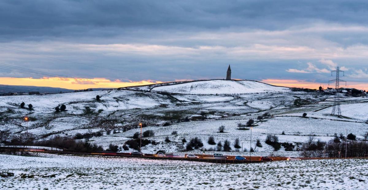
After the spring warmth recently, with temperatures reaching the low twenties, winter bites back to end the month, with temperatures in single digits and snow for some by Thursday.
It will turn much colder as we head through the rest of the week. Yesterday reached 18C across west Wales and western Scotland, but much colder arctic air will move down across northern Scotland today before spreading south across the UK behind a cold front on Wednesday – which will reach southern England Wednesday night. The cold front will pep-up as it moves south on Wednesday, bringing a band of rain but also hill snow on the back edge – as colder arctic air undercuts from the north. Wednesday night could see snow fall to low levels, even in the south, as the cold front clears here, so some waking up to a covering of snow on Thursday morning. Thursday and Friday will be cold, with wintry showers in many places. Turning less cold through the weekend, but remaining unsettled
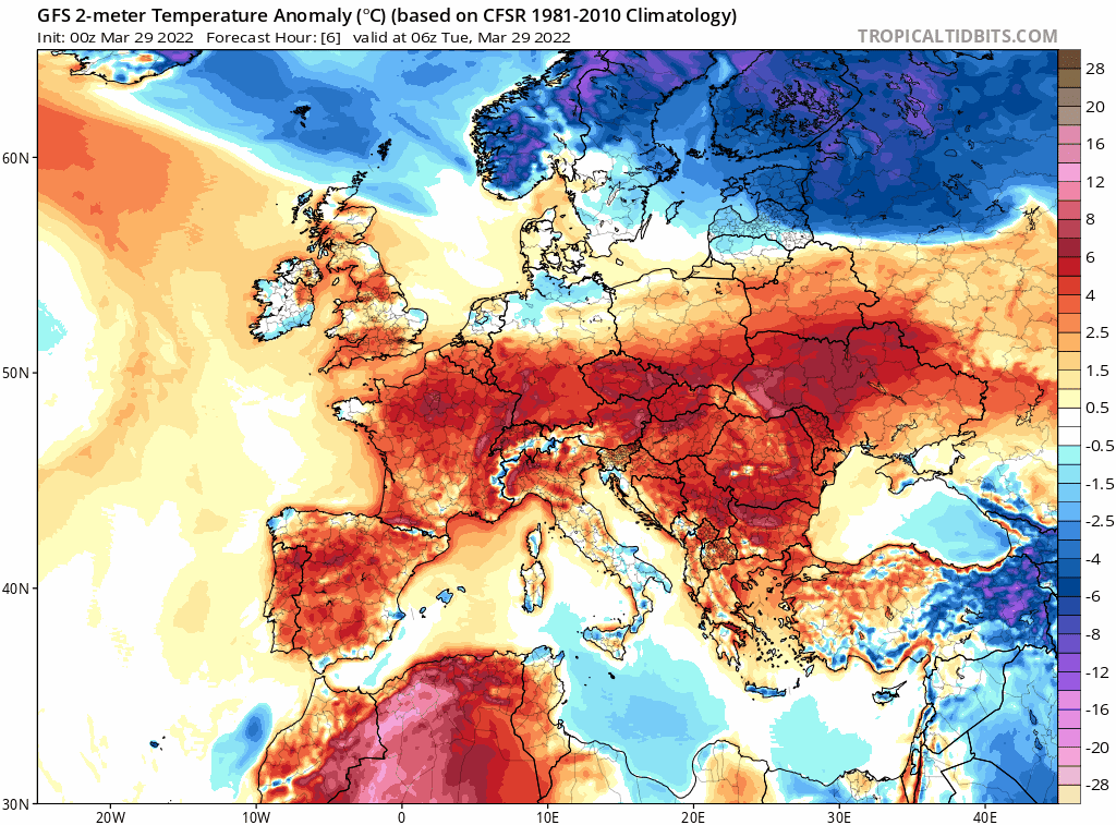
Cold arctic air spreads south across the UK and much of northern Europe by Thursday
For now, we have two weather fronts bringing some showery rain at opposite ends of Britain this morning. One front across the far south will bring cloudy skies and some showery rain across southern England this morning, the rain easing south through the day and becoming confined to southern coastal areas and the Channel Islands. Across northern Scotland, a cold front will arrive from the north with cloudy skies and some showery rain moving south across Scotland through the day, followed by much colder air across northern Scotland, with increasingly wintry showers, falling as snow to low levels across the Northern Isles and the far north of Scotland later.
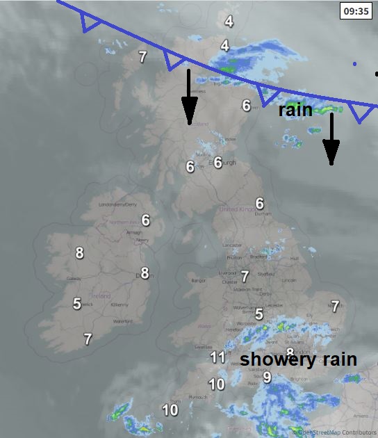
In between these two systems bringing showers at opposite ends of Britain, a misty and murky start for many, with some fog patches in places. Sunshine from the word go though across parts of the west though and there will be increasing amounts of sunshine across Wales, N. Ireland, central and northern parts of England – but the sunshine will trigger some slow-moving showers in places – especially over hillier areas – but they will be hit and miss.
Temperatures down on yesterday across the board. Temperatures reaching 11-14C at best, warmest temperatures across the west, coldest towards eastern coasts with onshore wind. Colder across northern Scotland as the colder arctic air arrives here, temperatures reaching 6-7C at best this afternoon, only 4C in the Northern Isles.
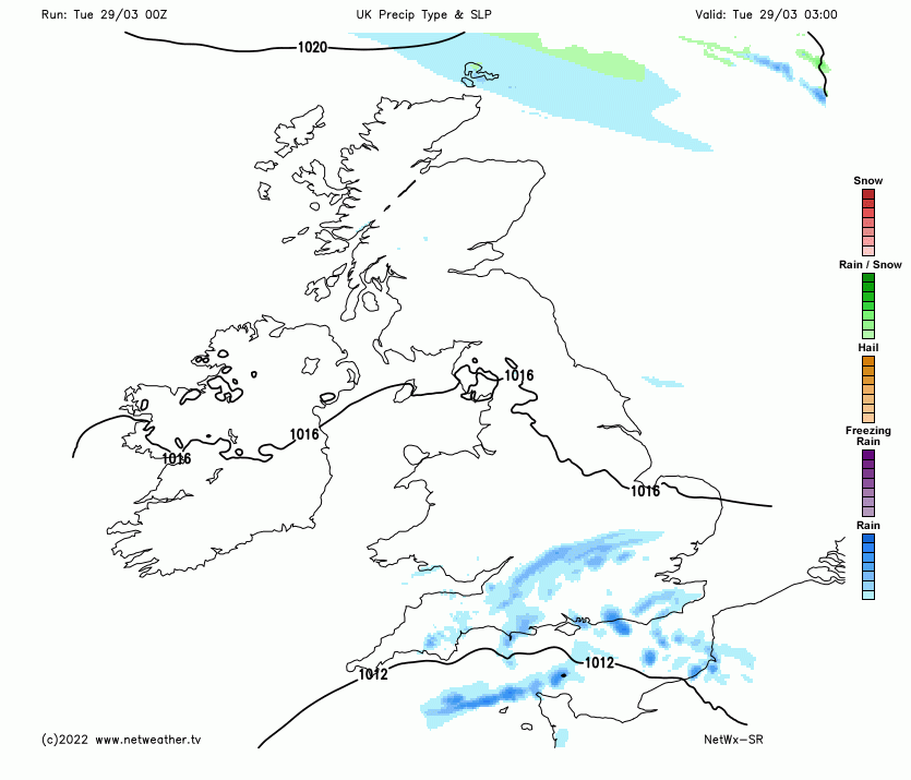
A band of rain, sleet and hill snow will continue to spread southwards across southern Scotland and northern England this evening and overnight, colder and clearer conditions following across Scotland from the north, leading to a frost, though some snow showers for northern Scotland. Wales, Midlands, southern England and East Anglia seeing any showers easing to a mostly dry night with clear spells, turning chilly, with perhaps a local patchy ground frost by dawn.
Cold front will continue to move south across England and Wales on Wednesday, with some rain along it but also some sleet and snow, snow initially falling over hills but increasingly falling to lower levels through the day across northern England – as colder air undercuts from the north. The rain, sleet and snow reaching south Wales, Midlands and East Anglia by early evening, before spreading down across southern England through the evening and overnight. Colder conditions with sunny spells and wintry showers following across Scotland and later northern England, snow showers across northern Scotland. Temperatures reaching double figures across the southwest and far south, but turning colder elsewhere, 7-9C Midlands across to East Anglia ahead of the cold front, 5-7C to the north of the front across northern England and Scotland.
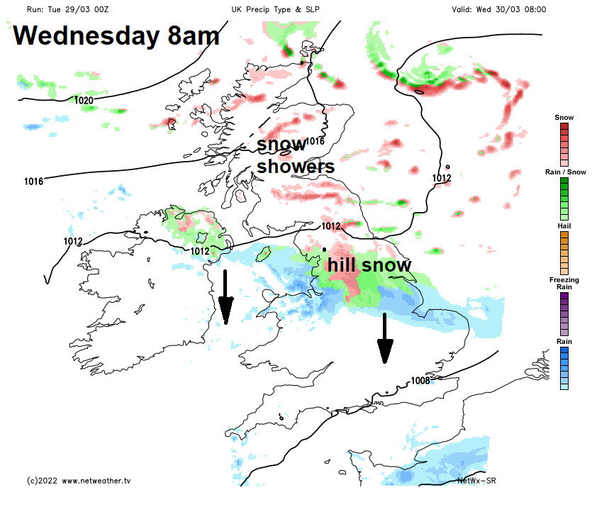
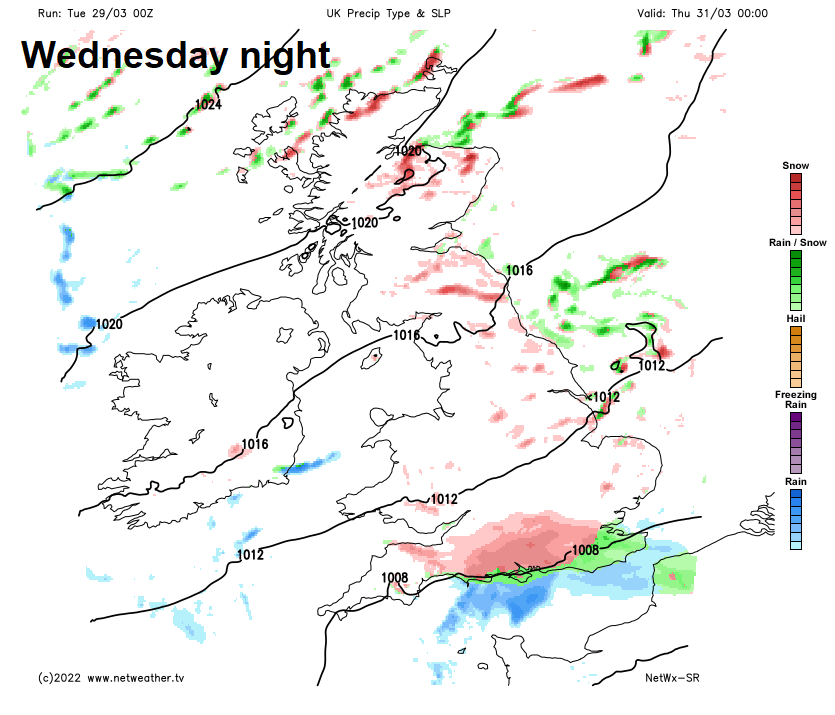
Rain, sleet and some back edge snow clearing southern areas Wednesday night, perhaps giving a covering of snow temporarily on Thursday early morning to wake up to, particularly over hills, perhaps to lower levels too, but unlikely to cause any disruption. Then following will be a cold day with sunny spells and wintry showers across all areas, showers of sleet, hail and snow driven through quickly by a strong northerly or northeasterly wind, which it will make it feel more like freezing than the highs of 5-9C suggest.
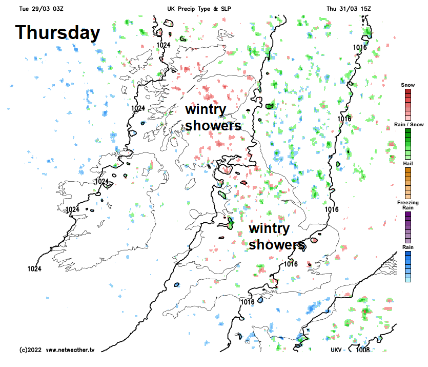
After a cold night with a widespread frost, Friday will see sunshine and further wintry showers for England and Wales in a brisk northeasterly wind, spells of rain and sleet preceded by snow spreading southeast across Scotland.
Further showers over the weekend, wintry at first, but increasingly of rain by Sunday as it turns less cold.