High pressure will bring a lot of settled weather this weekend for the UK. Dry, often bright but still with a cool breeze at times. Next week still looks fair but warmer as the flow comes from the south.
With high pressure nearby for the rest of this week, there will be a lot of fine, settled weather. It will be dry with some warm sunshine today and tomorrow. Chilly by night with patchy frost and a bit of mist and fog. The air is still from a colder source. Next week we'll pick up a warmer southerly. For the weekend, in the cooler air, we are at the time of year when how the day feels can vary greatly.
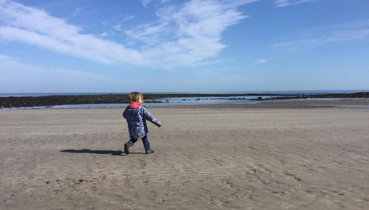
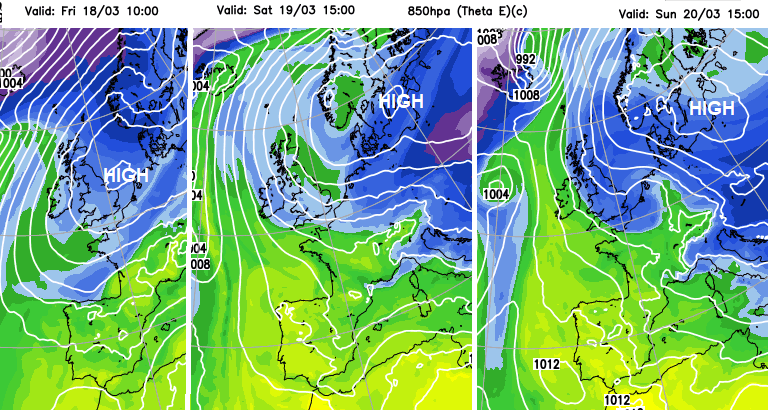
If you are sheltered sunshine, it can feel warm and it’s worth beginning to think about sun protection especially if you will be outside all day; walking, playing sport or off to the beach or park. There could be a few spots on Saturday in the sheltered west of Britain that might reach 17C. Saturday looks blustery but cooler air will reach the UK by Sunday; all the time drawn around the western side of a high pressure dominated the weather over northern Europe.
The air isn’t that warm over the next few days. So, adding on a brisk wind, particularly along North Sea coasts will keep a chill in the air. If the sun disappears behind clouds, then it will also feel cooler. By day temperatures will be around 10 to 14C and then after dark they fall well down into single figures. Cloud cover varies but there will still be clear spells allowing temperatures to dip further and this allows some frost.
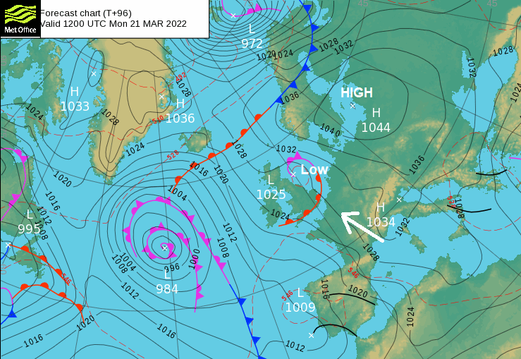
The only hiccup in this settled story is a feature moving north from the western Alps in the middle of the weekend. Spain and Portugal have seen some very unsettled weather recently. The high pressure centred near to Denmark will reach 1050hPa by Saturday and as the flow in between shifts into Sunday, this feature will get caught in the more southerly flow up through France. It develops into a low pressure and will bring throw more cloud ahead of it. Showery rain is also appearing on the forecast models, later on Sunday, reaching southern Britain or eastern England into Monday. There is some uncertainty with this part of the forecast, but it signals a variation in the settled, dry theme for the weekend.
Friday
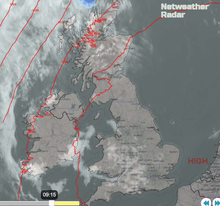
There has been fog for the West Midlands and West country this morning, this will continue to fade. NE England is likely to see fog forming tonight. A warm front it just edging by the Northern Isles this morning and that will bring more cloud and a little rain. There will be increasing high cloud from the far NW through today, turning the sunshine more hazy then milky over Scotland and Northern Ireland by this afternoon. London should reach 17C today. Birmingham, Cardiff and Manchester 15C. There will be a brisk southerly wind for western Scotland and Belfast will reach 12C today as will Edinburgh.
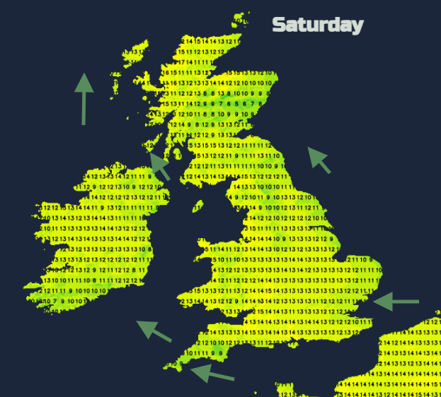
Saturday
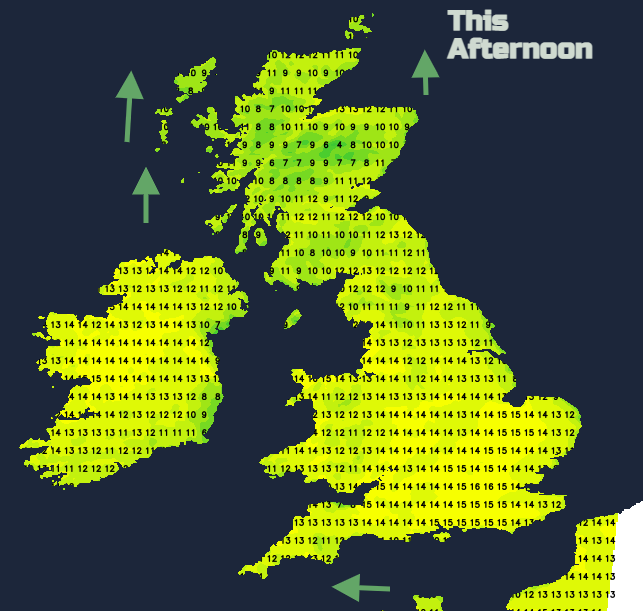
The NW Highlands could reach 17 or 18C with some shelter from the brisk south easterly winds. East coast England will feel cooler with moderate to fresh east wind off the sea. A moderate south veering SE wind for eastern Scotland and SE wind for Co Down. There will be strong lee gusts from the brisk east wind over southern Britain, so for western Wales and Cornwall and western Devon also for Northern Ireland.
A pool of cold air from central Europe reaches across to the UK on Saturday night and with more cloud about it will make the day feel less warm even with lighter winds. Then gradually next week, the air won’t have that nippy edge to it
The ongoing theme for the next week is more settled, dry weather with a more southerly flow. That means temperatures will be higher, into the high teens even low twenties Celsius on the cards.