A dry weekend with spring sunshine but a cool breeze. Temperatures could reach 18C 64F but with a cool breeze around a nearby High pressure
A dry weekend coming up thanks to a nearby high pressure. This will bring a good deal of fair weather although sometimes breezy. In the sunshine, there will be warmth but, in the wind, or shade there will still be an edge to the air and certainly, after dark, it will feel chilly. Fog and patchy frost by night but a fair settled weekend in store.
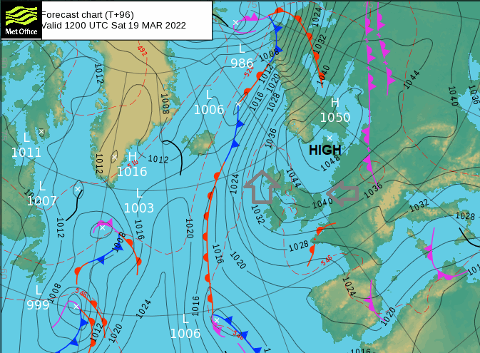
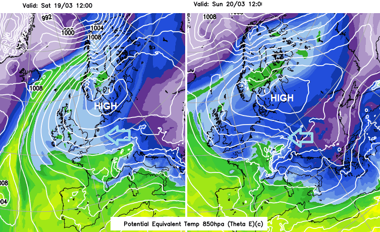
A sturdy high pressure builds in on Friday possibly reaching 1050hPa by Saturday over Denmark which doesn’t happen very often. The UK saw just over 1050hPa early in 2020.
This high pressure will keep our UK weather steady through the weekend by blocking any Atlantic fronts, keeping them at bay. Around the eastern side of the anticyclone, there will be quite a breeze at times. There should be a lot of clear skies and sunshine and as we pass mid-March there is warmth in that sun. However, the air isn’t particularly warm coming off the still cold continent. Anything that takes away from the sun’s rays will bring back the need for a jumper. A passing cloud, a more breezy spot and a nip in the air as evening arrives.
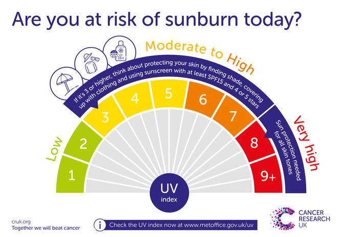
A nippy start on Saturday particularly for inland Britain with temperatures close to zero where winds are light. Southeast England will have a moderate east wind and western Britain with Northern Ireland a moderate to fresh SE to southerly wind. Saturday looks like a windy day. Along North Sea coasts it will feel cold in the wind at 9 or 10C. Elsewhere 14 to 18C (64F) which will feel warm in shelter and bright sunshine. Worth thinking about sunscreen if you are going to be out for a while.
Overnight the winds ease and with clear skies, the temperatures fall again, down to zero or a few degrees below. So, a slight frost for inland Britain, too much breeze for Northern Ireland. Both nights bring the risk of patchy fog or mist forming where the winds are light and temperatures fall away.
Sunday will see more of the easterly cool flow. For eastern Britain, the temperatures will be down a notch. Western areas still could still see 15C which will feel pleasant, maybe the odd sheltered sunny spot reaching 17C, but Saturday looks to be the warmer day of the weekend. Then another chilly night.

The only signs of rain over the weekend are late on Sunday evening. The possibility of showery rain around a low pressure moving up across the Channel to the south coast of England, well after dark.