15 or 16C are on the cards today in the mild southerly flow. Not as mild later this week as low pressure head in bringing bands of rain and strong winds, even gales.
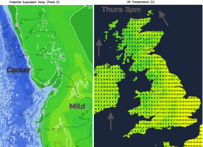
Thursday has started with much of Britain within a warm sector. It’s fairly mild although East Anglia has seen clear skies overnight, so not quite as mild here. Much of Northern Ireland, the Scottish Highlands and Ireland were in the colder air to the northwest and there has been a frost. Through the day the milder, southerly flow takes hold everywhere and temperatures could lift to 15C, even 16C. The day will become more blustery away from southern Britain where winds will be light.

There is a frontal boundary running up through the UK which is weakening but still bringing some patchy rain and a good deal of cloud. The brisk southerly flow almost pushes the cloud band away from Northern Ireland and across Scotland allowing more sunshine but still a coolness in any shelter for NW UK. The rain clears from Co. Down and Co. Antrim, but it will be grey and damp for western Britain this morning. Western Wales will brighten up and SW England will see sunshine behind the frontal cloud but for much of Britain it will be only fair at best today. However eastern and SE England stay in the mild region and the sunshine.
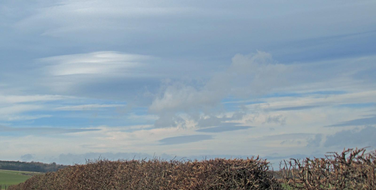
Temperatures into double figures with 14 to 16C here. We could see some spots in northern England reaching into the mid-teens with fohn effect over the high ground in this southerly wind where breaks form in the cloud cover. There have been some interesting cloudscapes already this week. Lenticular clouds forming to the lee of high ground.
Many areas become drier but there could be more patchy rain appearing from the Channel Islands up towards Hampshire or Dorset by this evening.
A mild start for many on Friday but with the breeze soon picking up. A low pressure will edge towards southern Ireland and throw patchy rain over SW Britain with a fresh to strong SE wind. The old frontal band will still be around with cloud and a little patchy rain for NE Britain. Friday becomes a blustery day as the cooler air is squeezed away to the NW. This air is mild but windy so temperatures will mostly be 10 to 12C. AS the low centres over Northern Ireland by teatime, there will be strong winds for the east coast and through the North Channel. Two occluded frontal bands of cloud and rain will edge slowly eastwards over Britain with outbreaks of rain and more windy weather for the northern half of the UK.
There will be drier gaps as the showery rain continues into Friday night, it remains unsettled. Gradually through the night cooler air moves in from the west and the Western Isles could see gales as the low pulls away. Temperatures at the weekend stay around 9 to 12C. Not especially cold by night although Sunday night could bring a touch of frost in the north.
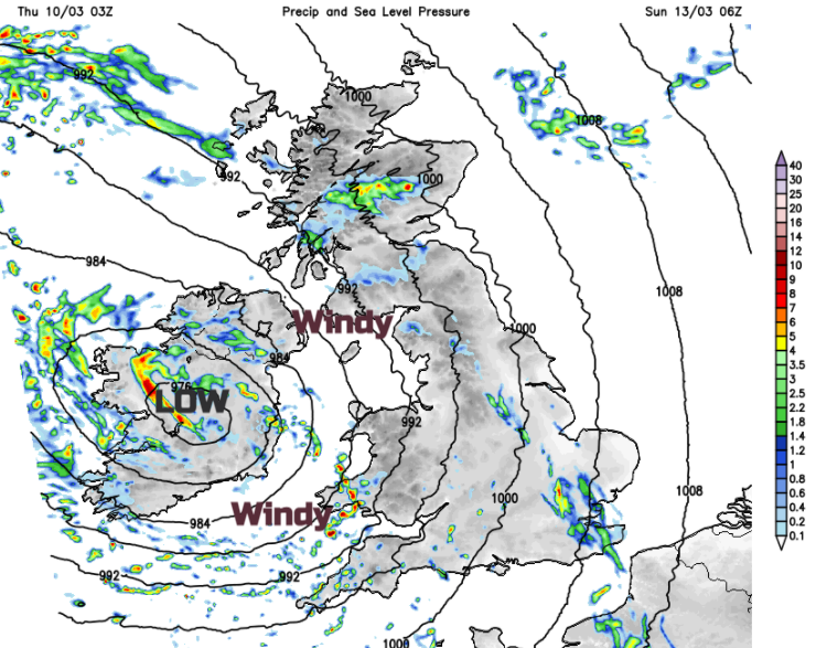
Saturday looks mixed with bright even sunny spells and a good scattering of showers. A new low pressure moves in from the SW on Saturday afternoon and evening and will bring wet and windy weather, especially for western Britain and Northern Ireland. This will then dominate the rest of the weekend weather as it moves northwards. Sunday could be very windy.