HIgh pressure will build over the UK this weekend with Friday's rainband taking its time to fade from SE Britain. A nip in the air as frosts return and a look ahead into next week.
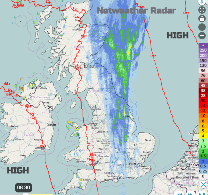
A band of rain sits over Britain for Friday morning running north-south. There is high pressure over Scandinavia and another over the Azores with this weather front caught in between, undecided which way to move. The two high pressures squeeze together over the weekend with the stranded frontal band looking even more out of sorts. It lingers over eastern then southeast Britain. However, don’t disregard this. Overall, it’s a story of high pressure for the weekend, with winds easing and frosts beginning to appear by night, even fog. Many places will be dry although England will take its time on Saturday to lose this weather front. The flow is a cold continental one but Sunday looks fine. This will last into Monday before a brisk southerly takes hold and the high falls away to the east.
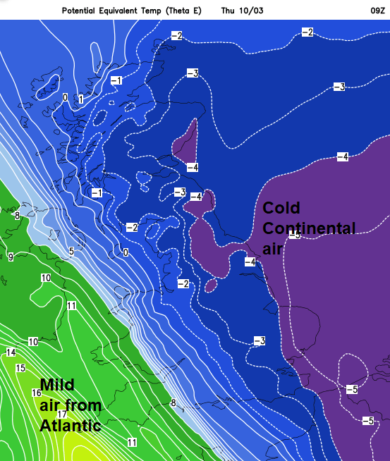
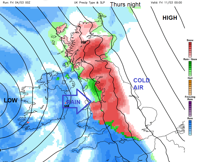
How the air flows around that resulting Scandi-high has been catching the eye. It’s a fair way off still but could feed some much colder air our way from the east. As the whole balancing act continues of High pressure over northern Europe and incoming Atlantic low pressures, will one frontal system hit the cold air and turn to snow? We are facing a quiet weather weekend with high pressure, there has to be some excitement to ponder.
This rain isn’t especially heavy, but it soaks you by stealth. It doesn’t look too bad outside, even that you might not take a brolly and then you get wet. It is ongoing and persistent yet not heavy.
It runs from the Northern Isles into NE and SE Scotland and will slowly edge eastwards from Shetland and inland Scotland during this afternoon. The east coast of Scotland will have to wait until this evening. The same band extends through NE England, Yorkshire into the East Midlands, down through Buckinghamshire and is more patchy for Hampshire. The band keeps its structure but edges over Lincolnshire and more of East Anglia, London and SE England through the day. IT remains over eastern England into the night. Western Britain and Northern Ireland will be brighter but see a scattering of showers, particularly for inland Wales.
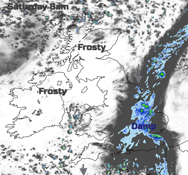
The frontal rain will still be around on Saturday for SE Britain but fine elsewhere with hardly any breeze. Temperatures will be 7 to 10C and feeling fine in sheltered sunshine. However, in the shade or rain and certainly after dark it will still feel chilly. Also, there will be a noticeable north wind on Saturday, it picks through the day for England and Wales, which will make it feel colder than the figures suggest.
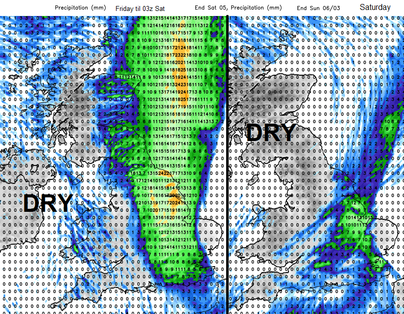
Sunday looks fine, cold and dry with light winds except for the English Channel. Here strong east to NE winds will blow. Then a widespread frost for Monday. Then back to the balancing act. Potentially a feed of much colder air off the continent and an Atlantic system coming up against that by Thursday. Shifting a blocking high is notorious for delays or changes however there could be heavy rain and gales later next week and maybe snow. Let’s get through the settled weekend first and see how the models progress.
For more model chat, join the Community Forum