Not looking as stormy over the coming week, although there will be rain at times. High pressure will be build in for next weekend, settling down the UK weather.
The UK is often balanced between a low pressure to the north or west this week and high pressures moving from the south to east. As all this shifting takes place there will be bands of rain, as there is today with blustery winds. But not look as stormy as late February which has been a mild month.
There is warmth in the sunshine now. If you find a sheltered sunny spot you can feel the promise of spring.
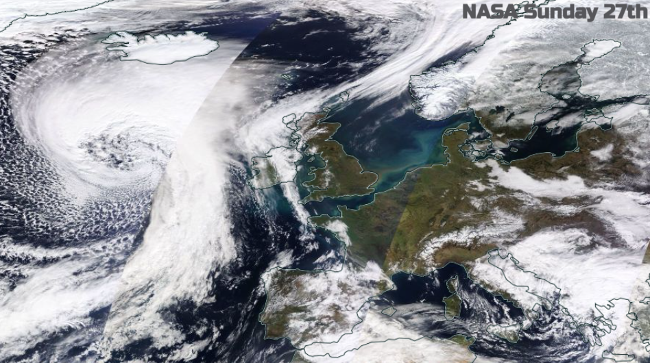
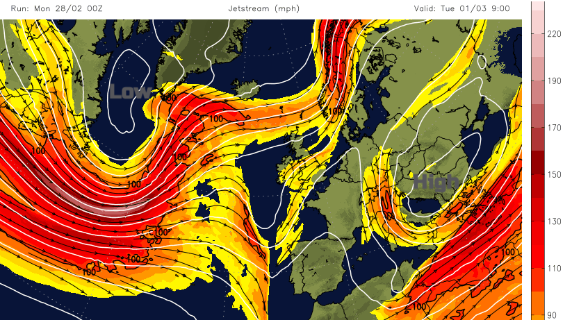
The NASA WorldView image from yesterday shows the glorious clear skies from Sunday over much of Britain and the large low pressure to the northwest which is responsible for today’s windy sometimes wet weather. Instead of the Jetstream just powering right across the Atlantic at the UK, there will be a more disrupted pattern this side. High pressure helping that and so no signs of further storms for this week.
Today signals the last day of meteorological winter. Southern Britain has not seen much snow at all, if any. Northern Scotland has seen a fair bit off and on, but as always high winds have impeded the ski resorts as they peek out of COVID restrictions. Glencoe Mountain resort was struck by lightning in the snow showers last week, which stopped lift equipment. In half term! The weather can be a real pain at times.
Behind today’s weather fronts there is cold air, from the northwest. Snow showers for the NW Highlands, that’s it really but frost across Scotland for the next two nights. Then milder air will push up from the south for midweek with temperatures returning into double figures for England and Wales. Then feeling a bit colder by Friday as high pressure builds in, although with lighter winds into Saturday. March into April is that transition time when it can feel warm in bright sunshine with no breeze but the same air can feel quite nippy. When the sun disappears behind a cloud, or if you are in a more exposed place with a breeze. Also chilly after dark.
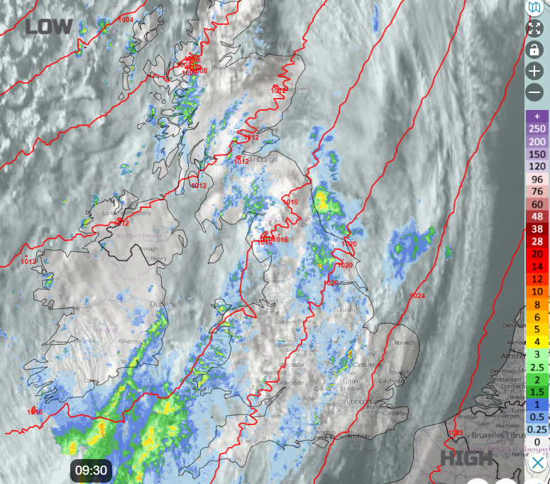
As the frontal bands edge southwards today, it is western Britain seeing most of the rain. The Midlands and northern England won’t be looking for any more rain after the recent flooding, but the river situations have stabilised now. Today into tonight it will be SW England, south Wales up to the Peak District and Yorkshire Dales seeing the most rain. Rain pulses up from the southwest later this afternoon with little reaching SE England and London by day. Slowly overnight the frontal band will reach across East Anglia and the southeast, allowing the colder, clearer conditions to take hold.
That frontal band, however, links back to a small developing low which allows rain to wave back in and up from the south during Tuesday. Keep the overall picture of that waving band of rain in your mind rather than looking for exact timings from weather apps. It will also pull an easterly wind for Tuesday night and Wednesday, so a change there. There will be fine weather for the north later on Tuesday but rain setting in from the south.
The rain is patchy by Wednesday over Wales and England, reaching further north later in the day. This is then joined by another frontal band from the west on Thursday. So again, some areas having patchy rain and more cloud, others a fair day with bright, even sunny spells. More likely for eastern England.
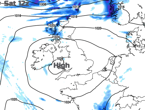
Then a gradual change to more settled weather through Friday for the weekend as high pressure builds in. Still windy in the far north of Scotland on Saturday and for more of western UK by Sunday.