High pressure arrived earlier this month and looks to stay with us through to the end of the month, so the month could end up very dry and settled for what is often a stormy month.
The weather in the UK looks set to continue an unusually prolonged settled and dry period for January, when normally we’d expect spells of wet and windy weather at times, perhaps one or two wind storms, occasionally colder snaps with snow too, along with a few days of quiet anticyclonic weather. January is statistically the coldest month over 40% of the time, with February close behind. Also statistically the windiest time of year, great for green wind power generation, but alas, not this month!
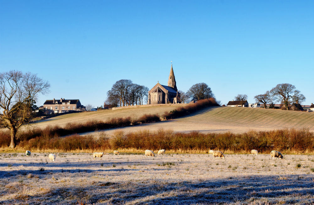
The month began with the warmest start to a New Year on record, with the temperature reaching 16.2C at St James Park in London, courtesy of low pressure west of Ireland, pumping warm air up from a long way to the southwest over the sub-tropical Atlantic. The low then moved northeast over the UK pulling down a cold northerly in its wake 4 days later, bringing some snow to some northern areas. A spell of cool and unsettled westerly winds followed up to around the 10th, but thereafter the jet stream shifted north of the UK, allowing high pressure to build over the UK, with the jet stream staying north, high pressure over or near the UK and in control over since, bringing calm winds, overnight frost and fog and pleasant sunny days. But Scotland has been milder but mostly dry, particularly for the north, not great for the Scottish ski industry.
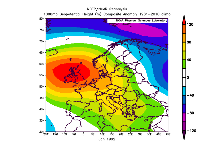
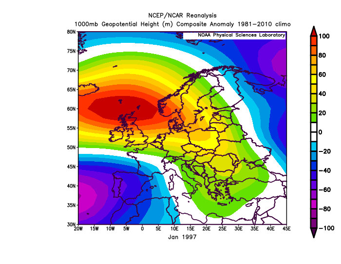
However, it’s not unprecedented for January or any other winter month to be exceptionally dry and dominated by high pressure.. January 1992 was very dry and anticyclonic, 1997 was the driest of the 20th century, with 18% of rainfall on average. High pressure ruled in January 2006 too, with England and Wales seeing only 33% of average rainfall.
Examples of anticyclonic Januarys in the recent past (high pressure orange-red / low pressure blue-purple)
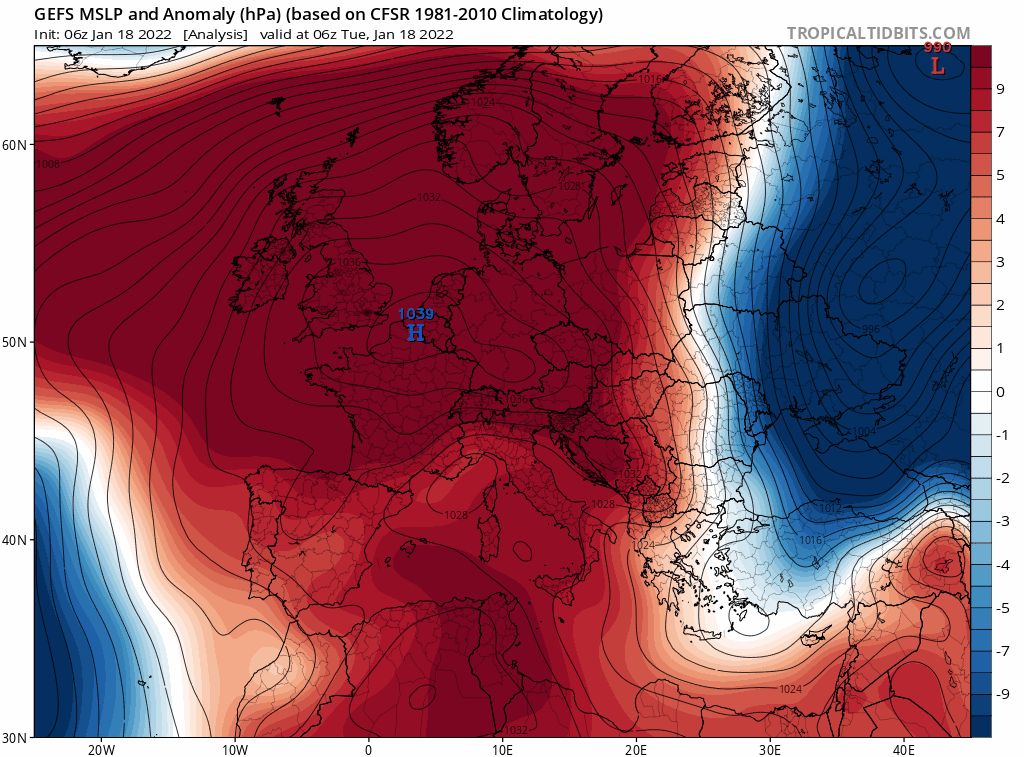
The outlook is for high pressure to remain near or over the UK and generally in control of our weather this week and likely through the weekend and into next week, perhaps all the way to the end of the month.
High pressure could stay in control of our weather until the end of the month, as indicated by the GEFS mean for mslp
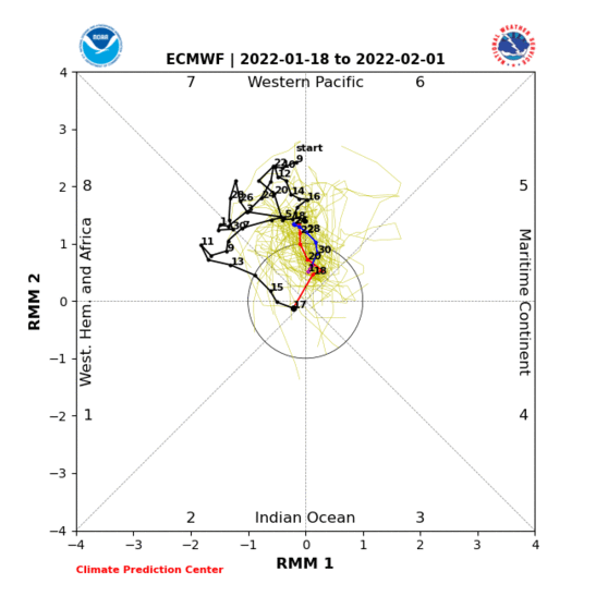
So, what’s behind the unusual persistence of high pressure this month? To put it as simply as possible, we are seeing a very stagnant western Hemisphere trough and ridge pattern since around the 10th of January. This means there’s little impetus to shift the positions of the troughs that bring low pressure and ridges that bring high pressure. Perhaps a reason for the stagnation is a standing wave of tropical convection over the western Pacific. Usually, convection over the tropics propagates as a coherent wave from the Indian Ocean across the Maritime Continent to the Pacific Ocean before the cycle repeats over 30-60 days, this is known as the Madden Julian Oscillation (MJO). However, the MJO has been stuck in phase 7, briefly wandering to 8, (western tropical Pacific) since early December and this has led to forcing, with a lag, an increasingly stagnant upper flow pattern downstream this month.
The MJO has been circling round in 7 for over a month on RMM plots, recently in 8, now gone into COD before perhaps returning to 7. This perhaps leading to slow or stagnating upper patterns in the northern hemisphere this month.
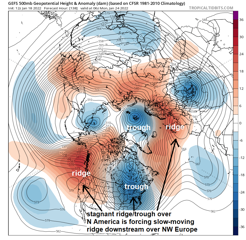
There have been changes to the upper pattern over North America over the past week or so too, perhaps linked to the MJO moving more towards phase 8, with a trough of cold air over western North America, bringing wintry conditions to NW U.S.A. and British Colombia to start the month shifting further east towards central and eastern N America – bringing wintry conditions here while a ridge builds and turning milder further west. This trough across eastern North America and Greenland forcing ridging downstream over the North Atlantic and NW Europe. But with the MJO perhaps moving back into phase 7, there is likely to be little impetus for this pattern of western North America ridge / eastern North America trough / NW Europe ridge to change anytime soon. Perhaps not until early February.
The ridge of high pressure likely to be near or over the UK for the rest of the month will try and attempt to build further north briefly at times over the coming week or two. As an example of this, a northerly develops tomorrow into Thursday as the ridge builds north to our west and a trough drops southeast to our east, bringing a brief incursion of cold arctic air. But thereafter the flow flattens again, thanks to low heights / cold upper air dominating over Greenland and eastern Canada driving a strong northerly tracking jet stream east across the far North Atlantic. There may be further brief amplifications in the flow for the rest of the month. But there are no signs from the model deterministic runs and ensembles of pattern change.
For those wanting to see snow, it’s looking increasingly like we may have to look into February for a pattern change. My winter forecast mentions the descending easterly QBO eventually perhaps weakening the currently strong stratospheric polar vortex, while a shift towards a more east-based La Nina SST pattern as we head through winter perhaps forces a more favourable tropospheric pattern of more high latitude blocking. It is evident that the troposphere remains disconnected to the stratosphere, but the tropospheric pattern, through stagnation of the troughs and ridges in the western hemisphere and strong tropospheric vortex this month, is not really favouring any high latitude blocking, as may have been hinted at by the winter forecast for the second half of January. But there is still potential I think for more latitude blocking in February bringing sustained colder spells with snow, as the polar vortex weakens in response to the easterly QBO combined with forcing from the east-based La Nina.
However, confidence is low on this outcome. Although historical analogues of eQBO and east-based La Nina winter months suggest high latitude blocking, climate change does look like making these analogues less and less relevant. The anomalously warm North Atlantic SSTs this winter, perhaps because of global warming, could also be forcing the sub-tropical Atlantic high pressure belt near the Azores to be displaces further north this winter too, preventing the jet stream from tracking far enough south over the Atlantic and NW Europe to allow sustained cold and wintry weather and high latitude blocking. But that’s for another discussion!
Still just under a month and a half of winter left, plus March can bring snow too. So, who knows, those who haven’t seen snow yet, may see some over the next 6 weeks or so.