Two more settled days before the Atlantic throws in rain and blustery winds midweek. However, there is cold air away to the northeast. Will it push back for Christmas?
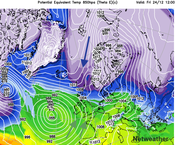
The recent steady, settled spell continues for Monday and Tuesday with light winds and dry weather. The variation in cloud amounts has been key over the weekend for how the day felt: dull, damp and gloomy or sunny and uplifting even if both were cold. Changes are afoot in the run-up to Christmas. We lose the steading high pressure, and the UK sits in between two lows. One over Scandinavia trying to throw cold, wintry air our way and the other, a large Atlantic low pushing in milder, wet and windy conditions.
For cold and snow lovers, or just those dreaming of a White Christmas, this is either adding to the seasonal excitement or causing stress and tension. For those still to organise presents and food or with travel plans, the steady high pressure would have been more suitable, except for the fog.
This week will start with light winds, a cooler feel and the ongoing mix of sunshine for some but large areas of cloud and fog, which lifts through Monday and dissolves more for Tuesday. There will also be frost thanks to less cloud by day and colder air particularly for Wednesday morning. It turns much milder during Thursday, particularly for southern Britain, into double figures for a time. And by the time Santa Claus is on the move, there is much colder air to the northeast and mild air to the southwest. But where will the boundary be? And where will see snow?
The Scottish Highlands look to get some in the second half of this week. The Pennines and any other high northern hills too. The rest of the UK and what about Christmas Day? The models are too uncertain.
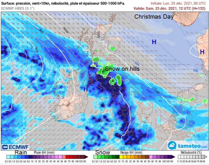
The ECM has a front from the southwest pushing right up through Britain with snow over northern hills as it hits the cold air. Then another Atlantic low pressure takes control with wet and windy weather.
The GFS has that same front with more snow for the Pennines but a push of colder air from the NE bringing snow showers or even more of a trough up til lunchtime and then more of a snow signal later in the day and overnight into Boxing Day along a band over central Britain, clipping Co. Down.
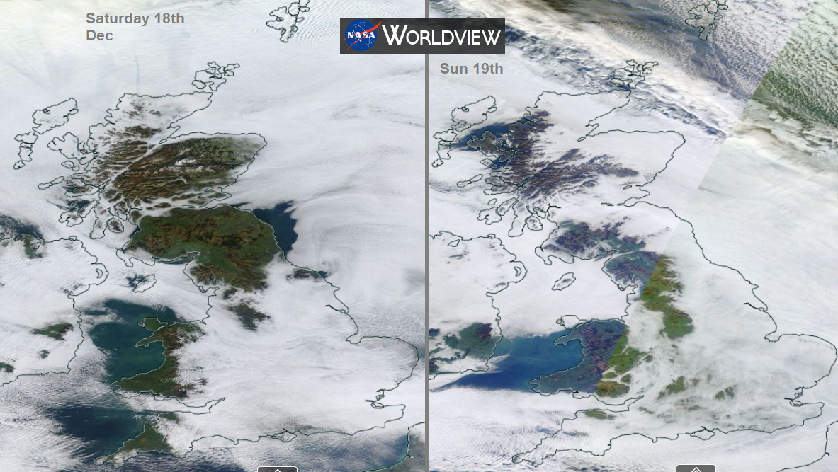
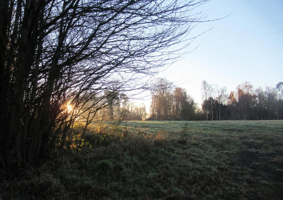
The varying cloud cover from this weekend. Gorgeous blue skies and sunshine for some, gloomy grey for most.
Today
Parts of western Britain will again start the day with sunshine and blues skies whereas much of the UK will be grey with low cloud and even mist or fog. Through the day the cloud will lift, and the fog will disappear this morning, so not as gloomy as it has been and even some brightness appearing. There will be no wind for NE Britain but a cool east breeze for SW England. Aberdeen and Edinburgh a 6C with Exeter and Southampton at 8C
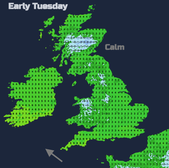
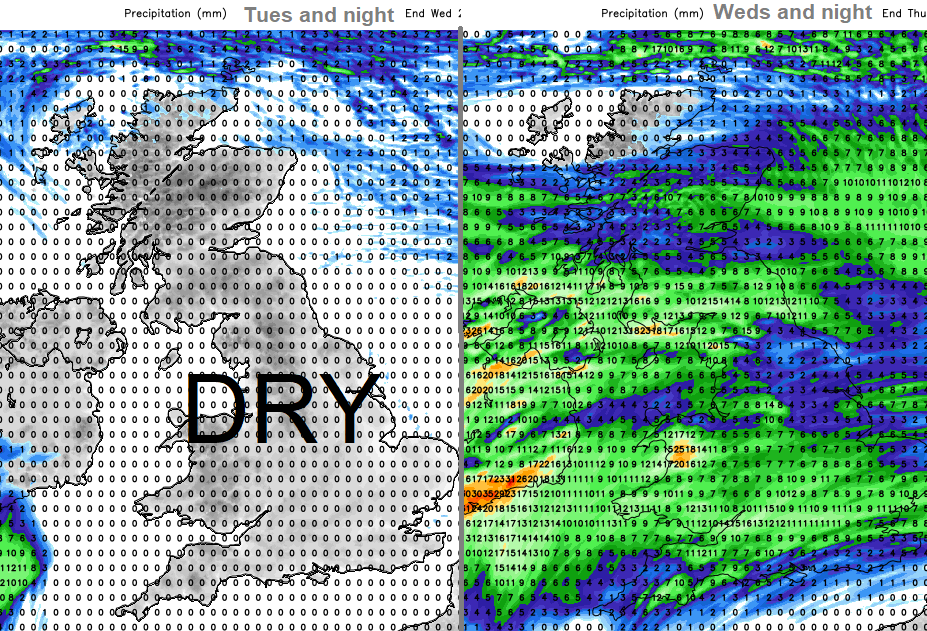
Another still day for most with varying amounts of cloud, an early frost for a few. Feeling cold. The far north will become damp and then see rain as a cold front pushes south. For the rest of the UK, it will be another dry day. Then colder overnight with a frost for Britain.
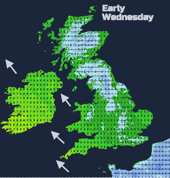
A SW wind begins to pick up as the Atlantic low pressure edges in. Bands of rain and cloud with blustery winds sweep across the UK with milder air tucked in. Very changeable for Wednesday and Thursday.