It's already turned colder but once the north wind takes hold, you will certainly know about it as rain and hill snow arrives. Very windy in north and west later on Friday
It’s turning (even) colder. The end of this week looks interesting and more lively. There will certainly be a more wintry feel to our UK weather and for some, a dollop of snow. Yes, northern hills look most likely.
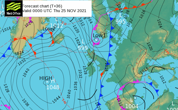
The graceful dance on the synoptic pressure charts over the next few days shows a collection of high pressures line up to the west allowing a northerly flow. This comes directly from the Arctic, down to the UK later this week. A few small low pressures get caught up in that flow. Today’s swerves off over the North Sea to Denmark but its cold front opens the cold flow gate. Friday’s low pressure from the north looks more potent. Again moving down the North Sea, although thankfully we are not at spring tide time. However, there are already warnings about strong winds on Friday and Saturday and it will feel cold with some foul weather.
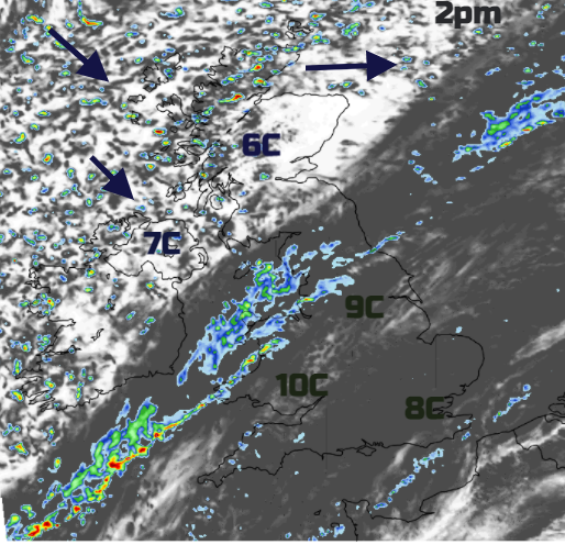
This morning there is patchy fog and frost about for southern Britain where the high pressure is holding on. A chilly, still start today and yesterday, the diurnal range across the Wales and UK was from -3.8C in Sennybridge, Powys up to +11.7C in Scoulton, Pembrokeshire. Today temperatures will manage 8 to 10C ahead of the cold front but only reach 6C behind. However, where there has been a chilly start in East Anglia and Surrey it will feel cold today under the gloomy skies.
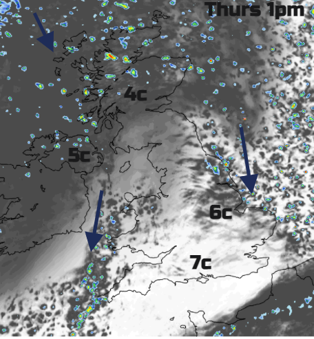
The high pressure slides out over the Atlantic, the first low pressure moves across Shetland to the North Sea with gales, even severe gales and rough seas for the far north of Scotland. The cold front moves south today with rain arriving for northern and western Wales by mid-afternoon. In the colder air, there will be sunshine and the wind will veer to a west or north-westerly. Tonight the showers over the Scottish mountains will increasingly turn to snow, some wintry to lower levels just for a time with frost and ice by morning. It will feel cold in the strong NW wind.
There will be a slight lull on Thursday. Feeling chilly with a light to moderate north to NW wind adding to the cold feel. By Thursday evening temperatures will have fallen near to freezing with a frost forming but the low pressure of interest will already be throwing cloud and precipitation over NW Scotland. This low could potentially bring stormy weather to the UK. It looks wet, windy and wintry.
Friday
A cold, frosty start in the south but frontal rain will be sign-up southwards. By lunchtime, Scotland will be seeing snow showers feeding down from the north as the winds strengthen.
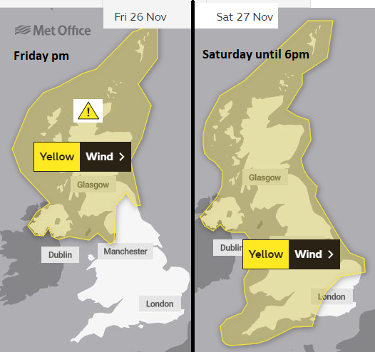
This low pressure could get named, it would be Arwen. An amber warning for the strength of the winds is possible, we will wait for the UK Met office. It’s a Friday into the weekend, people are on the move and the shops will be busy on Saturday.
Currently, the worst of the high winds look to affect north and west Scotland and Northern Ireland on Friday evening. Then overnight through the Irish Sea, down to the Bristol Channel so more of western Britain. By Saturday morning the worst of the damaging gusts look to have passed but there will still be a cold, fresh north wind cutting its way over England and Wales.
There is still some uncertainty around the development of this low, it could be slightly further west.
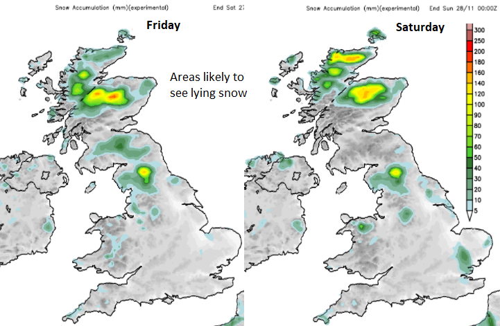
So exact amounts of snow away from prone hills is difficult. Mostly it will be from snow showers caught in the northerly flow but there seem to be plenty of swirls during Friday night and early Saturday that could bring a sprinkling further south. A bit of snow maybe exciting but it is the forecast of stormy conditions on Friday that need watching for now. If you have outdoor plans for Saturday, such as walking do not underestimate the cold wind.