


High pressure close by today and through much of the coming week across the south will bring mostly settled conditions, while the north will be more changeable and windy at times. Generally mild, but briefly cooler mid-week.
Normally November is more likely to be wet and stormy than any other month of the year, as the polar vortex strengthens as the polar regions become cold. The increasing contrast between the rapidly cooling polar regions and warmer mid-latitudes in turn strengthens the jet stream over the Atlantic, bringing a succession of depressions with their wind and rain. Occasionally we may see a burst of northerly winds bring cold arctic air and even wintry showers on the back of these depressions as they clear east, particularly later in the month.
But sometimes November can bring quiet, grey, drab and foggy weather or bring a few days of late autumn sunshine that bring out the last of the autumn colours before the next bout of windy weather strips the last of the leaves off the trees. But these calmer conditions are less common than wet and windy.
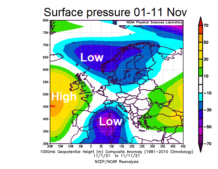
This November, so far, we’ve only really had one or two days of wet and windy weather, last Friday an example. The weather has been generally rather quiet, with high pressure in charge close to the west and southwest, more than low pressure. Today and the coming week will continue this theme of calm but often grey and drab conditions across southern areas, with high pressure close to the south. Northern areas more unsettled.
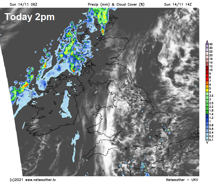
A grey start to Sunday, with some patchy drizzle here and there and some stubborn fog this morning in places which will be slow to clear. Mist and fog will lift into a mostly cloudy but mild day for many, but there will be some breaks developing to allow some sunny spells in places - particularly across Wales and SW England. Though cloud will be thick enough around western coasts for some patchy drizzle, while a few showers are possible across East Anglia for a time. Turning wet and windy across western Scotland through the afternoon as a cold front arrives here.
Band of rain along a cold front will slide southeast across Scotland, N. Ireland and NW England tonight, though weakening with rain turning patchy. Cloudy skies spreading southeast across England and Wales with this weak front on Monday, some patchy light rain for Wales and northern England, drier further south. Clearer and sunnier skies following the front across Scotland and N. Ireland.
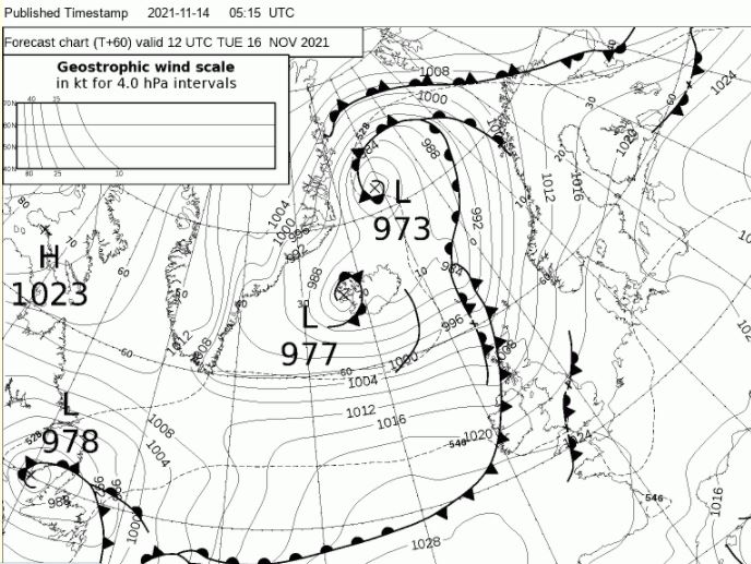
A spell of wet and windy weather sweeping across Scotland and N. Ireland on Tuesday, followed by showers towards coasts of the northwest. A weak front straddling England and Wales will mean generally cloudy with the odd spot of rain or drizzle.
Tuesday noon synoptic situation: active cold front arrives in the north bringing spell of wet and windy weather. Weak front in the south bringing cloudy conditions with the odd spot of rain or drizzle.
Turning cooler for a time mid-week, before mild air returns from the west on Thursday
Turning cooler and breezy for a time on Wednesday, some sunny spells, with the south mostly dry, showers across the north, particularly around western coasts. Milder on Thursday but generally cloudy and still breezy, with some patchy rain or drizzle over hills and coasts in the northwest. Similar day on Friday, though perhaps a better chance of sunny spells in the east.


