The mixed week continues with rain affecting many parts today (Tuesday). Wednesday and Thursday will be quieter and drier though.
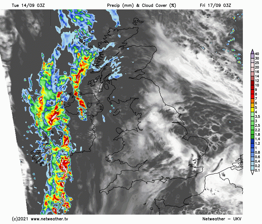
Today has started off wet and overcast for much of the UK, particularly the majority of Scotland (with the exception of north-west Scotland) and central and eastern parts of England. Sunshine is largely confined to west Wales, Cornwall and parts of Northern Ireland and north-west Scotland.
During the day, a belt of moderate to heavy persistent rain will spread north-eastwards from the south Midlands through much of the rest of the Midlands and into north-east England. The rain to the north of this band will gradually fizzle out, but a large part of northern England and the far south of Scotland will hold onto some light rain or drizzle for most of the day.
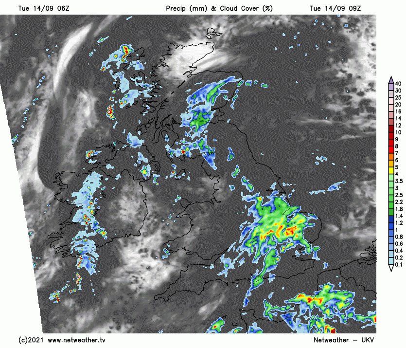
Most of the country will also remain cloudy, but it will brighten up over Wales and south-west England, with the clear, sunny weather currently over west Wales and Cornwall slowly moving further north and east, also spreading across southern England, especially near the English Channel coast.
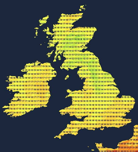
With plenty of cloud and some rain for most, temperatures will generally be on the low side for the time of year, reaching just 12 to 14C over much of central and southern Scotland and northern England. It will be warmer in the areas where the sun gets out, particularly Wales, south-west England and along the English Channel coast in central southern England, where temperatures will reach 18 to 20C. Highs of 18 or 19C are also likely in parts of northern Scotland and Northern Ireland.
Overnight, with cloudy skies holding on over much of central and eastern England, temperatures will fall no lower than 13 to 15C, but clearer skies moving into much of northern and western Britain will give a cooler night, with many parts of Wales and Scotland falling to between 8 and 10C.
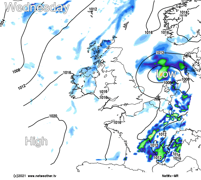
With a ridge of high pressure over the British Isles, Wednesday and Thursday look like being relatively quiet and settled, though not necessarily particularly warm or sunny. On Wednesday some weak fronts will push eastwards through Scotland, bringing quite a cloudy day with some scattered showers for central and northern parts of Scotland and in the east of Northern Ireland. Some isolated showers will develop over England and Wales, particularly the east of England, but here most places will stay dry.
The southern half of England in particular will see increasing amounts of sunshine during Wednesday, and this region will see the highest temperatures, reaching 20 to 22C in some southern spots close to the English Channel coast. Elsewhere, highs of 16 to 18C will be typical, except in north-west Scotland, where, under persistently cloudy skies, temperatures will typically get no higher than 15C.
The ridge of high pressure will hold on for Thursday, which will be a warmer and sunnier day for much of England, with highs of 22 to 24C in parts of the south-east, particularly around London. Again some isolated showers will break out, these most likely to turn up in northern parts of England, but most places will stay dry.
Friday will stay dry with some sunny spells for eastern parts of the country, but rain will push into most western areas and will become slow-moving over Northern Ireland, western Scotland, Wales and south-west England.
The weekend looks set to have weak rain belts moving slowly from west to east, particularly across the south, but generally just small amounts of rain, and many parts of northern and eastern Britain will stay dry. Sunshine amounts over the weekend look set to be variable rather than plentiful.
The latest concern in the Atlantic hurricane season is Tropical Storm Nicholas which has recently been upgraded to a hurricane. It has recently made landfall in Texas and is currently bringing heavy rain to Texas and Louisiana. This has led Joe Biden to declare a state of emergency in Louisiana, as this is just a week after Hurricane Ida caused considerable disruption and left many residents without power (reports of over a million residents without power in Louisiana).