Despite recent forecasts for a breakdown in the recent settled weather this weekend, models have backed off with blocking high pressure staying in control, though moving east to allow warmer air in this weekend too.
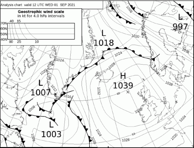
High pressure looks to remain stubbornly in control to end the week and also through the weekend into early weekend, continuing the dry and settled weather of the last few weeks. The area of high pressure has been unusually strong for the time of year, with 1038mb recorded in Stornoway in the Western Isles yesterday.
Close to record high pressure for early September yesterday centred to the northwest of Britain
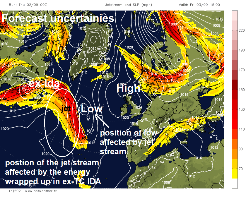
Recent forecasts suggested a breakdown over the weekend, however, this now doesn’t look to properly happen until the middle of next week at the earliest. The uncertainty and shift over when we may see high pressure relax to allow more unsettled weather in from the west is likely related to the energy wrapped up in remnants of Hurricane Ida, a post-tropical cyclone emerging out of New England, causing subtle changes in the jet stream over the North Atlantic – which affects the position of low pressure and high pressure areas downstream over the Atlantic and Europe.
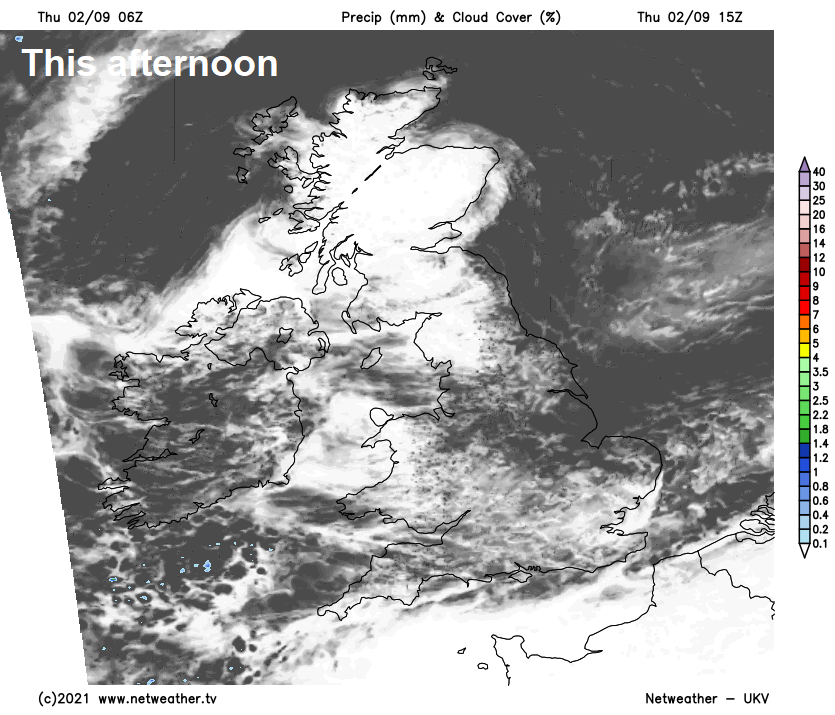
The high pressure system governing our weather the last few weeks will continue to sit over or close to northern Britain to end this week, continuing to feed in a lot of cloud across England and Wales today and tomorrow, but it will be generally dry. However, after the generally cloudy starts for all in the morning, some sunny spells will develop in the west, but eastern areas will likely remain cloudy.
High pressure drifts east to Scandinavia over the weekend with cool conditions for many replaced by warmer air spreading from the near conitnent.
The stubborn blocking area of high pressure over northern Britain to end the week will tend to drift eastward over NE Europe this weekend. This means a change in wind direction from a cool and cloudy northeasterly that many have endured this week to a warmer and hopefully sunnier southeasterly flow off the near continent by Sunday for England and Wales. Though fronts look to make inroads across Scotland and N. Ireland bringing some rain to end the weekend, but this comes with some uncertainty.
In a little more detail for the next few days, a lot of cloud around to start Thursday away from western Scotland and western Northern Ireland – where there’s some sunshine. Like recent days, central and eastern areas of England will likely hang on to cloudy skies, thick enough for some patchy drizzle towards the southeast. But sunny spells will develop across large parts of Scotland, N. Ireland, west Wales, NW England and some southern parts of England. Temperatures reaching 16-19C where it stays cloudy, 20-21C where the sun comes out, maybe 22-24C across NW England, central and western areas of Scotland.
Friday generally dry but mostly cloudy for many, some sunny spells across the northwest and also developing across southern England. Temperatures similar to today, low twenties where the sun comes out, high teens where it stays cloudy.
High pressure begins to drift east towards Scandinavia on Saturday, so the wind will turn more southeasterly, changing the distribution of cloud, allowing sunnier conditions to develop southern areas, but northern and eastern areas hanging on to cloudier skies. Perhaps a few showers in the far northwest.
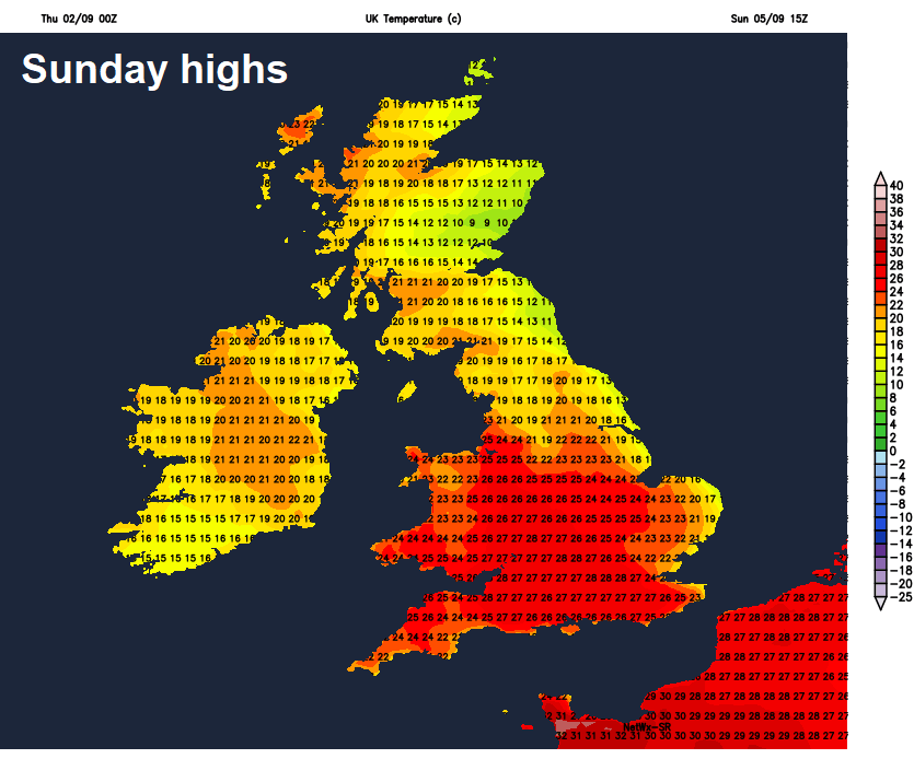
Sunday should hopefully see sunshine become more widespread across England and Wales, as high pressure continues to drift east across Scandinavia, with temperatures responding upwards too with a warm southeasterly flow out of the near continent. Temperatures perhaps reaching 26-27C across southern England. A question mark for Scotland and N. Ireland – which may see a frontal system move in from the Atlantic, bringing cloudier skies and outbreaks of rain. But differences between models over timings and extent.