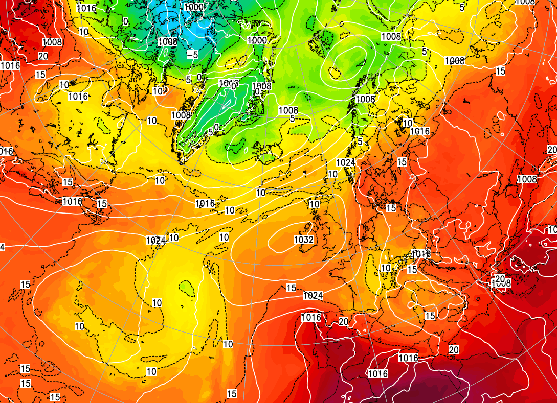
The Azores high is slowly ridging up towards the UK from today, bringing a change to sunnier, warmer and drier weather.
High pressure is starting to ridge in from the Azores towards the UK today, but we have a low pressure system moving out into the North Sea and a northerly air stream on its western flank. Thanks to this, much of the UK has seen a cloudy start, with a little light rain and drizzle affecting many parts of England. However, a large area of Scotland, parts of East Anglia and some western coastal areas have bucked the trend with a clear, sunny start.
This is following on from flash floods in parts of London yesterday, triggered mainly by heavy, thundery downpours, and a dull wet day in parts of northern England and southern Scotland, associated with that low pressure system which is now moving away.
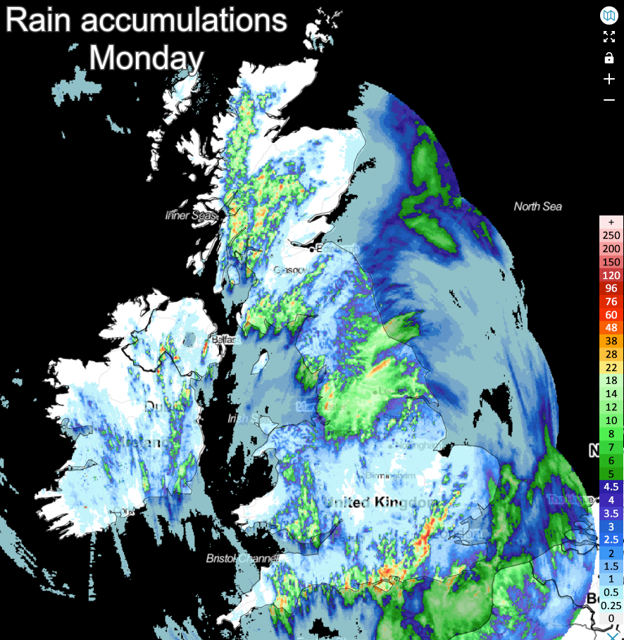
As the ridge of high pressure starts to come in from the west, we should see some of that cloud sheet break up, particularly in central and western parts of the UK, allowing increasing amounts of sunshine to come through. As the sun emerges, we will see scattered showers develop, especially over the west and south-west of Scotland and in central and southern parts of England, and these could locally be heavy and thundery in the south, but many places will stay dry. High cloud will increase from the west late in the day, especially over Northern Ireland, associated with a weak frontal system coming in from the west. It will stay mainly cloudy in many eastern areas, especially in Norfolk, with cloud continuing to stream in from the North Sea.
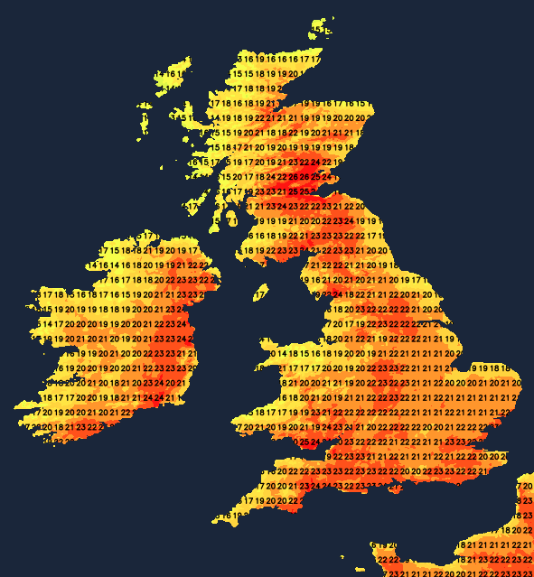
Despite the northerly winds, temperatures will be well up to the average for the time of year in most parts of the country, reaching 21 to 23C in most southern and western parts of Britain. The warmest areas will be around London and Glasgow, where highs of around 24C are possible. However, it will be cooler near North Sea coasts, where highs of 17 to 19C will be typical.
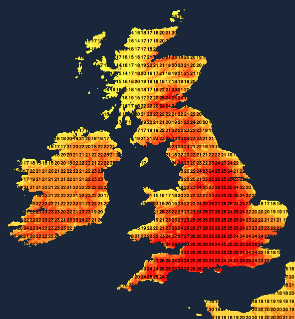
The high pressure will come closer to the British Isles on Wednesday, which means that a large majority will have a dry day, with temperatures generally creeping up, reaching 22 to 25C in most inland parts of the country from the Scottish Lowlands southwards. Although cloud amounts will be variable, some sunny spells are expected, especially in Wales and in southern, central and western parts of England. Northern Ireland will also be dry and bright, with highs of around 22C. It will be cooler and cloudier in western Scotland and some eastern coastal counties of England, particularly Norfolk.
On Thursday, the high pressure will come into western parts of Britain, but weak fronts and a northerly flow will affect the east of England. It will be relatively cool and cloudy, though dry, in many eastern parts of England, though still with highs of around 20 to 22C. It will be dry and generally sunny in central and western parts, with highs of 22 to 25C again.
Temperatures overnight will fall to around 8 to 10C in parts of north-western Britain early on both Wednesday and Thursday, but most of the country will have a minimum between 11 and 14C. It will be warmest in eastern and southern areas, with temperatures near the east coast being held up by more cloud cover.
With high pressure moving right across the country, a spell of predominantly dry sunny weather is set to take hold. Temperatures will continue to steadily increase by the day, such that by the weekend, highs will widely be between 25 and 28C. It will be cooler near North Sea coasts, where some low cloud may come onshore at times, particularly in eastern Scotland and north-east England.
The high pressure looks set to stick around into early next week as well, promising more hot and sunny weather. There is potential for thunderstorms to develop around midweek, but this is a long way off, and detail is likely to change nearer the time.