Low pressure will be around for the start of this week, continuing the unsettled, cool and wet May theme. The slow-moving front will bring a line of heavy rain with gusty winds, particularly to the SW
Hopefully, you managed to enjoy the Saturday sunshine after Friday’s grim offerings. Sunday is starting off fine and sunny for eastern England and northern Scotland but elsewhere there is already more cloud and rain from an Atlantic low. This low will bring unsettled weather for the start of the week with some heavy rain, blustery winds and as it begins to pull away on Tuesday, colder air from the north. We are really having to take our chances with May 2021. Several sites around the UK have already broken their May monthly rainfall records.
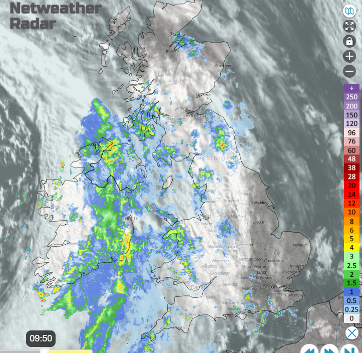
It has been cold overnight with an air frost inland for northern Britain. The frontal rain is rather slow. That means that some parts of eastern and northern Britain will manage a fair weekend and not see the rain until this evening or even overnight. Sunday has started wet for Northern Ireland with showery rain ahead of the main occluding front reaching Wales and northern England. As the frontal band swings over the Irish Sea and North Channel later this morning it will become more active.
On the forecast rain and cloud chart, you can see a line of brighter red, running north-south. This shows that line convection is likely, a short spell of intense rainfall. This will be the part of today’s weather to keep an eye on via the radar. It has a very distinct signal visually and when it arrives in real life you will certainly know about it. Comments about the crazy May weather will increase.
As the rain tries to clear Northern Ireland by lunchtime, it looks like Co. Down and Co. Antrim could get caught by this heavy rain. There will be an improvement in the afternoon as the frontal band clears away to SW Scotland. The blustery southerly winds veer to a much lighter westerly and there will be bright or sunny spells. Temperatures only 10 or 11C at best. However, Ireland will then be in the unstable air and heavy, even thundery showers will appear.
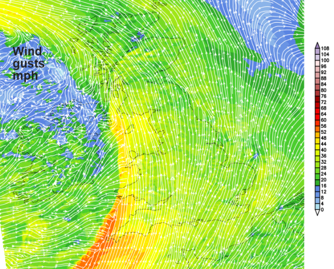
For much of Britain, there will be increasing cloud, a scattering of showers appearing from the west and a southerly breeze. This starts off light but will freshen for SW England, Wales and SW Scotland by lunchtime. Cornwall exposed parts of Devon and of Wales will see strong and gusty southerly winds and also for the Isle of Man by this afternoon. The active front edges inland slowly over western Britain bringing a spell of heavy rain and gusty winds. SW England could see coastal gales and the conditions will be wild for a time as this front moves through. By this evening it will be blustery for more of Britain ahead of the front. The frontal band will have cleared Wales, Cornwall, Devon and Dumfries & Galloway allowing brighter skies, a lighter westerly wind but a scattering of showers.
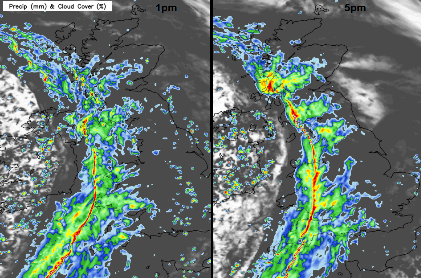
The rain band will really take its time and although there will be showers ahead of it, the main rain won’t reach the Isle of Wight until after dark, Edinburgh around dusk and London by midnight. The fresh southerly winds will be over SE England and East Anglia tonight as a strengthening easterly wind picks up for the Northern Isles
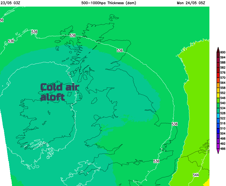
Overnight the low pressure will be right overhead with a pool of colder air aloft. This sets up a more unstable picture for Monday with the risk of heavy downpours and thunderstorms once again.
The frontal band from Sunday will be stuck over the far north of mainland Scotland and Orkney for Monday morning. The heavy downpours look to be focused on Wales and SW England to start with on Monday but become more widespread over England during the day. The winds will be light so temperatures could reach 12 to 15C and will feel warmer in any strong sunshine but it’s all still very disappointing for late May.