An unseasonably deep low will move east over the next few days, bringing windy conditions with spells of rain for all. Cool over the weekend, with sunshine and showers on Saturday, then wind and rain returning Sunday.
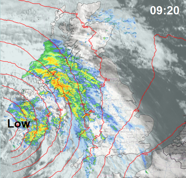
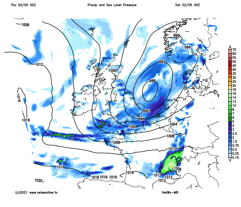
Deep lows bringing wet and windy weather are not a common feature of May weather, but this weather more typical of early Spring or late autumn is what the UK and Ireland will experience today and tomorrow. An unseasonably deep low will move in off the Atlantic across Ireland this afternoon, spreading blustery spells of rain northeast across most areas through the day. Heaviest rain will be across the west and northwest, while the strongest winds will be across the southwest later. Low pressure will move east across the UK on Friday, so continuing windy and cloudy with blustery showers or longer spells of rain, gales towards southern coasts. Saturday breezy and cooler with sunny spells and showers, wind and rain returning on Sunday – as another deep low moves in off the Atlantic. This low moves away to the east of Britain early next week, followed by high pressure building in from the west – bringing increasingly settled, drier and warmer conditions after a showery start to the week.
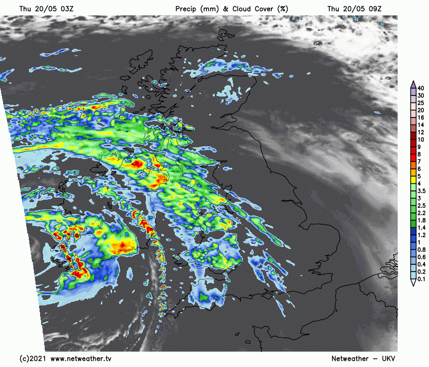
For now, after bright and chilly start to the morning across the bulk of Scotland and eastern England, cloudy skies, spells of rain and increasingly blustery winds already moving into the west will quickly spread northeast across many areas this morning and continuing through the afternoon. The rain will be heaviest and most persistent across southern Scotland, NW England, N. Ireland and Wales, lighter and more patchy across central, southern and eastern England and also across northern Scotland. Temperatures reaching 10-13C in the north, 13-15C in the south.
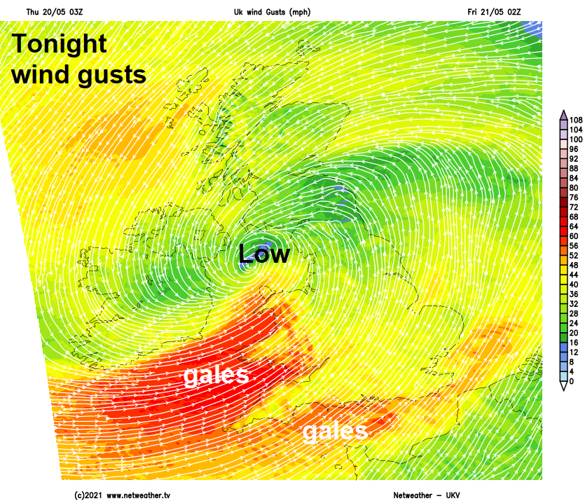
Gales developing across south Wales and SW England from late afternoon and through the evening, with gusts of 45-50mph inland, 55-60mph over coasts. These strong winds spreading across southern coastal counties tonight and into early Friday morning. The Met Office have a yellow wind warning in force from 6pm today until 9pm tomorrow.
Perhaps turning brighter with some late sunshine for a time this evening across southern England before showers and increasingly strong winds arrive overnight, gales in the southwest also developing towards the south coast. Further north windy with spells of rain revolving around low pressure moving over the Irish Sea, rain will be locally heavy, especially over northern and western hills along with NE Scotland.
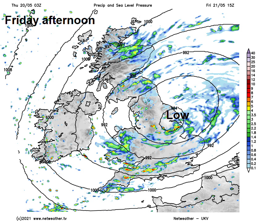
Low pressure centre moves east across northern England on Friday, sunny spells and a few blustery showers across southern England in the morning, but the strong westerly wind will be the most notable feature, with gales through the English Channel and perhaps inland at times, which could cause some travel disruption and bring some tree branches down now they are coming into leaf. Further north, windy too and generally cloudy with spells of rain, locally heavy and persistent, spiralling around low pressure moving east, these spells of rain tending to transfer southeast towards SE England and East Anglia by evening, followed by more showery conditions, perhaps turning brighter in the northwest, with some sunshine to end the day across N. Ireland and western Scotland. Temperatures disappointing again, reaching 11-14C generally, only 8-10C across northern Scotland.
The showery theme returns on Saturday and it will be cooler too, thanks to a northwesterly breeze. So a breezy day with sunshine and scattered showers developing, the heaviest of which will be across south Wales and southern England.
All change again on Sunday, after a dry and bright start bar some showers in the west, cloud will thicken across the west with rain arriving through the morning before spreading east and northeast across most areas through the afternoon, though northern Scotland perhaps staying dry and bright. Clearer but showery conditions following the rain across the west in the evening. Temperatures both days pretty rubbish for the second half of May, reaching 10-14C at best both days.
An unsettled start to next week, with low pressure close to the east, showers developing widely on Monday, locally heavy with hail and thunder, sunny spells between the showers but it will feel rather cool out the sun. Cool northerly breeze on Tuesday and Wednesday, with sunshine and showers again for many. But and improving picture looking likely after mid-week, as high pressure builds, with lighter winds, fewer shower and feeling a little warmer.