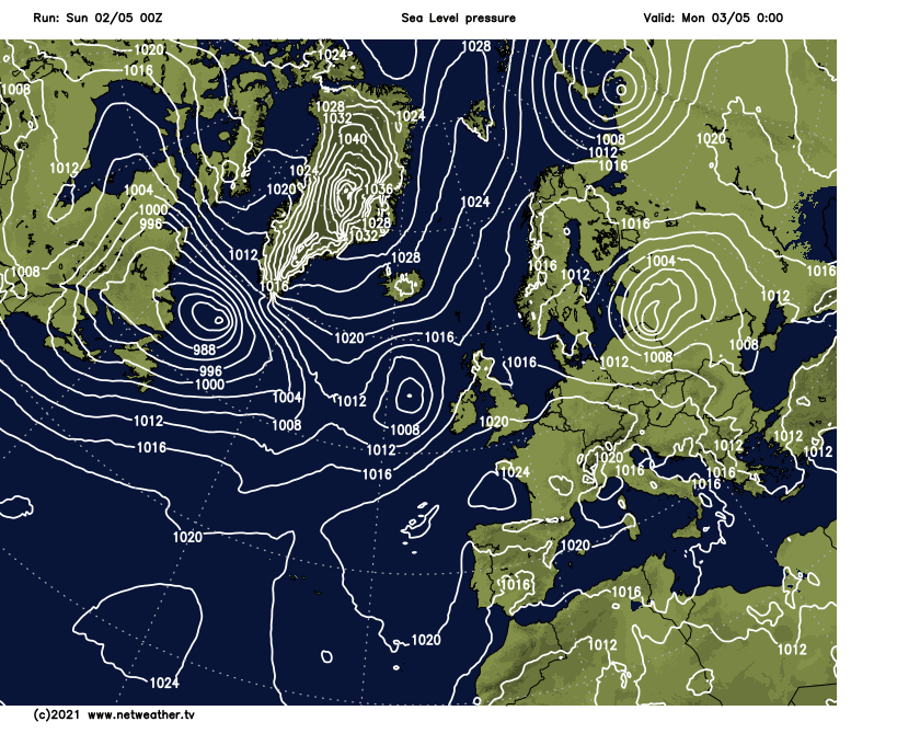
After another day of sunshine and scattered showers today (Sunday), a deepening area of low pressure is inbound for Bank Holiday Monday, bringing rain and gales with it.
Two days left of the long weekend, and although there may be some exceptions, if you're looking to do something outdoors, then today (Sunday) looks to be the pick of the days. Sunshine and showers will again sum up the weather today, albeit with fewer showers than yesterday, and temperatures may even touch 15c or so in places. There's a deep low inbound, though, and that's going to dominate the weather on bank holiday Monday.
Just as yesterday, many parts have woken to sunshine on Sunday morning, but the cloud will tend to bubble up as the day wears on. Pressure is a bit higher than yesterday, though, so the showers should be a little fewer and further between, plus winds are a touch lighter, so it'll feel that little bit warmer - although they will pick up a little later this afternoon especially in the south.
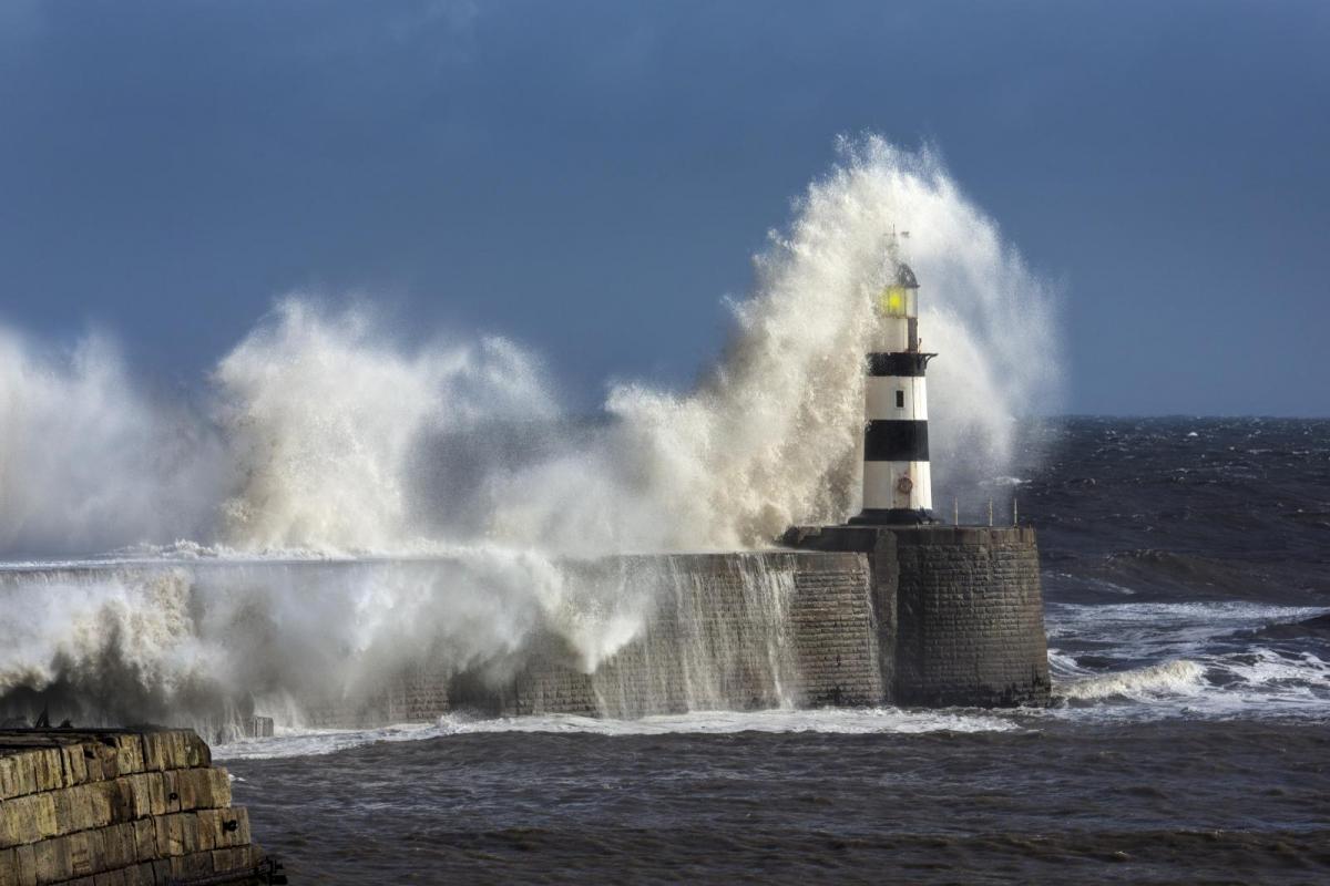
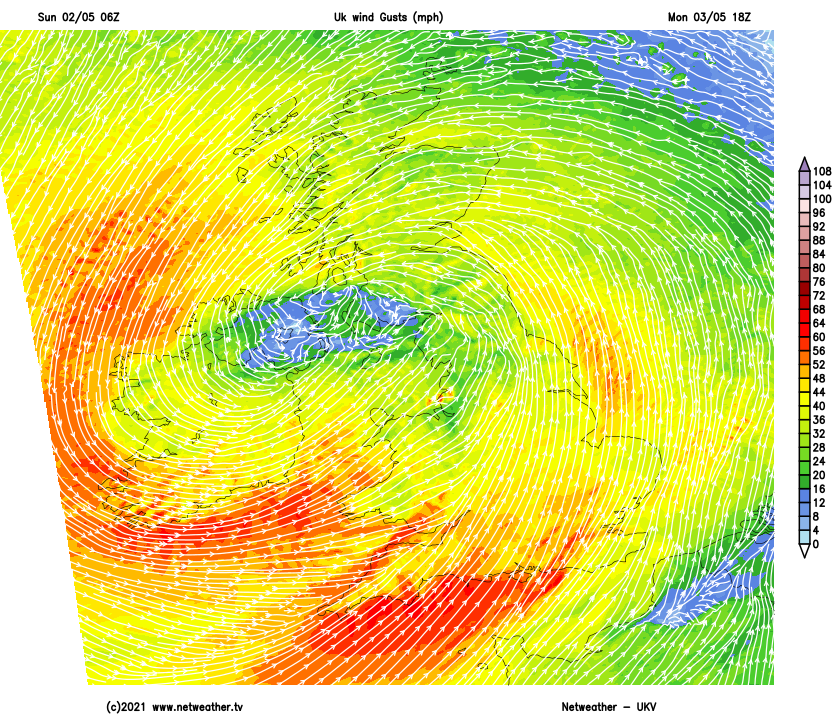
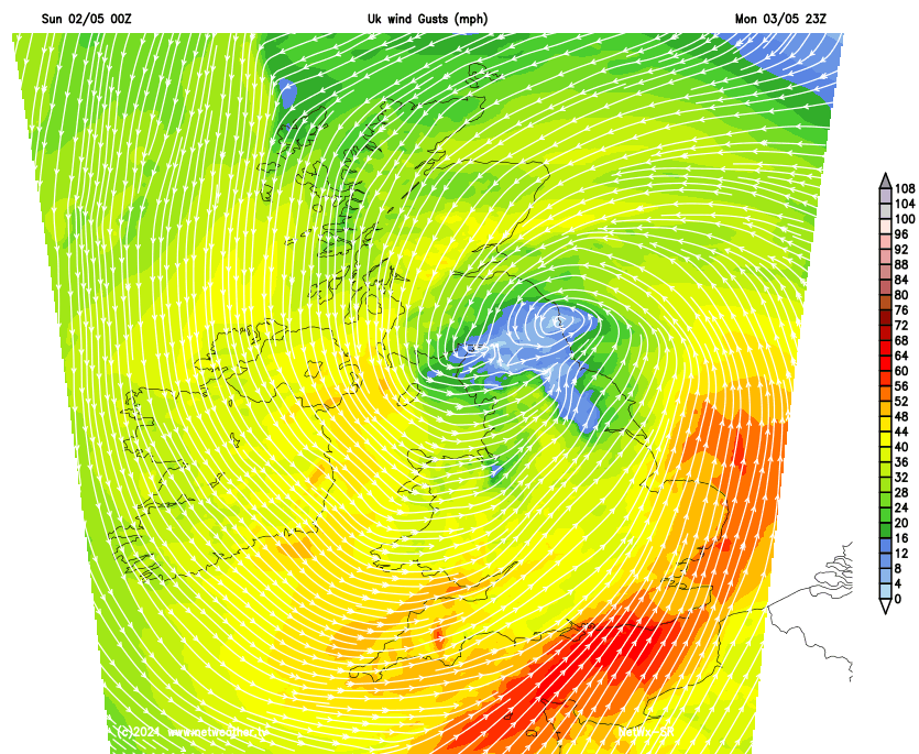
Monday is the day to watch, though, with that low pressure moving in off of the Atlantic, deepening as it does so and bringing a spell of high winds and persistent rain with it. The strongest winds will affect Wales, coastal areas of both southern and perhaps also northwest England, along with coastal regions of much of Ireland (north and south) with gusts of 60-70mph or thereabouts likely in exposed spots. So, not a day to be taking a pleasure boat out offshore. The Met Office has already issued weather warnings to cover the wind, and I'd not be surprised if they're updated today.
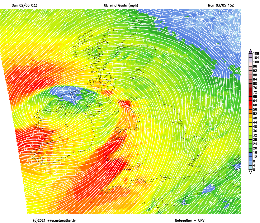
The wet, windy weather will arrive across the island of Ireland during the early hours of Monday. That will all quite quickly spread across into Britain, with the rain reaching across into eastern regions into the afternoon.
The southeast corner may stay mostly dry until the evening, though, and the northern half of Scotland could also avoid the persistent rain for much of the day. The rain will clear from Wales and western England during the afternoon, with sunshine and a scattering of blustery showers following behind.
With the cloud, wind and rain, it'll not be a warm feeling day anywhere with highs of 8-12c generally, with many parts doing reasonably well to make it into double-figures. Much of the persistent rain should have cleared eastern parts through the evening, but some is likely to wrap around into eastern Scotland for a time. There'll also be some sharp showers leftover, and these will continue through much of the night. The winds will start the night strongest in eastern and southern areas but will begin to ease back into the early hours as the low pulls away into the North Sea.
That then leads us back into a familiar pattern of sunshine and showers on Tuesday. The winds will still be on the blustery side, blowing down from the north or northwest, which means another chilly day for the time of the year - southern areas should see highs into the teens, but elsewhere 8-12c will be about it.
There'll be more frost patches overnight Tuesday, then Wednesday will see colder air being pulled south over the country with winds swinging further round into the north. It'll be cold enough to bring a wintry flavour to the showers over the hills of northern Britain during another day of sun and showers.