More cloud from a cold front over England and Wales today with a bit of patchy rain, not much. Colder air from the north but back to the high teens later this week with more dry, sunny weather.
High pressure just keeps dominating our UK weather bringing settled mostly dry weather with chilly nights but often warm sunshine by day.
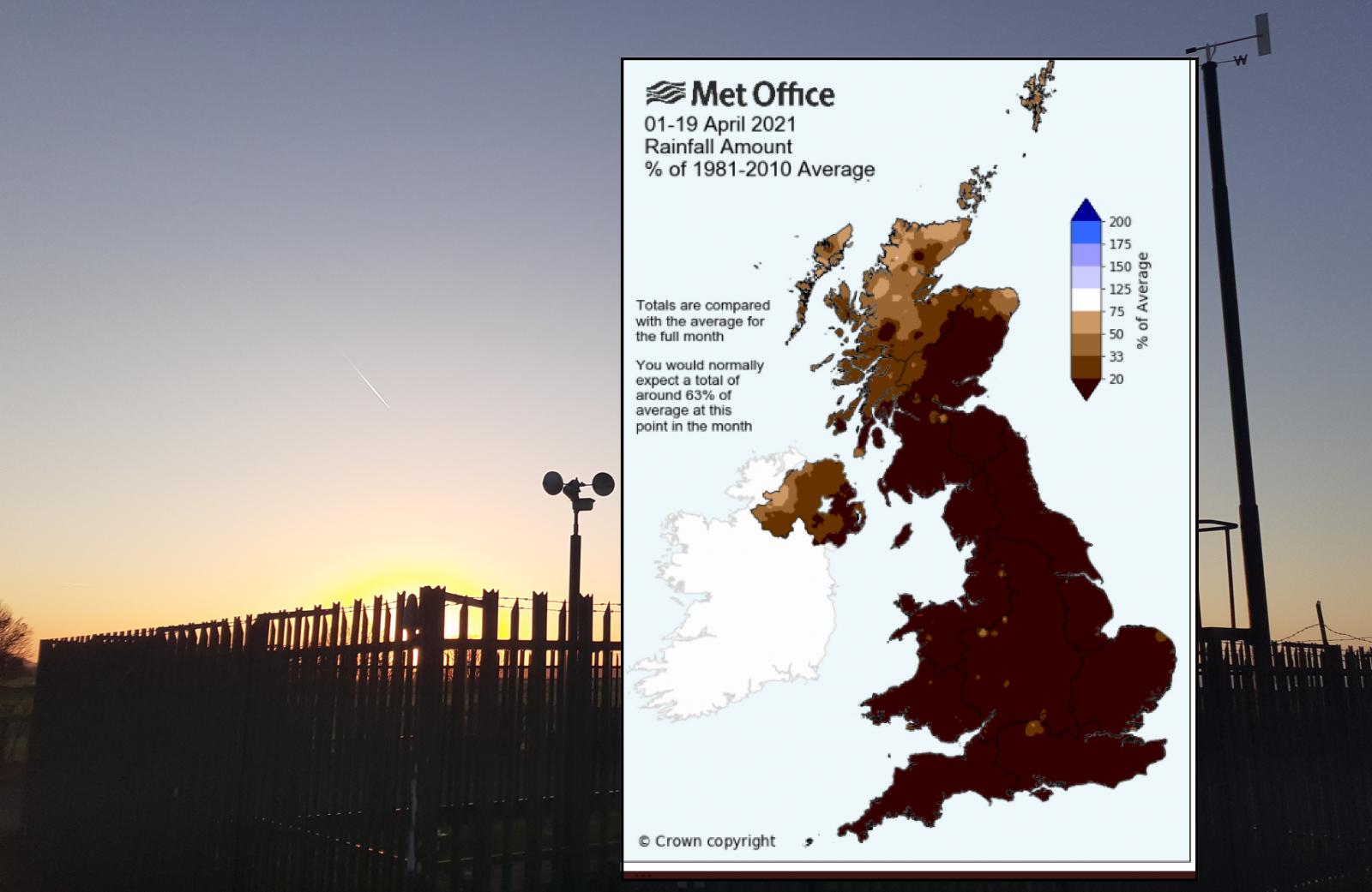
In case you haven’t noticed, it has been very dry and also cold by night so far this month. More frosts than usual, although warm in the sunshine by day and for many parts of the UK, it has hardly rained at all. The Met Office graphic below shows the rainfall amount up to the 19th of April as a percentage of the monthly total. It explains that by now we would usually see around 63% of the month’s rain, which would be in the light brown category, only showing for the far north and far NW of the UK. Of course, it could utterly chuck it down for the rest of the month and even up to average, but that looks very unlikely as high pressure continues to linger.
“It's been the coldest start to April since 2013, with mean temperatures widely 2-4°C below average. It's also turning into an exceptionally dry month with some places barely seeing a drop of rain so far. “ Met Office
Highland Scotland has seen rain this week with a weather front lurking over the Western Isles and far NW of the mainland. This front also brought a bit of rain to Northern Ireland and more of Scotland overnight before fading over the Borders and Northumberland. There has also been patchy rain and drizzle inland for Yorkshire overnight with outbreaks moving SW over the West Midlands towards Cardiff with more cloud this morning across England and Wales to start the day.
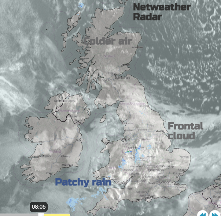
So not as sunny for a central swathe of Britain this morning with cold air to the north and a frost to start the day. It is a cooler start in the southeast of England with early clearer skies, but the cloud will increase for southern England and by lunchtime, there will be more cloud and a scattering of showers over southwest England with a few for south Wales and central-southern England too.
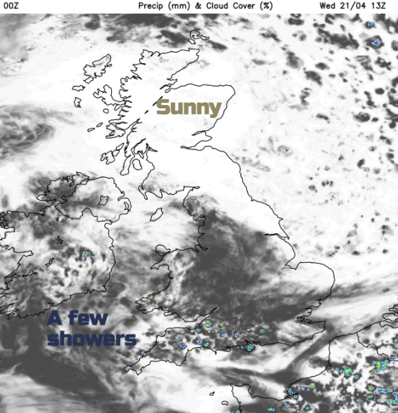
There will be a lot of fair, bright weather about just not the glorious sunshine of yesterday for much of England and Wales but a shift for Scotland with blue skies although cooler air. More of eastern Britain will see clearing skies by the afternoon and so more sun but it will feel nippy with the breeze off the North Sea. There is high pressure extending in from the NW today as the weakness from the old front is nudged towards the West Country where temperatures could reach 16 to 18C. London Heathrow and Pershore managed 18.6C on Tuesday with other parts of England and Wales reaching 17 or 18C in the sunshine but will have lower temperatures today. Many areas low to mid-teens with the east coast at only 8 or 9C.
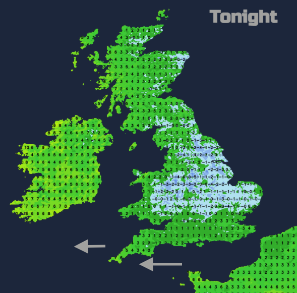
Tonight will be clear and so colder with frost. There will be a noticeable east breeze along the south coast of Britain and for Cornwall with a bit more cloud in the far NW of the UK. Then it is high pressure all the way, right through the weekend with nippy nights, more of a breeze from the east for southern Britain and daytime temperatures lifting (away from the east coast of England) into the mid to high teens.