Cloud and patchy rain over southern Britain today will lurk close to SE England even on Saturday but behind this frontal band is colder Arctic air with sunshine, snow showers and widespread weekend frosts
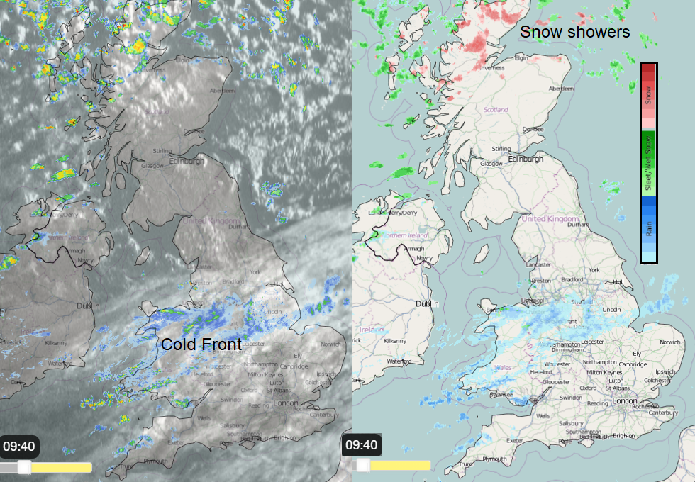
Cold Arctic air is flowing down from the north once more. It won’t feel as cold as the end of Easter weekend with lighter winds and not quite such a direct route from the North Pole this time. The cold front introducing this chillier air is over Yorkshire, the Midlands and Wales but will edge southwards through the day. Behind this cloudy, damp band is bright sunshine and plenty of dry weather. It is the far north seeing snow showers continuing for northern Scotland and wintry ones reaching Northern Ireland and then NE England
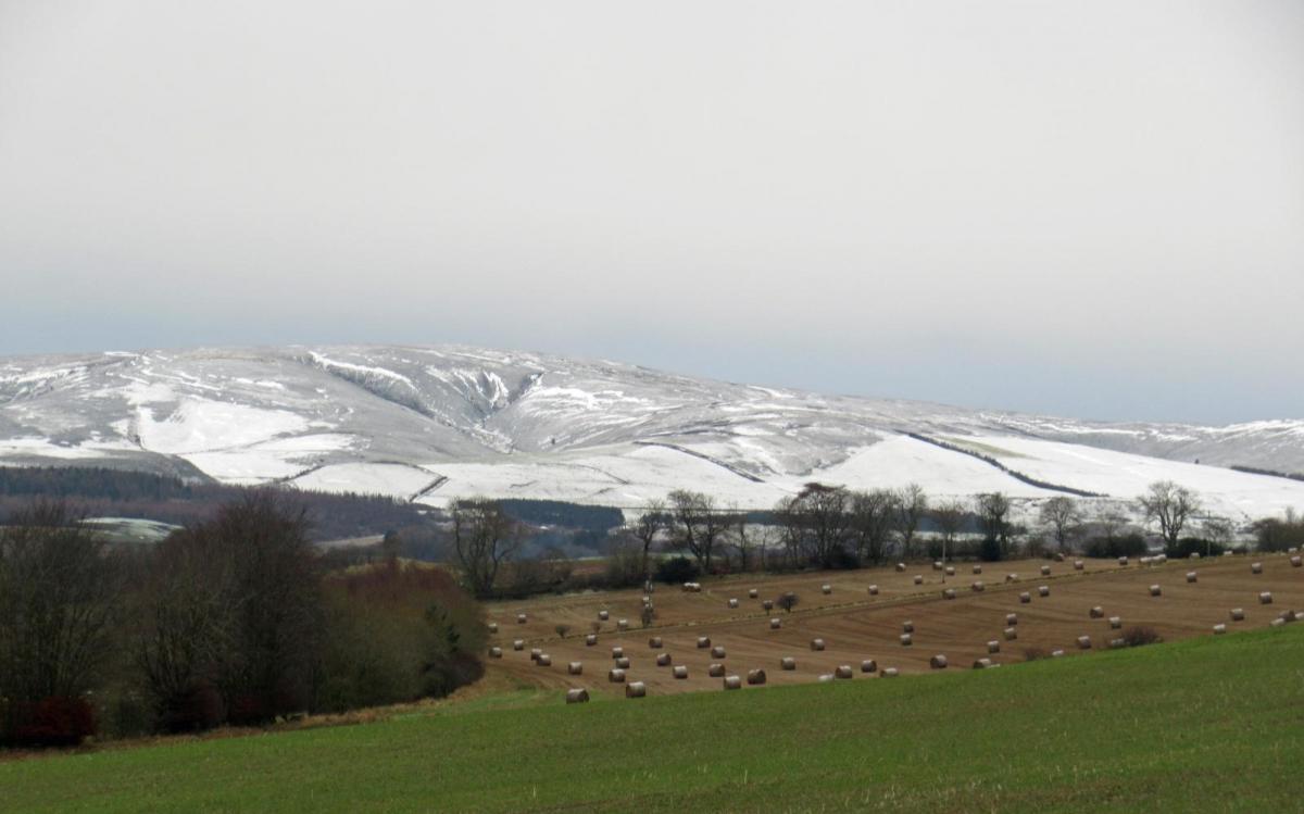
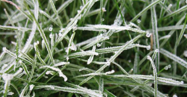
A widespread frost tonight although the lingering cloud over southern England stops the temperatures from falling too low and rain will return on Saturday. Elsewhere a frosty, sunny start to the weekend with a scattering of snow showers passing by. It will feel cold in the shade or breeze, but the sunshine is strong. Temperatures today range from 5C in the north to 10 or 11C in the south but for Saturday only 7 or 8C at best.
This cold front is linked to a vigorous low pressure which brought stormy conditions to Shetland overnight and is now heading over Scandinavia bringing snow and high winds across to the Baltic Sea. The long frontal boundary stays across Europe west to east at the weekend, after it falters on Friday night over northern France and looks to wave over SE England during Saturday. Then digging away south through France into northern Spain on Sunday.
High pressure tries to build in from the west during the weekend, it is this that gives lighter winds and with the clear skies, more of a frost as the cold air winds its way down.
Today
Northern Scotland continues to see passing snow showers and has the risk of ice to start the day. The gales have now passed but it remains blustery and cold. Further snow showers reach down through Scotland, well scattered and missing the SW but still a wintry look and feeling cold in the N to NW wind. Northern Ireland will also see icy rain or sleet and snow showers today from the NW. Temperatures around 5 to 7C with bright spells then increasing cloud and the showers with clearing skies later in the day.
Part of Northern England is in the cold air with sunshine and will reach 8 to 10C with a distinct wind veer to the north as the front clears south. Yorkshire, Greater Manchester and Merseyside should brighten up this afternoon, but the frontal cloud lingers for much of Wales, the Midlands, East Anglia and southern England. There is a wintry tinge to the precipitation over Snowdonia and the Peak District to start the day. There will be bright spells at times, ahead of the band of patchy rain with a west wind and temperatures of 8 to 11C. If gaps appear in the cloud for London, then the temperature could reach 12 or 13C but the low 20sC of last week are a distant memory.
The weekend
It will be cold overnight with a frost. Further snow showers for Highland and Grampian from the north and through the weekend a few cms possible for Cumbrian Fells, Cheviots, north Pennines, North York Moors with flurries passing by for other northern areas. Don’t rely on weather app timings for the rain in the far south on Saturday. There will be more frontal cloud and a breeze from the NE but have a look at the radar, to see how it is brushing up from the south coast over the Home counties and then fades for Saturday evening as do many of the daytime snow showers further north.
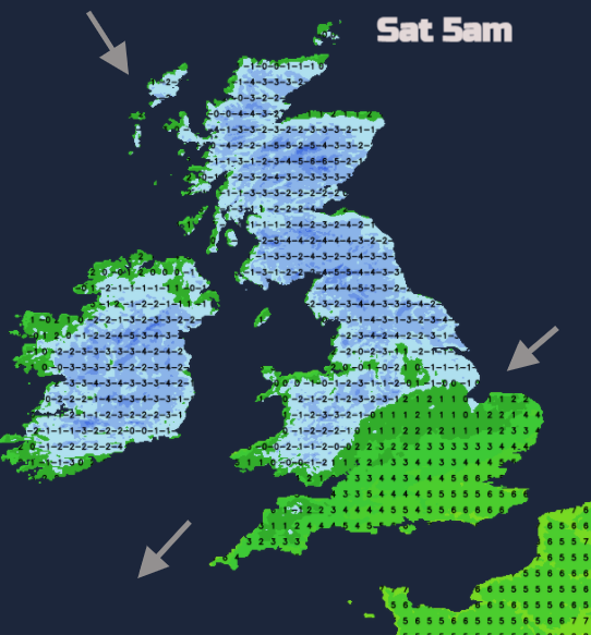
A hard frost in the north and colder for southern England with clearer skies and temperatures down below zero. The north wind could still bring wintry showers into East Anglia to start Sunday and then a scattering for other parts of Britain during the day around the side of the high pressure. A low from Iceland will throw its fronts towards NW Scotland to end the weekend with rain and hill snow with another frosty night for the rest of the UK.