A look why it can snow in early April at temperatures several degrees above freezing. Clue: to do with how dry a cold arctic airmass can be this time of year.
We are all experiencing an unseasonably cold blast of air direct from the arctic to start the week. If this was the depths of winter, given 850 hPa temperatures (about 1500m above) falling to -10C or below across many parts on Tuesday, then surface day maximum temperatures would likely struggle to get above freezing widely. However, with more daylight and the sun stronger in early April, surface temperatures will generally stay above freezing, even in the far north, during daylight hours.
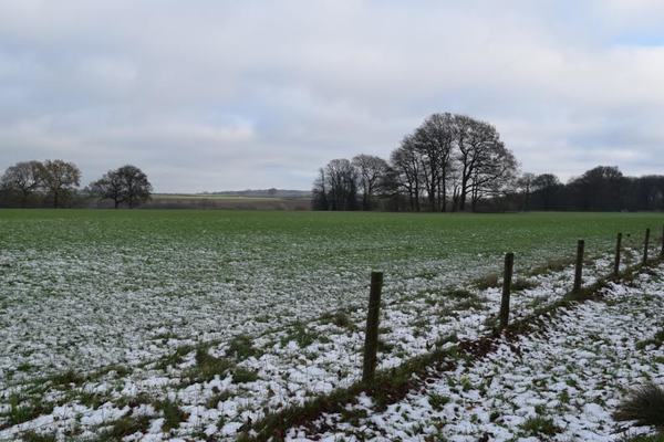
But how come snow has fallen to the ground and not melted from showers on Easter Monday and today, with temperatures above freezing, as high as 5C? Yet in winter, we may experience temperatures close to freezing yet it rains?
The most obvious answer may seem that it simply takes time for a snowflake to melt as they descend through air above freezing. However, this is not the main reason. The humidity of the air is the key. The drier the air is, the higher the temperature can be while snowing. As snowflakes fall, some of them will evaporate, but this process of evaporation and also melting requires heat absorption from the surrounding air. This absorption of heat by evaporation and melting subsequently cools the air surrounding the snowflakes falling – keeping them frozen.
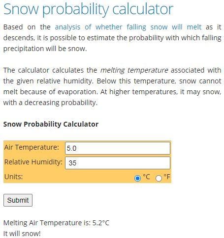
The snow calculator "calculates the melting temperature associated with the given relative humidity. Below this temperature, snow cannot melt because of evaporation. At higher temperatures, it may snow, with a decreasing probability"
Example below, which is fairly typical of temperatures and humidity across inland northern and central areas this afternoon, uses temperature of 5.0C and a humidity of 35%. It calculates the 'melting temperature, and that snow will fall at 5.0C.
When it is snowing and the temperature is above freezing the temperature will typically drop. The cooling from evaporation is more significant if the relative humidity is relatively low, so when snow falls into dry air, it can be expected to cool more quickly than if the air is moist. Evaporation has a much higher influence on cooling the air if the air is dry.
Low sub-zero dew points across the UK today, taking longer for snow to melt as it falls through the dry surface layer
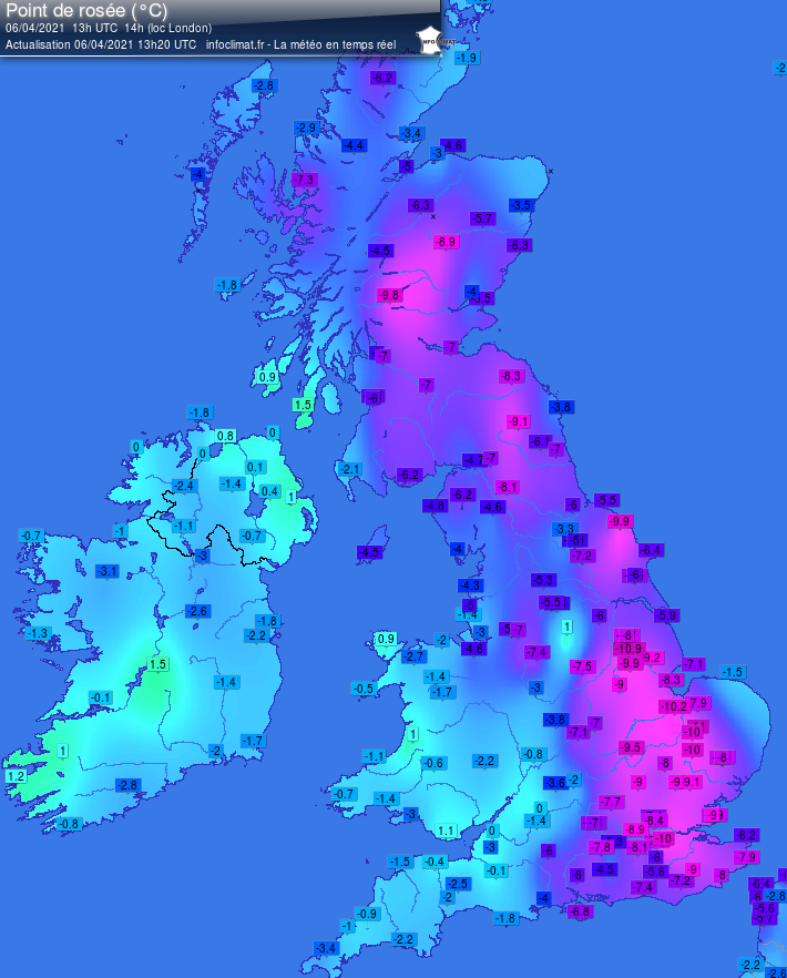
Indeed the arctic air flowing across the UK today is quite dry, this helped by sea surface temperatures being at their annually lowest point after cooling all winter, the lower SSTs the less moisture from the sea the dry air picks up. Relative Humidity levels are typically around 30-50% inland, with dew points of between -6C to -10C – that’s pretty dry air!
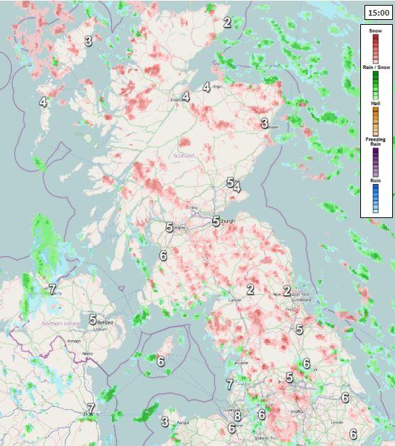
More snow showers developing and spreading south from northern to southern areas this afternoon, unlikely to settle during the day though away from high ground in the north, with temperatures too high.
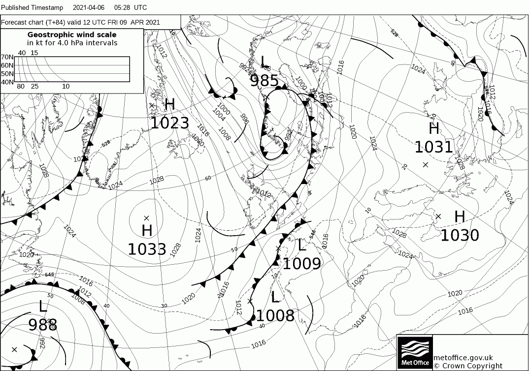
The cold northerly will ease on Wednesday and turning slightly less cold as wind turns northwesterly, wintry showers becoming confined to eastern coasts before fading. Thursday and Friday less cold but windier with some cloud and rain spreading along a cold front, which will reach the south on Friday. Colder northerly winds returning as the front clears by Saturday, as a cold weekend looks likely, with sleet and snow showers spreading south. Certainly a below-average first half to April looks on the cards.
Another cold northerly looks set to return on Friday and into the weekend!
Loading recent activity...