High pressure close to the west will ensure it stays dry for most today and Easter Sunday, cloudy east today but sunshine more widespread tomorrow. Cold arctic northerly winds Easter Monday will bring wintry showers including snow.
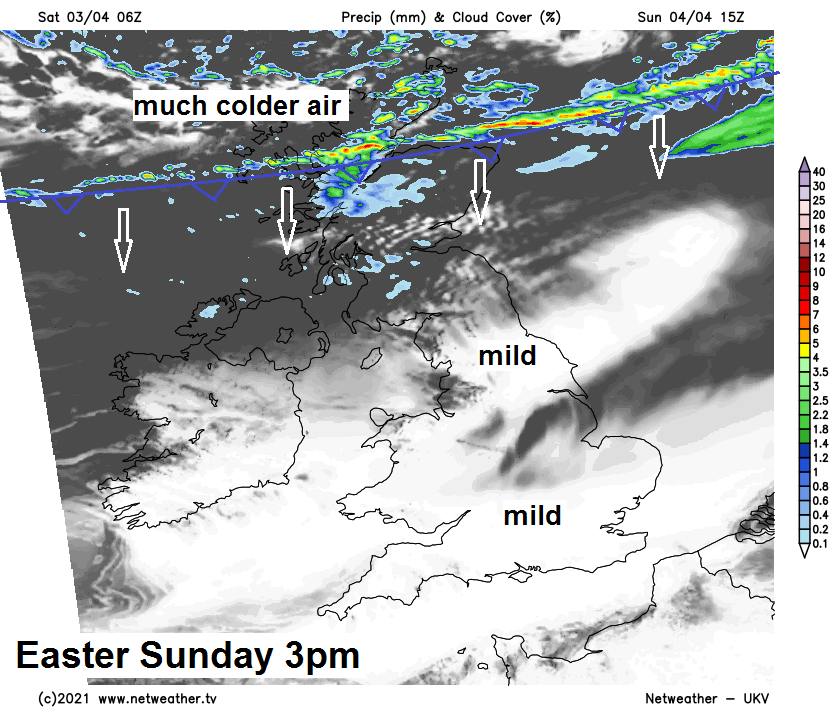
Today will be dry thanks to high pressure close to the west, but there will still be variations across the country thanks to cloud cover, with northern and western areas seeing the best of the sunshine and higher temperatures, while eastern areas keep the cloud and stay chillier. Easter Sunday will see more widespread sunshine across England and Wales and warmer too, but the beginnings of a major change in the weather for all across Scotland, with a cold front approaches bringing cloud and rain later in the day. Sunday night then sees the cold front sweep south opening the doors to a strong and bitterly cold northerly wind developing across all areas on Easter Monday, bringing wintry showers, with snow falling in places, even in the south.
For now, chilly and dry start to Saturday everywhere but cloudy across large parts of England away from the far southwest and northwest. Clear skies across Scotland, N. Ireland and west Wales have allowed temperatures to fall around or below freezing overnight. Tulloch Bridge in the Highlands falling to -5.7C overnight.
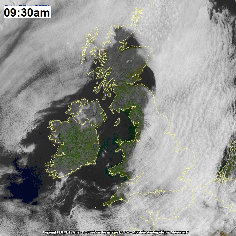
Credit: EUMETSAT/Meteociel.fr
Central and eastern areas of England keeping a fair bit of cloud through the day, though tending to lift and break in places the further west you are to allow some sunny spells, but much of eastern England likely to stay overcast with a chilly northeasterly wind for much of the day. But for much of Scotland (away from a cloudier far north and northwest), N. Ireland, NW England, Wales and SW England there will be some prolonged sunshine. In the sunshine across the north and west temperatures reaching 11-14C, perhaps 15-16C across central and eastern Scotland, cloud across eastern England pegging back temperatures to around 9-10C.
Tending to cloud over and a westerly breeze pick up over across western Scotland, NW England and N. Ireland overnight, clearer skies elsewhere leading to a touch of frost across eastern Scotland, northeast, central and western England along with Wales. Cloudier across southern England and East Anglia, keeping it frost-free here.
Easter Sunday will see more widespread sunshine across England and Wales, so sunnier for eastern England which has been cloudy the last few days. And with the wind switching from northeasterly to westerly it will be milder too, temperatures reaching 12-15C. It will cloud over across northern England in the afternoon though. A different story for Scotland through the day, after a bright and frosty start in eastern Scotland, quickly clouding over from the west to join all of Scotland and N. Ireland to a cloudy day, with a band of rain along a cold front pushing south through the afternoon and evening. Much colder arctic northerly winds with sleet and snow showers following across northern Scotland. Temperatures across Scotland and N. Ireland reaching 9-11C before the cold front moves through, falling to 6-8C following the front.
Cold front moving south across Scotland tomorrow sweeps south across England and Wales Sunday night, clearing the south coast by dawn. So cold arctic air spreading south across all parts on Easter Monday, a strong to gale force bitterly cold northerly wind blowing hail, sleet and snow showers south across many parts, though parts of southern England may stay dry. Sunny spells between the showers.
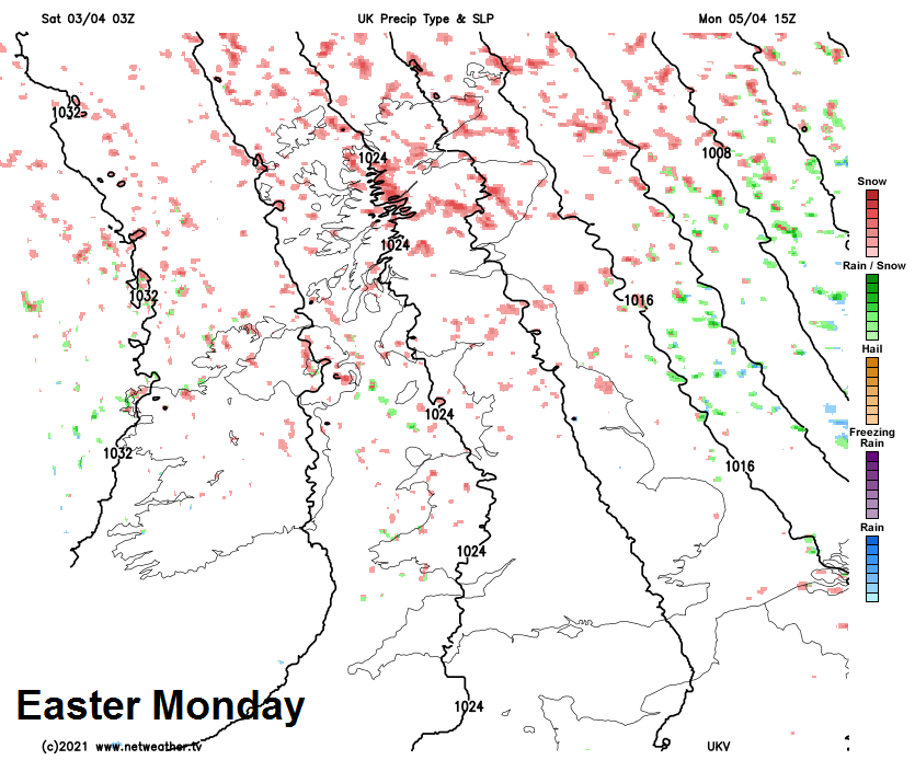
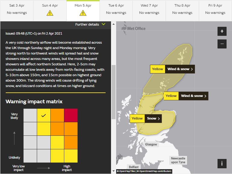
Wintry showers most frequent across northern Scotland and around eastern and western coasts. Some significant accumulations of snow across northern Scotland, with a Met Office Yellow Warning for snow in force here issued yesterday and also a new warning issued this morning for wind and snow, with gusts of 50-70mph, for far north of Scotland and the Northern Isles:
A cold day for early April, temperatures reaching 3-6C across Scotland, 6-8C across N. Ireland, England and Wales. The wind chill making it feel more like below freezing in northern and eastern coastal areas exposed to the strong northerly wind, 1-4C inland.
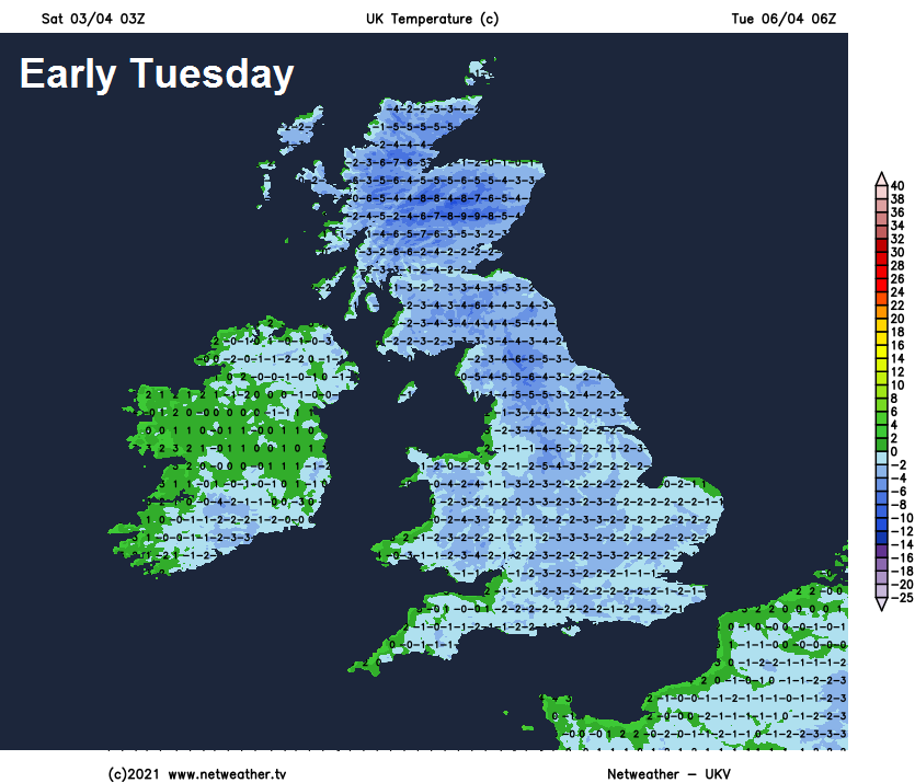
A widespread frost following Monday night under clear skies, so gardeners beware. Tuesday remaining cold in a brisk northerly wind, but there will be fewer showers and more in the way of sunshine inland away from the far north along with eastern and western coastal areas – which will see further wintry showers. Temperatures reaching 6-8C a best.
Any early wintry showers near eastern coasts clearing, otherwise Wednesday looking largely dry and bright across England and Wales with winds easing but still chilly. Cloud and rain or sleet preceded by snow, especially over higher ground, moving in across Scotland from the northwest. Some uncertainty for later in the week, but it looks like it will turn generally milder. Unsettled across the north with cloud and rain on Thursday, drier and brighter in the south, then turning more unsettled from the west more generally on Friday, with showery rain moving east but some drier spells too.