Dry & settled but on the cool side for now, but come Easter Monday a dramatic change, as a cold front sweeping south Sunday night opens the floodgates to a cold arctic northerly wind bringing wintry showers and widespread overnight frost.
Many of us will have outdoor plans this Easter Weekend, be it gardening, going for a walk, outdoor sports, meeting people in a park or even a barbecue. It will be mostly dry with some sunshine in places today, Saturday and Easter Sunday – the best of the sunshine in the north and west.
However, those hoping for the kind of warmth we saw earlier in the week will be disappointed, it will feel chilly the next few days, thanks to a northeasterly breeze. Turning milder for a time on Easter Sunday, as winds turn westerly. But, it will turn much colder and windy on Easter Monday, as a cold front sweeps south and a strong northerly wind develops direct from the arctic, with wintry showers sweeping south. It will turn drier from Tuesday away from coasts, which will see further wintry showers, but remaining cold with a risk of widespread overnight frost.
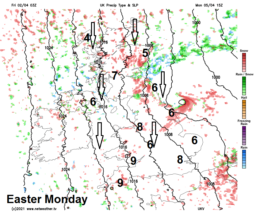
Much colder arctic air flooding south on Easter Monday, bringing wintry showers of hail, sleet and snow!
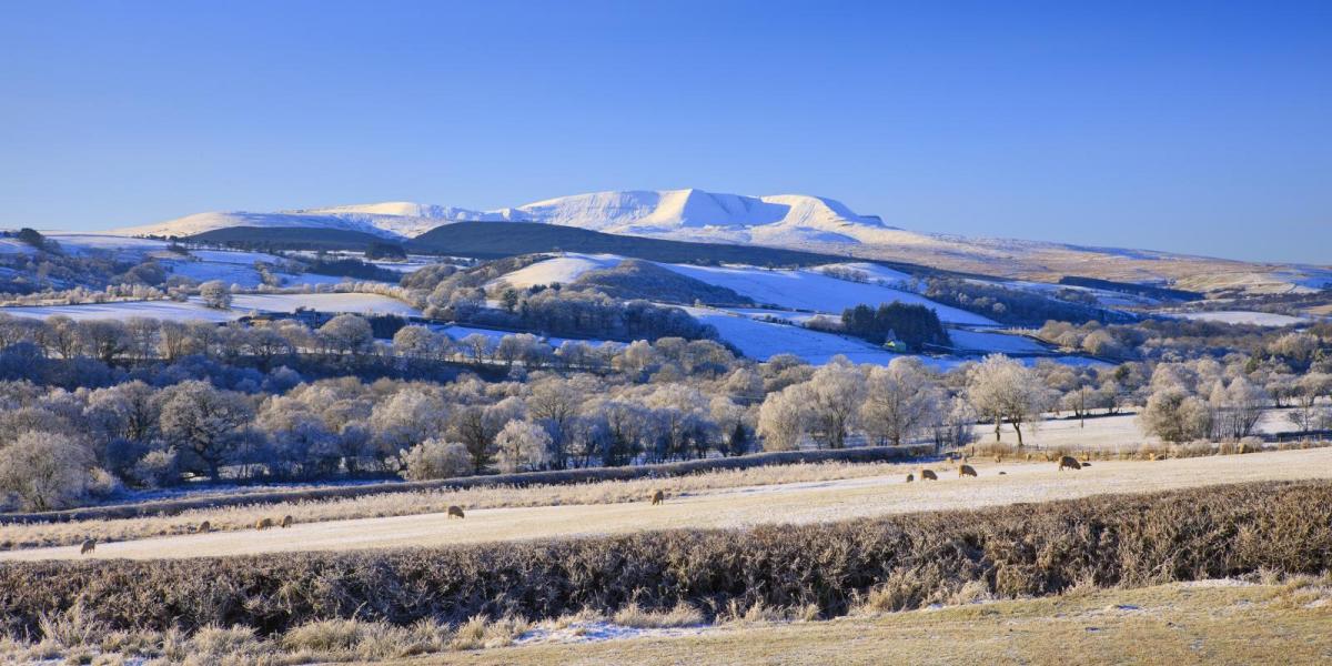
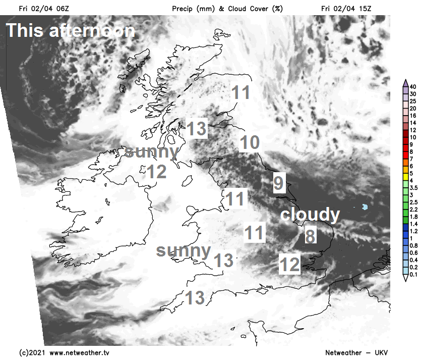
For now, Good Friday will see high pressure close to the west, so it will remain dry. A brisk and chilly northeasterly wind across southern and eastern England will feed in cloudier skies towards the east, perhaps thick enough for the odd light shower near North Sea coasts. But elsewhere across the UK there will be some decent sunny spells developing after a cloudy start in places. The best of the sunshine across Scotland, N. Ireland, NW England, Wales and SW England. Warmest in the west today, where we see the best of the sunshine, temperatures here reaching 12-14C, cooler towards the east with temperatures reaching 8-10C along North Sea coasts with the onshore wind, 10-12C inland.
Generally cloudy and breezy across central and eastern areas of England along with the far north and northeast of Scotland tonight, keeping temperatures above freezing but still chilly. Elsewhere, clearing skies will allow temperatures to fall close to freezing – with a frost developing in the north and west.
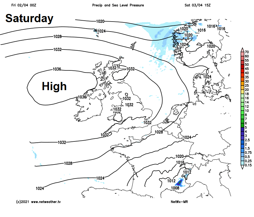
Another dry day on Saturday, thanks to high pressure close to the west, a cloudy start for central and eastern areas of England and the far north, bright and frosty elsewhere. Staying rather cloudy and breezy across eastern England and the far north and northwest of Scotland, but sunny elsewhere. Temperatures reaching 10-13C generally, colder towards North Sea coasts – where temperatures will reach 8-9C at best.
Another fine day for most of England and Wales on Easter Sunday, sunshine widespread including eastern areas which have been cloudier over previous days – it will be milder too, with winds switching to a westerly, temperatures reaching 12-15C. A different story for Scotland and N. Ireland, after a bright start, thickening cloud looks to spread south, with a band of rain along a cold front sweeping south during the afternoon, much colder air with sleet and snow showers following from the north across northern Scotland in the evening. Highs here reaching 8-10C before the cold front sweeps through.
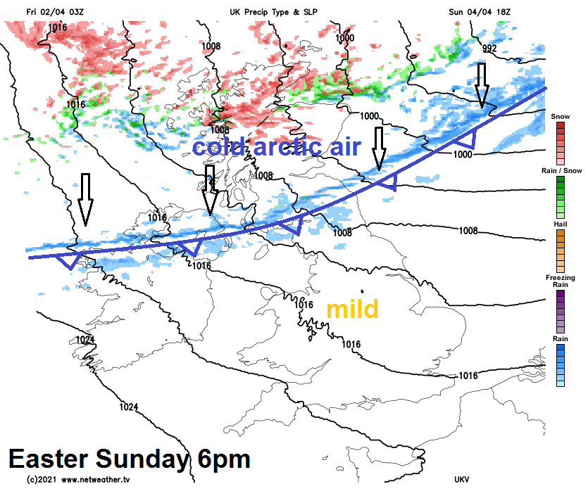
Cold front will sweep south across all parts Sunday night, opening up the floodgates for bitterly cold arctic air to sweep south for all on Easter Monday. The strong northerly wind will feed in wintry showers of hail, sleet and snow across many areas, perhaps the odd rumble of thunder too. Showers most frequent across northern Scotland – where there could be some significant accumulations of snow over higher ground. Snow unlikely to settle elsewhere away from high ground, with sunny spells in between the showers. A cold day, temperatures reaching 4-7C across Scotland, 6-8C generally across England and Wales, perhaps 9-10C across the southwest where it will be more sheltered.
Drier and sunnier for many on Tuesday after a widespread overnight frost, but still a cold northerly with wintry showers persisting for northern Scotland and along eastern and western coasts, but a few showers can’t be ruled out inland across the north too.
Continuing on the cold side with brisk northerly or northwesterly winds, which will feed in wintry showers at times, but there will be some sunshine at times too. A widespread frost risk overnight, so gardeners be aware!