A windy start to the week when temperatures will rise into the low 20sC with glorious sunshine before plummeting ready for the Easter weekend. Ongoing rain, flooding and coastal concerns for Scotland
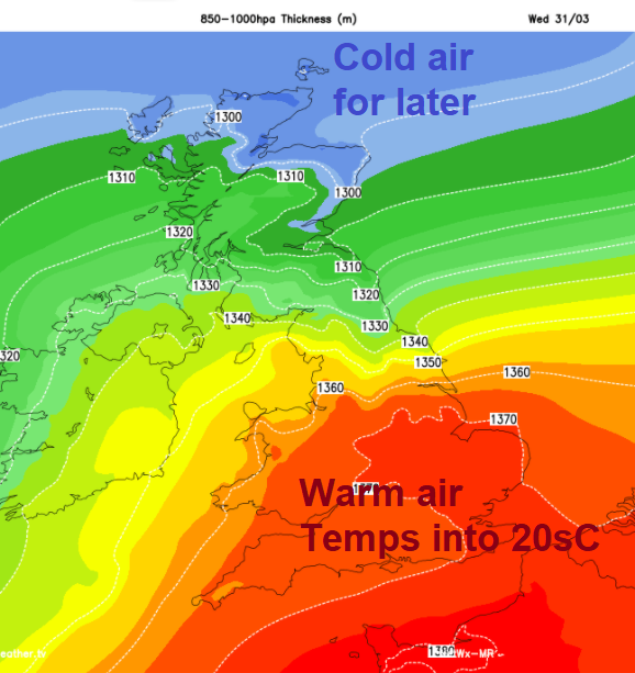
This week we will see great changes in our temperatures, up into the twenties Celsius over the next few days with the warmth particularly for England and Wales with the highest temperatures in the east and for London. Later in the week, colder air pulls down from the north, leaving a chill and frosts over Easter weekend. Even signs of sleet and snow showers from the north. Think of that as the sun warms you over the next few days.
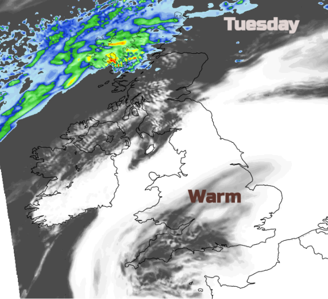
It’s not all sunshine and rising temperatures. It has been a wet weekend for western Scotland and there is more rain to come, with flood warnings in place. The warnings started on Sunday and run through until Tuesday with parts of mainland Scotland seeing “persistent, often heavy rain with significant flooding impacts possible”. It has already been very windy with gusts over 50mph. With extra-high tides this week, SEPA also warned
“Take care when walking or travelling near coastal areas, including the Western Isles and Orkney, due to surge, strong winds and wave overtopping.”
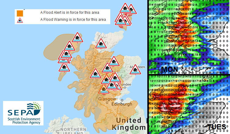
SEPA flood warnings for Monday 29th with UKV forecast rainfall totals from waving front.
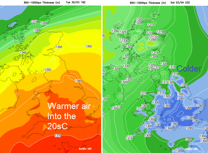
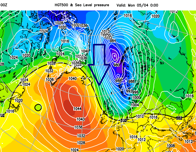
There is a rain warning from the Met Office which mentions “150-250mm over the highest ground” and the strong SW winds continue today around the Irish Sea and North Channel, for Northern Ireland, north Wales, northern England particularly for Pennine routes and Scotland, away from the far north. The waving frontal band responsible for all this rain is quite key in our change of air and so temperatures later this week. Away to the north is colder air and to the south a push of warmer air. As a high pressure builds in, south of Iceland, the front will shift southwards midweek.
For many though, this week’s talking point to add to “have you had your COVID jab?” will be “isn’t it warm!” as people in England and Wales see lockdown restrictions easing slightly and temperatures rising. London could see 23C (73F) on Tuesday maybe 24C by Wednesday.
There is high pressure over Europe to start the week which will guide the warmer flow up towards the UK. The winds ease over southern England today and for many areas, it will be fine and dry with sunshine. For Northern Ireland temperatures will be in the teens, Belfast up to 17C but other areas further north and west sticking at 13 or 14C. For England and Wales also 13 to 17C with eastern Britain seeing the higher values with 18 or 19C likely in a few posts including for London.
Some of the cloud over southern Scotland, the Pennines and Cumbria could be thick enough to bring further patchy rain and the main frontal band edges a bit further north to the Highlands and Western Isles. In the brisk SW flow, Aberdeenshire could see 17 or 18C today thanks to the Fohn effect over the mountains.
The rain band edges further north today night with blustery winds conditions for northern Britain and Northern Ireland. Still cloudy and damp for Cumbria and inland from the Solway Firth in this SW flow. Southern Britain sees calmer conditions and temperatures dip under clearing skies. There could even be a touch of frost or fog patches in the south, the diurnal range can be large at this time of year.
A glorious sunny, warm day for much of England and Wales. Temperatures in the mid to high teens with central, eastern areas and the SE inland seeing 20 to 23C. Bit of breeze from the S or SE for Devon and Cornwall and still the SW flow off the Irish Sea bringing low cloud and dampness to Cumbria, Dumfries& Galloway and Isle of Man coastline. Northern Ireland will have a fair day with temperatures of 14 to 18C but cooler for Scotland.
Easter Monday possible cold Arctic flow which could bring sleet and snow showers.
During Tuesday night the frontal band in the north begins to edge southwards. This will bring rain to more of Scotland, Northern Ireland and Cumbria and temperatures fall for Scotland but ahead of it, another fine day. More widely into the low 20sC for England and possibly 24C for London. That will be it and the change to the colder air later in the week, the holiday weekend, will be stark.