A proper Spring mix of weather coming up with a rollercoaster ride of temperatures from cold to warm to cold again during the coming days. On top of that, there'll also be some heavy, persistent rain in the northwest.
We're set for a real Spring mix of weather during the coming days and through into Easter with some heavy rain in the north and particularly northwest but increasingly warm sunshine further south into next week. We'll be on a rollercoaster ride of temperatures, this weekend it's colder, the first half of next week will be warmer, with highs likely to climb into the low-twenties in southern and central England, but then it's back to cold again as we close in on the Easter Weekend.
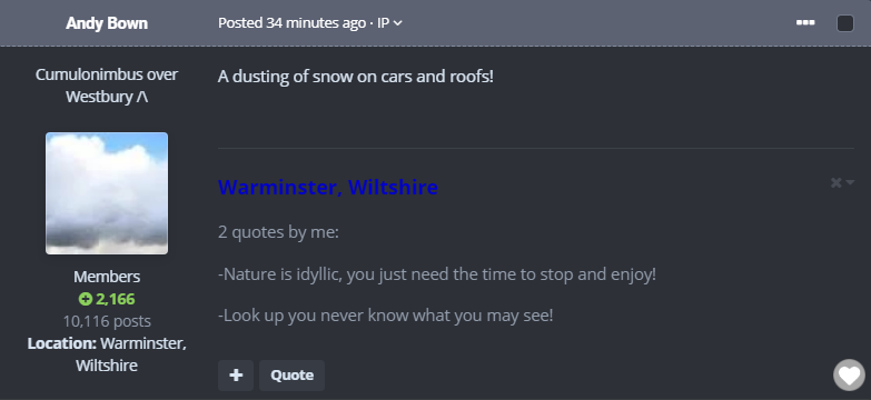
It's been a cold, if not wintry start to the weekend in places, some even saw some snow overnight - even as far south as Warminster in Wiltshire.
Through the remainder of Saturday though, many of the overnight showers will die out, especially away from the west and north of the country. Early sunshine will tend to fill in from the west though, ahead of a band of rain which will cross into Ireland after lunch, reaching the west of Scotland later in the afternoon. With a colder airmass overhead, it'll not be a particularly warm day, particularly in the wind. Highs will reach 10-12c in central and southern regions of England, 7-10c more typical elsewhere.
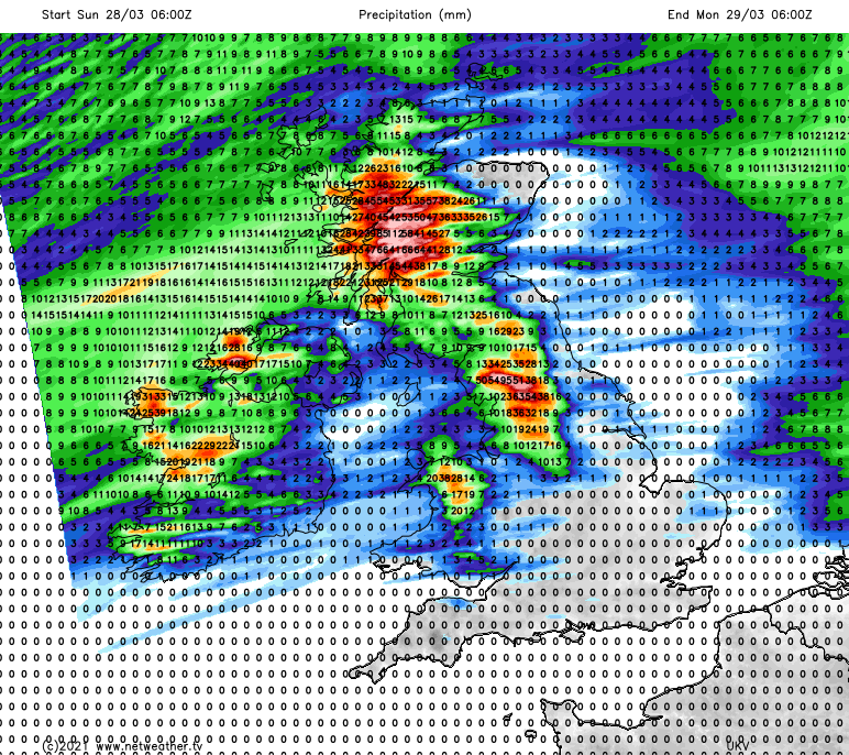
The rain will spread further south and east during the evening and overnight, with some real downpours and persistent heavy outbreaks of it affecting the west of Scotland and northwest England for a time, before it clears from the north during the early hours. With high pressure over the continent, the rain band is going to begin to struggle the further south and east it tries to push, becoming more patchy through northern and central England along with Wales early on Sunday. Faced with that high to the south, it'll then turn around and start to head north again through the day, reaching into Scotland again by later morning or lunchtime - with some further heavy bursts also pushing in from the west.
With the rain, there'll also be strong winds on Sunday - particularly under the rain band and through western and northern regions. Gales are possible near to coasts and over exposed hills. Away from all that, it's still breezy, if not blustery at times with a lot of cloud around. The southwesterly winds will be bringing milder air with them though, so it'll be warmer that Saturday, with highs into the low, maybe even mid-teens across a good part of England. Other parts with see maxes of 8-12c.
Overnight, and into the start of next week, the rain will keep on falling over northern Britain, with northwest England and western Scotland in particular getting quite a decent soaking. There'll be enough rain to bring the threat of flooding in places, and there are already weather warnings issued for western Scotland for Sunday through to Tuesday. All the while though, high pressure over the continent will be ridging further north over England and Wales, setting up a real contrast in fortunes north to south.
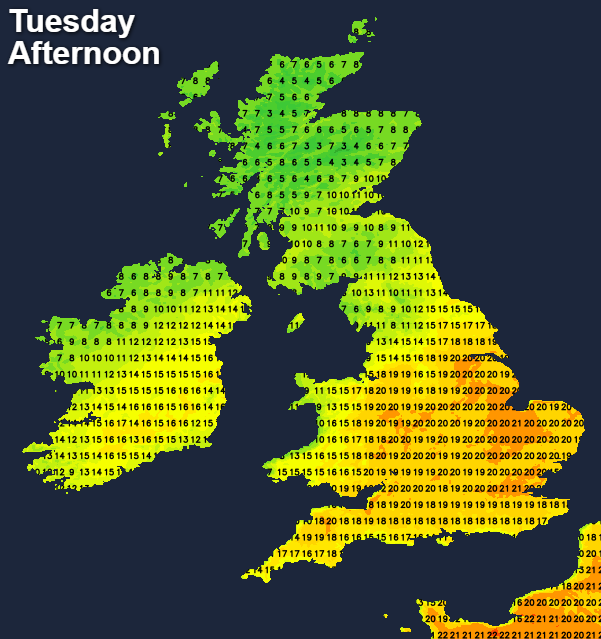
Monday will see sunnier skies breaking through from the south through the day, allowing temperatures to rise into the mid-high teens for parts of England. Tuesday sees the highs influence extend further north, and become stronger with loads of sunshine across the bulk of England and Wales, with maximum temperatures reaching into the low-twenties.
All the while, the rain will continue across northern and central Scotland, along the boundary of warmer and colder air. The rain will start to edge south through Scotland during the day, before continuing to journey south into Wednesday, squeezing the warm air away to the south as it does so.
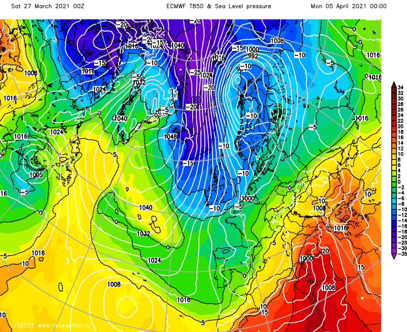
The second half of the week, including the Easter weekend then see a complete change in fortune with colder air in situ, thanks to winds from the north or northeast. I'll leave you with what can only be described as a sreaming Arctic northerly wind being shown by the ECMWF model for Easter Monday this morning. It's a long way off though, so not certain to happen by any means, but definitely something to watch.