Daytime temperatures will reach into double figures for the start of this week as high pressure builds in with a lot of dry weather. However, a northerly flow will bring colder air to eastern England.
We have a cool start this morning in the north and east, milder at 6 or 7C for the south and west to begin Monday. There is pushing and shoving this week of milder air to the west and colder Arctic air in the east. The wind veers from a west/north-westerly to a cold northerly then to the northeast. All the time high pressure builds towards the UK. This results in a lot of drier, steady weather but frontal bands do manage to sidle past bringing outbreaks of rain even wintriness by Friday.
Colorado and Wyoming saw a huge winter storm this weekend with 27” and 36” of snow respectively (nearly 70 and 90cms). Power cables fell in the heavy snowfall and there were blizzard conditions. This low pressure and one which develops a bit further south midweek will move towards the eastern seaboard then the Atlantic, but our high pressure will be like a great protection buffer.
There are mixed skies this morning; sunshine for some, more cloud and greyness for others. It’s not as windy as it has been with a light north-westerly wind. There are a few showers about, a scattering over SE England and the Midlands, clusters brushing Co. Fermanagh and more appearing for Cornwall this afternoon. Areas with sunshine will see the cloud filling in. Eastern Britain will still see bright spells but out west, there is an incoming warm front. This will bring thicker cloud and a line of patchy rain to Ireland and the Western Isles which will reach western Britain this evening.
Temperatures by day will reach double figures for many. 10 to 13C for most but only 9C along the North Sea coast and for more of Scotland. Overnight in a light westerly wind, temperatures stay around 7 or 8C but there will still be clear spells along the east coast and here dip down lower. The warm front moves through overnight bringing a grey damp start to East Anglia, London and the southeast to start Tuesday and the cold front will bring some bursts of heavier rain to Scotland and Northern Ireland overnight but it moves through quickly reaching northern England and north Wales for Tuesday morning.
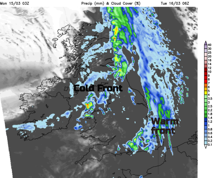
That continues to push its way south, most noticeably over eastern England, fading further west. Behind the cold front the skies clear, there will be sunshine in the north and a colder, still night to follow with the high over us. The hang back of cloud over England and Wales will take its time to clear so staying grey all day and the cloud remains over SE England by night. In the sunshine temperatures will rise to 14C, perhaps a few degrees higher in sunny breaks over southern Britain. It will be mild everywhere but as the winds veer to the north some coasts will have a nippy breeze off the sea. East Anglia and Kent will notice that by Tuesday evening.
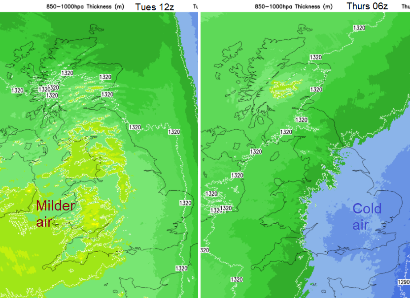
By Wednesday in a northerly flow, there will be a chilly start with a bit of frost in places and then temperatures should reach between 10 in the east and 17C in the west. Eastern England remains cooler with a pool of cold air aloft and more of a brisk north wind over SE Britain. Norfolk will feel chilly. The settled, mostly dry weather continues midweek with north winds bringing just a few showers over England. Turning murky and damp along the North Sea coasts on Wednesday night and then a scattering of showers for East Anglia and the Home counties into Thursday as the winds veer to the NE. It will feel colder, especially where it is damp and grey in the east. There is a signal that during Thursday night and Friday, any precipitation will turn wintry for eastern Britain. This doesn’t look to amount to much just a few sleety bits or snow grains however later Friday into early Saturday there could be some heavier precipitation in the far SE. Just something to keep an eye on.
There will be a contrast across the UK, feeling mild in any sunshine for western parts but a real damp chill further east. Think of those school children sitting with the windows open in mid-March.