A wild start in places for Thursday with gusts over 70mph. It stays windy into tomorrow, but not as strong however colder air brings lots of showers and even hill snow.
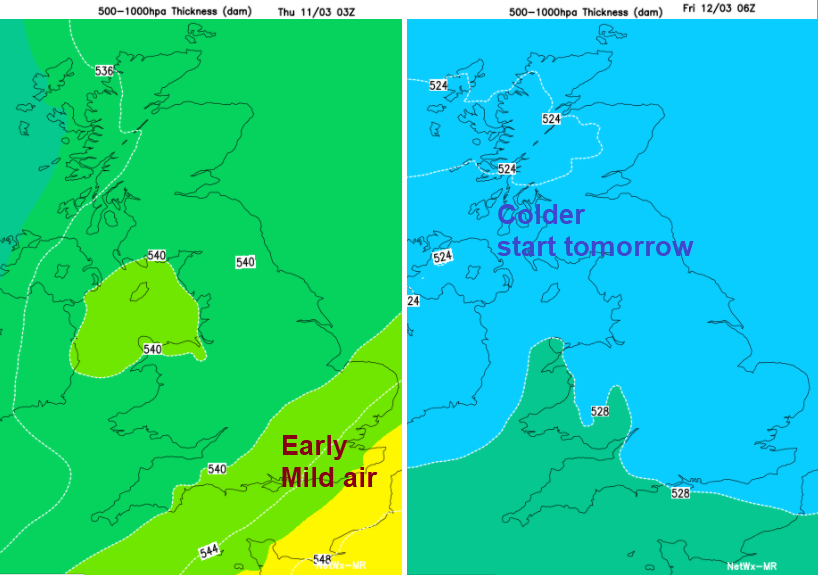
A wild start this morning with gusts over 60mph. Overnight a deep low pressure has moved past northern Scotland, trailing its weather fronts over the UK bringing a spell of rain. As these frontal bands clear away over the North Sea there will be clearer, brighter skies with a rash of blustery showers from the Atlantic. By tomorrow, as colder air takes hold, some of these showers will turn wintry with snow on northern hills. Further rain or showers from the west into the weekend but less so by Sunday.
The second Atlantic low pressure of this week has brought strong winds and high gusts overnight with exposed parts of Wales bearing the brunt of 80+mph gusts. This same system is affecting western Europe with warnings today for coastal Spain and Portugal, northern France this morning as the wind warning over England and Wales continues. The strongest gusts and gales will ease from eastern England, over the Pennines and along the English Channel by mid-morning.
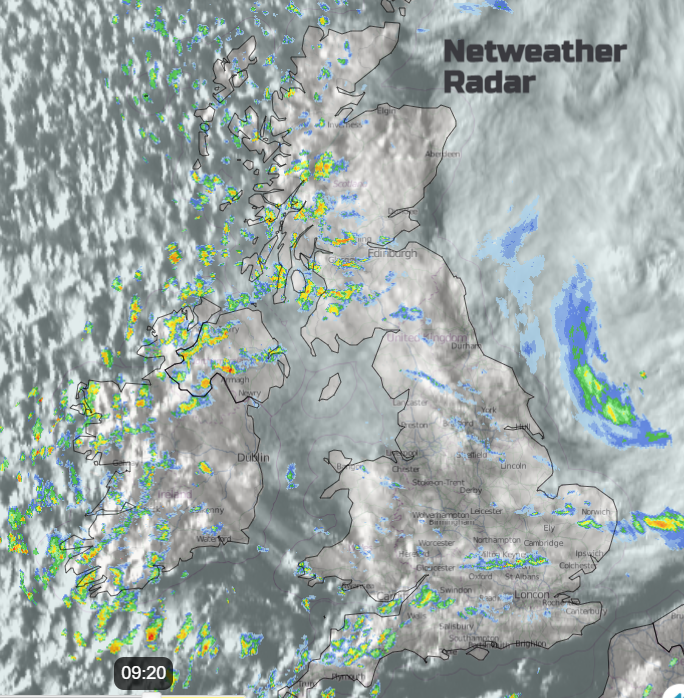
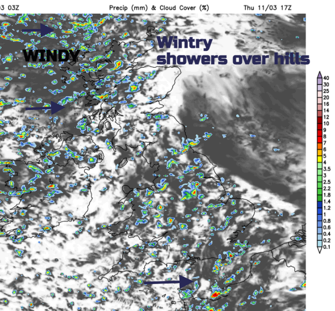
Already on the radar, we can see a change, post front. The area of frontal rain and cloud in white with darker areas (clear skies) dotted with showers. There will still be a spell of gales and gusts around 60mph this morning as the trough pulls away, but the strongest gusts do then ease down. It remains very windy in the very unstable, colder air with some hefty downpours. These will include hail at times, there could be lightning. Some areas become dry for a while with brighter skies and blustery winds. Western parts will see lots of showers whistling by and more make their way across Britain during this afternoon. Temperatures will register as 7 to 12C today but in the wind, it will feel colder particularly as the showers pass by. In sunnier, sheltered spots it will feel okay but the winds and gusts do pickup this afternoon for SW England and once more for the Channel Islands.
The westerly winds strengthen for NW Scotland this evening with high gusts re-appearing and the blustery winds across the UK back slightly during the night. England and Wales become clear and cold for a time with temperatures dropping well down into single figures. The ongoing showers over Northern Ireland and Scotland turn wintry with snow over the hills and sleet or hail to lower levels by dawn. A cluster of heavier showers heads towards SW Britain early on Friday as the winds pick up. Not as windy as today but lines of heavy, gusty showers working their way eastwards over southern Britain with rain and an occasional icy tinge. A low centre develops over eastern England on Friday morning which could bring a spell of heavier rain, even some sleet. A grim short spell of wet and windy weather for Greater London, Essex, Kent and East Sussex tomorrow. For Wales, northern England, Northern Ireland and Scotland there will be bands and clusters of heavy showers with a mix of rain, sleet or hail and snow over the hills. It will feel cold.
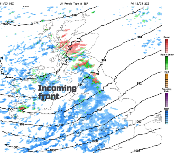
The blustery showers with sunny spells theme continues across the UK into Friday afternoon before a warm front from the Atlantic shows itself. This will bring more cloud and heavier rain from the west and for a time as it hits the colder air, snow for inland Scotland and Cumbria. This shouldn’t amount to much away from the hilltops and mountains but for essential journeys on Friday night conditions will be wintry for higher level routes with icy slush to lower levels. Very wet and windy for southern Britain overnight as the fronts move through with strengthening winds particularly around the coasts.
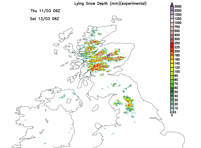
Lying snow is shown affecting the higher ground of Scotland and also overnight the Pennines and Cumbrian Fells.
Saturday will be mixed with sunshine and showers. The early rain and hill snow clears eastwards from northern England, but a host of showers blow in from Northern Ireland over western Scotland, to Greater Manchester, the Peak District and over northern Wales. Other areas escape and will enjoy sunshine but still feeling cool.