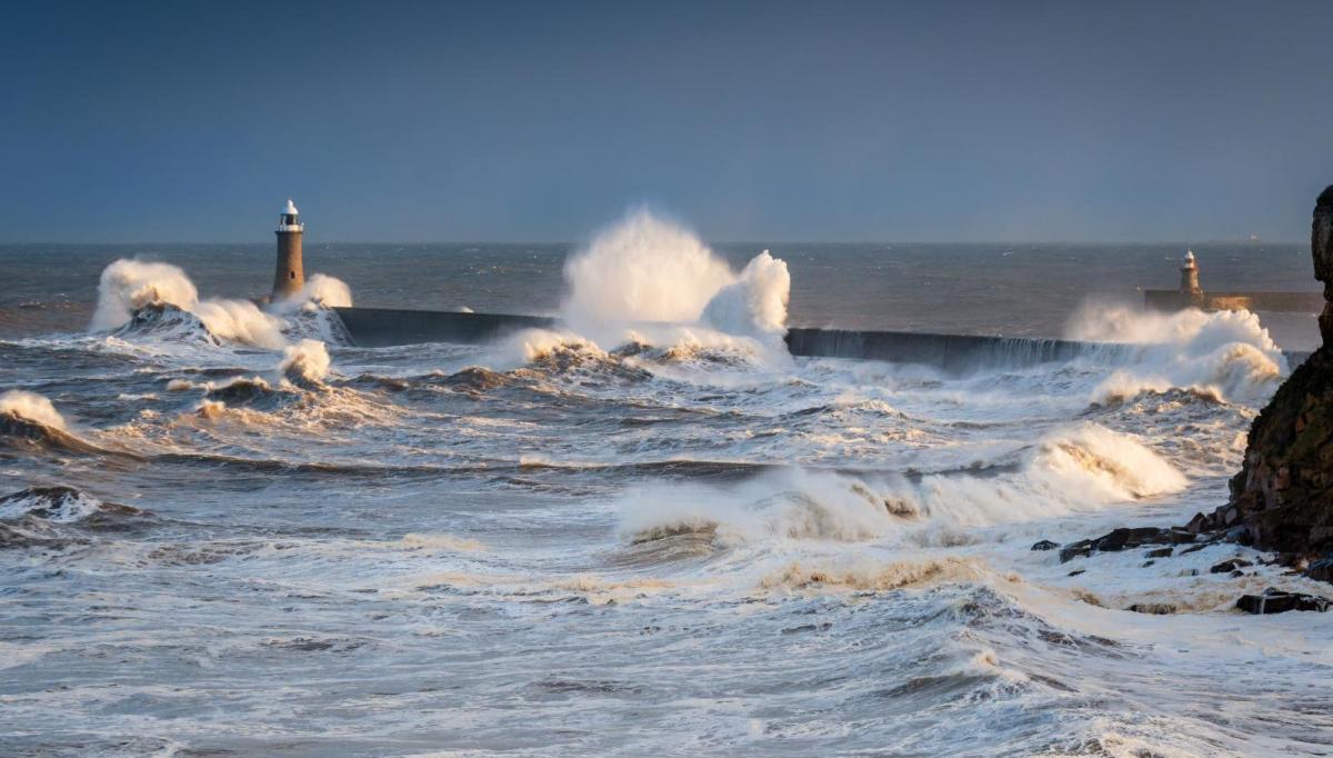
The weather will see a dramatic switch from a stretch of relatively calm weather with high pressure charge since the beginning of March to a wet and rather windy spell, as a strong Atlantic jet stream comes barrelling in from the west. Most areas will see spells of rain and also gales develop on Wednesday, as two deep depressions track northeast close to the northwest of Britain.
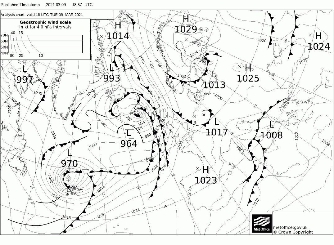
The first of these lows passes northeast to the NW of Scotland this evening, bringing rain and strong winds to the far northwest, with gusts of 60-70mph for a brief time. However, it is the second low much further out west over the Atlantic which will bring more widespread gales and rain across most areas from Wednesday afternoon through into early Thursday morning.
The second low, already with central pressure of 970 hPa southeast of New Foundland at 6pm on today, will deepen further under the development left exit of a strong 200mph jet stream racing east across the Atlantic towards the UK & Ireland.
This evening's synoptic situation
Wednesday midnight synoptic situation
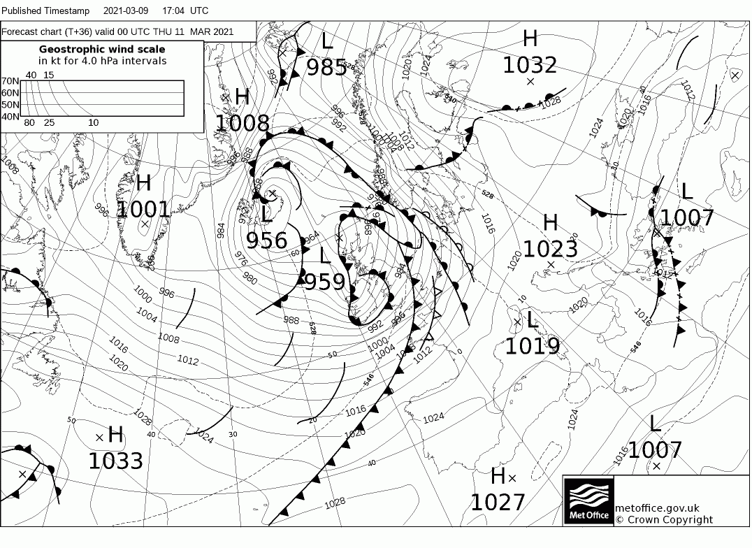
The low deepening to around 959 hPa just northwest of Scotland at midnight Wednesday night. This second low will bring more widespread gales, the worst of the winds spreading east in a broad swathe across Ireland, Wales and England from Wednesday evening through Wednesday night before winds ease from the west after breakfast time Thursday morning. Some travel disruption is possible into Thursday morning, with potential for exposed bridges closed to high-sided vehicles, delays to ferries and trains etc. Also, the strong winds and resultant large swell could cause some coastal flooding in coastal southwestern Britain and coastal areas of Ireland.
The jet stream will continue running west to east into NW Europe to end the week and into the weekend, so remaining unsettled and windy, with a strong westerly wind blowing blustery showers eastwards, wintry over higher ground in the north. A few longer spells of rain or northern hill snow possible too pushing east. Showers and the westerly wind perhaps easing through Sunday, as the jet stream begins to buckle upstream over the Atlantic, allowing a ridge of high pressure to build in from the west by the start of next week.
It looks like the wild and unsettled weather starting tomorrow will be short-lived, with the weather models generally agreeing on high pressure expanding northeast across NW Europe through next week and becoming firmly established across the UK, bringing a return to dry and settled conditions.
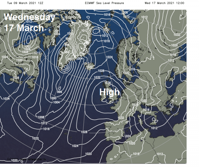
The orientation of the high will be important on how cloudy, mild or chilly it will be over different parts of the UK though. It may start off sunny for some, feeling pleasantly mild by day but chilly overnight under clear skies, with a risk of frost. The high may migrate northeast to be centred close to Scotland or towards Scandinavia, as a few recent runs of GFS and ECMWF model have suggested. This would mean a colder easterly flow could develop, making days on the chilly side too, but also cloudy towards eastern coasts where there could be showers, wintry over higher ground, but sunny in the west. If the high sits more centred over southern Britain, then Atlantic fronts may bring cloudier skies to Scotland and N. Ireland while further south it’s sunnier and fairly mild.
Loading recent activity...