A cold front moving southwest will remove the dull, gloomy and damp weather by Friday, with most areas becoming dry, bright and settled into the weekend, but on the chilly side, with risk of overnight frost.
It will be a chilly day for all, generally cloudy for England and Wales, while there will be brighter skies moving down across Scotland following a cold front moving south bringing a band of rain and hill snow. An area of high pressure dropping down from Iceland today will settle over the UK on Friday and will hang around centred across southern Britain through the weekend, so for many, it will remain dry with light winds, but with a fair bit of cloud floating around, although some bright or sunny spells too. The exception will be across the far north over the weekend, where Atlantic fronts will bring in thicker cloud and outbreaks of rain. Where skies clear at night, there will be a risk of frost.
For now, a cold, grey, gloomy and misty start, foggy for some, across much of Britain. Most places are dry, but some outbreaks of rain affecting southern Scotland and NE England as a cold front moves through here, sleet and snow over higher ground of the Southern Uplands, Cheviots and Pennines. Some showers affecting eastern parts of England further south too, even some very localised snow across parts of east Cambridgeshire, north Essex and west Suffolk earlier – thanks to heavier bursts leading to evaporative cooling of the air enough to allow snow to reach the ground.
A band of patchy rain and hill snow along a cold front will continue to move south across northern England through the morning, reaching north Wales and the Midlands by late afternoon, by which time will be mostly light. Drier and brighter but breezy conditions following the front across Scotland and the north of northern England. Remaining generally dull and misty ahead of the front across south Wales, Midlands, southern England and East Anglia – though early showery rain, sleet and snow will clear East Anglia, while any early fog should lift too.
A colder day generally, exacerbated by a chilly northeasterly wind towards eastern coasts, temperatures reaching 5-8C generally, milder across the far SW of England – where we could see 11C.
Thicker cloud and patchy light rain or drizzle clearing southern areas in the early part of the night, then drier conditions with cloud becoming more broken with clear spells following across most areas in the early hours of Friday, allowing a frost to develop where cloud clears. Lowest temperatures overnight across the north – where skies will be clearest, perhaps falling as low as -4C in Scotland.
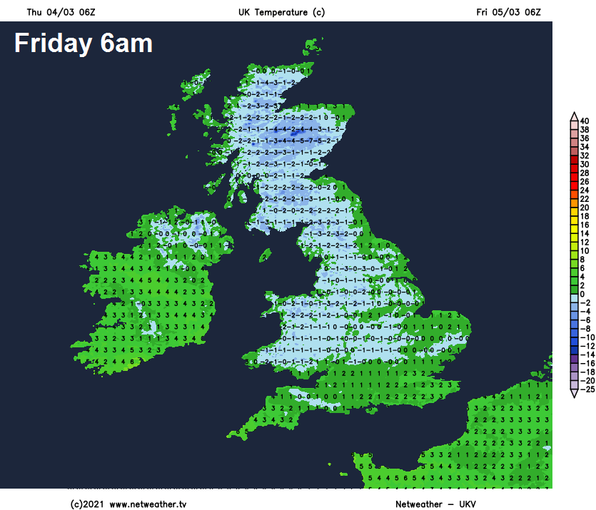
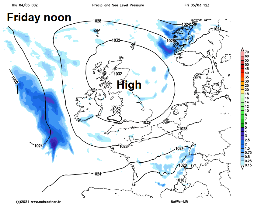
High pressure moving south will become established across Britain on Friday. So for most it will be dry and settled but on the chilly side. There will be a fair amount of cloud drifting around, particularly across central areas, but also some bright or sunny spells, best of which could be across southern England and East Anglia and Scotland – where there’ll be more of a breeze. Temperatures reaching 6-8C generally.
Saturday will dry and settled for most, with high pressure in charge, a fair amount of cloud floating around in the circulation of the anticyclone sinking south over Britain, but there will be some bright or sunny spells at times. The exception will be across the north of Scotland – where thicker cloud and more of a breeze will bring some patchy rain. Still chilly, temperatures generally staying in high single figures widely.
Sunday will be cloudy, damp and breezy across northern and western Scotland along with the far west of Britain further south, but otherwise most places will have another dry and settled day with variable amounts of cloud and bright or sunny spells. Temperatures reaching 8-10C.
Starting off settled next week, with most places dry and bright or sunny on Monday, though turning breezy. However, turning wet and windy across the northwest and this will herald a change to more unsettled conditions taking over from the west, as a succession of Atlantic lows move in off the Atlantic, initially close to the northwest on Tuesday, but perhaps running across the south later in the week. So all areas can expect to see spells of rain moving through interspersed with brighter spells and showers, it will be rather windy at times too, perhaps will gales in the north and west.