With high pressure in charge of the UK's weather this weekend, it's a settled, often sunny picture. The high stays into next week too.
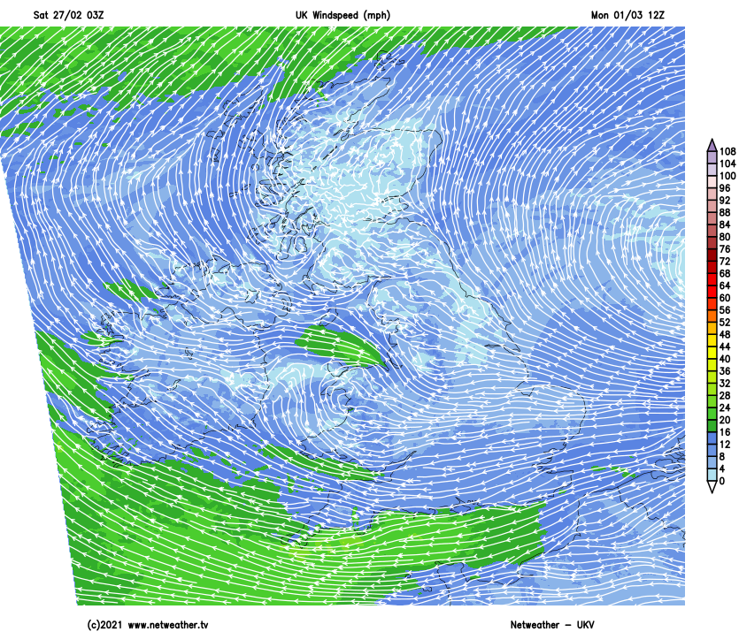
High pressure is now well in charge of the UK's weather and looks set to stay that way into next week as well. That means a lot of settled, dry, and for the weekend at least, sunny weather. There'll be some flies in the sunshine ointment at times though - a weak front in the north today and tomorrow, some mist and fog in the mornings, and into next week with easterly winds picking up a little, more cloud from the north sea may move into eastern parts.
Today, after a chilly start, it'll be a fine day for most of the country with lots of sunshine and light winds. That weak front will be over central and southern Scotland and a good part of Ireland, but the life will have been sucked right out of it by the high pressure. So, beyond a few spots of rain, it'll be just nuisance value in terms of bringing extra cloud. Temperatures today will typically reach 8-12c, warmest in eastern parts, with the teens not out of the question in places - so milder than normal for the time of year and probably feeling very springlike in the sunshine. Perhaps a perfect day for a spot of gardening - check the February guide and to-do list here.
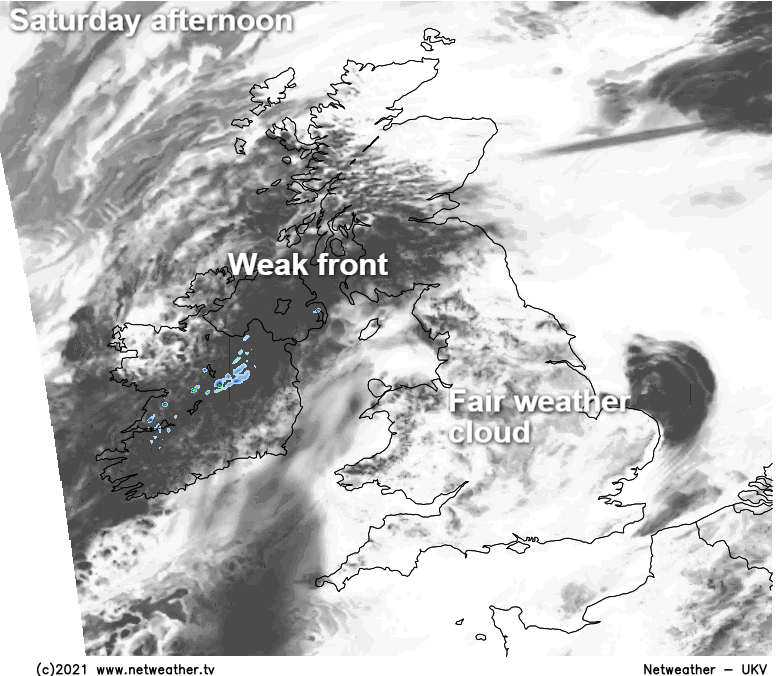
Overnight tonight, mist and fog will become quite widespread, as will another frost. The front will still be across southern and central Scotland, Ireland and perhaps the far north of England, bringing a lot of low cloud and maybe some bits and pieces of rain here and there.
Into Sunday morning, the murky patches in England and Wales will take a little while to lift, but once they do, there'll be bags of sunshine for many. Some cloud may cling on near to eastern coasts throughout, perhaps even becoming more widespread into the late afternoon before spreading further west into the evening and overnight again. The front further north will still be in play but will weaken all the while, bringing more gaps in the cloud as the day wears on, but on the flipside of that, the far north and northwest of Scotland will probably see more cloudiness arriving into the afternoon.
Temperatures on Sunday may be a degree or two cooler than today but should still feel pleasant enough in the sunshine. Where the cloud and murk hang around in those eastern coastal parts of England it won't feel quite so nice, with maxes of just 5-6c possible.
Into Monday, with an easterly flow becoming more pronounced, the early mist and murk will have more trouble clearing in many central and eastern parts, leaving the west the best of but still not all of the sunshine. Where the sun does break through, 10-12c is likely, but under the cloud, 6-8c will be more like it and feeling chillier than that in the wind. The northern half of Scotland bucks a couple of trends though, with lighter winds and more sunshine, even in the east, but head to the far north and northwest, there could be more cloud again as Atlantic fronts brush nearby, and here the winds will be in the west rather than east.
Tuesday follows along a very similar theme, with mist, murk and fog overnight, with some frost patches where skies stay clear. The cloud will take its time to thin and break again during the day but may do so more widely than Monday. Then, some models want to bring some disturbances up from the southwest into midweek as low pressure lurks and the high edges a little further away, but this is very uncertain. The over-riding theme into the latter part of the week still settled and mostly dry with high pressure never too far away.