Once the rain and cloud clears from SE Britain today, high pressure will bring a settled few days. Light winds, sunshine, nippy nights with some frost and fog but fine and dry this weekend.
18.4C in Suffolk on Wednesday. That is the peak of this week’s exceptionally mild weather. High pressure is building so that will settle things down for Friday and the weekend. Good news for those who had to endure high winds and heavy rain this week with the risk of flooding.
Wednesday 24th Feb 2021, very mild air from the south before the front
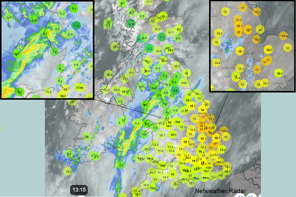
We have a cold front to get rid of over England today which is bringing more cloud, some still over Wales but also a band of rain which was rather lively overnight for northern England. The frontal rain is heading to Hampshire, the Isle of Wight and the Channel Islands this morning and there will be further pulses of rain over East Anglia and SE England and London this morning. There is a bit of a wave developing which means its clearance from Kent this afternoon could be delayed. Behind this distinct frontal band, there will be a lot of sunshine. A fresher feel to the day as the SW winds veer to a westerly, off the Atlantic rather than the continental flow which reached back to north Africa.
Temperatures today will be around 9 to 12C.
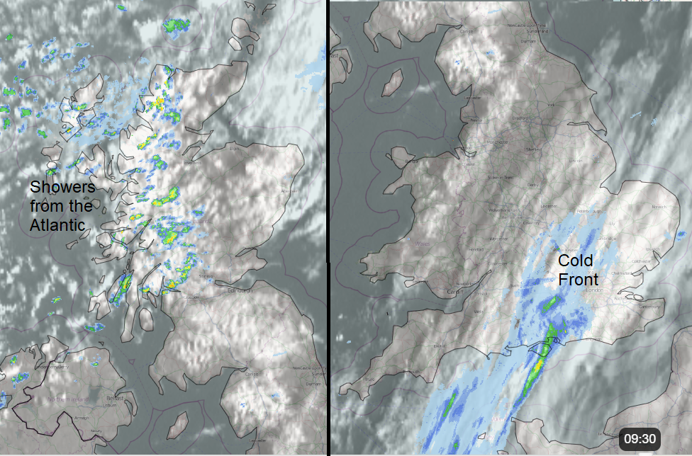
Showers continue to feed in from the west particularly over Scotland, linked to a small low away to the north. These work their way through the Central Belt and a few reach Northern Ireland. Still windy for Scotland with gales in the far north and the winds become lighter further south through the UK. One or two light showers could move over Wales but the rising pressure will suppress them leaving a fine day.
With temperatures in double figures this week there is now tree pollen about, if you are feeling a bit ‘hay’fever-ish. Hazel, alder and yew tree pollen particularly for central and southern Britain with some fungal spore levels rise too.
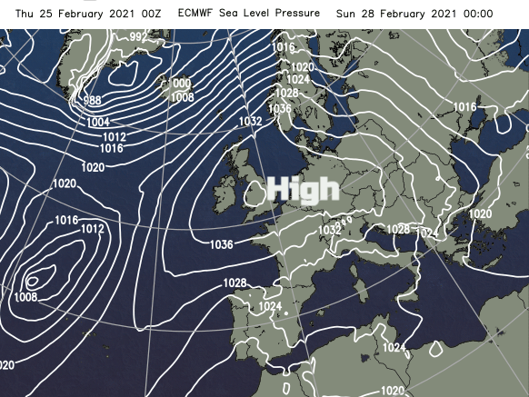
High pressure begins to build in from the SW and will weaken and slow an Atlantic frontal system heading in during Friday and Saturday. The high pressure will bring more settled, steady conditions throughout the weekend even into the start of next week when it moves over central Europe.
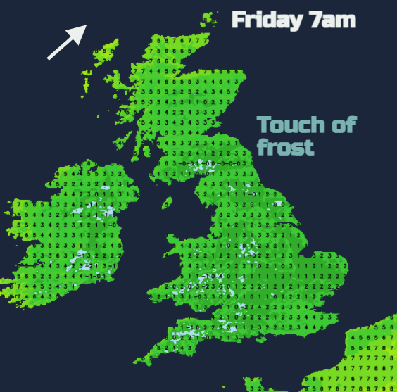
There will be colder nights, it has been mild by night as well as by day this week. As the winds ease down and clear skies tonight there will be a touch of frost in places by dawn. A fine, sunny day on Friday with temperatures just into double figures, 13C for some spots. The S/SW winds pick up for northwestern Scotland as the Atlantic cold front heads in. England and Wales cool off by night with very light winds but it stays milder with more cloud further north and west. There will be rain for Northern Ireland and western Scotland during Friday night with the fading band dipping over northern England by Saturday morning. It will be a colder start for southern and central Britain with frost in places and some mist with fog.
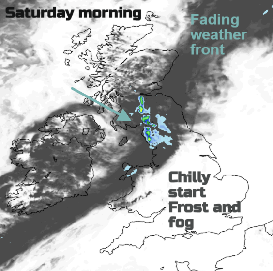
The frontal band tips over more of northern England during Saturday and into Wales, so more cloud here and patchy rain but still light winds and some brightness. Elsewhere a fine day with sunshine on Saturday.
Sunday will see more low cloud and fog over a central swathe of the UK but again a settled quiet day with sunshine and dry weather. It’s mild enough by day but a bit of a nip where skies are clear by night. A more settled, fine few days to come.