That bitter easterly wind keeps on coming and will continue to feed snow showers in from the east today and tomorrow as the UK's wintry spell of weather continues.
That bitter easterly wind keeps on coming and will continue to feed snow showers in from the east today and tomorrow. Although through tomorrow a nose of high pressure will begin to move down from the north, easing the winds and in turn easing some of the showers as well.
For now, today (Tuesday) will be a very similar day to yesterday, so those winds will continue to cut through you. The snow showers will be at their most frequent in eastern regions, but some of them will get blown a good way inland, so although western regions will stay mostly dry, there'll still be the threat of seeing some snow. The showers may merge from time to time, ganging up to bring longer spells or streams or snow.
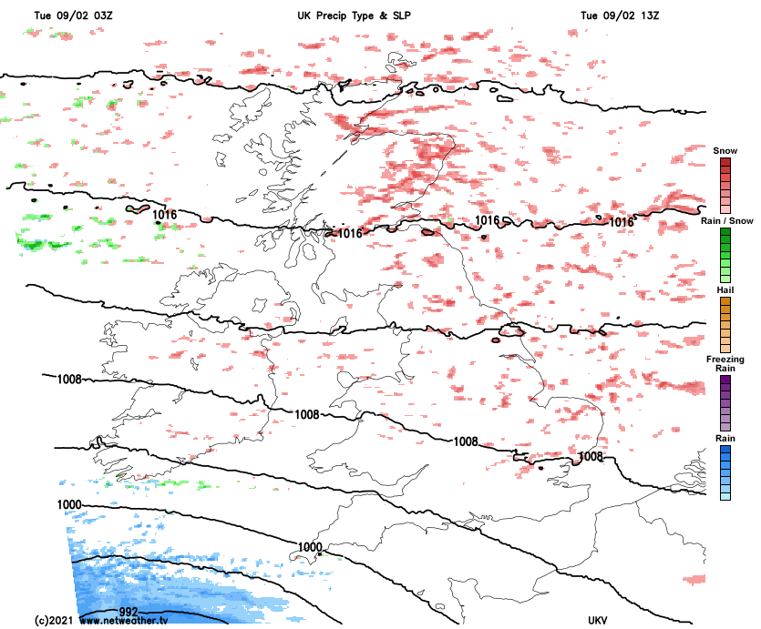
Snow will continue to accumulate today in prone spots and over the hills especially. In those parts which have maybe seen an overnight dusting though, it's likely to melt as and when the sun comes out, but with the showers continuing into the evening and overnight, affected spots will see another covering or a further top-up. There's also low pressure not too far away down to the southwest of the country, and that may allow for some additional showers to get into the southwest of England as well.
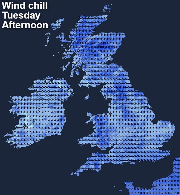
Temperatures will vary from -2c to 2c typically today, and will also vary depending on whether you're under a shower or not - they'll fall quickly when the heavier ones move through and rise again during sunny spells. Regardless of what the thermometer says though, it's going to feel bitter in the wind, with -3c maybe as 'warm' as it'll feel in more sheltered spots.
Tonight, it'll be a cold one everywhere with widespread ice and frost. The showers will continue in the east, with some continuing to make their way through into central and even western parts. By the end of the night, the showers in the north of Scotland will just be starting to ease down as pressure begins to rise.
Into Wednesday those winds will still be there for all but the north of Scotland, although they'll be more from the northeast than the east and will be a touch lighter than they have been. The snow showers will also still be with us, potentially still ganging together at times, and still most frequent in the east with western parts enjoying the best of the sunny spells. With that higher pressure making a move down the country, those showers will start to get some of the life sucked out of them, initially across Scotland but later from the north in England as well. They're not likely to disappear altogether, but will become less widespread and lighter in the main, with southern England the last to see this change overnight.
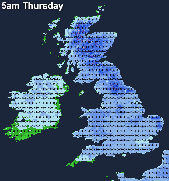
Thursday will start cold, as with lighter winds temperatures will have plummeted overnight, -10c or so is likely for parts of East Anglia and northern England over the snowfields, and -15c or so for the Highlands of Scotland, with much of the rest of the UK will be several degrees below freezing as well. For the most part, Thursday will be a quiet day with sunny spells, and after that cold start, temperatures will recover to 0-3c. There may be some snow showers still affecting southern England first thing and the odd rogue one elsewhere, but for the majority, through the first half of the day, it's likely to be dry.
But, we'll have to look northeast and southwest as the day and evening progresses, with low pressure in both the North Sea and the Atlantic throwing their fronts our way. The one in the southwest is likely to bring some outbreaks of rain, sleet and snow across the south of Ireland initially, before crossing into southwest England and south Wales late on in the day.
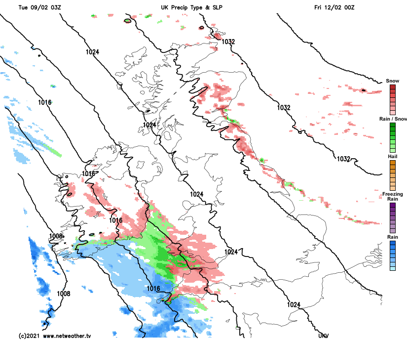
The northeastern one is likely to bring a batch of snow showers into eastern Scotland and later down the eastern side of England, probably from East Anglia northward. Both of these are quite uncertain right now, especially the southwestern one which may well struggle to make any inroads at all as it tries to cross from Ireland into the UK.
After a brief lull, the wind will become more of a feature again, blowing in from the southeast by this point and strongest in western parts for the end of the week and start of the weekend. It'll still be cold, with overnight frost and ice, along with a few snow showers will affecting eastern coastal counties. Another Atlantic system will be trying to move in from the west as well, which may mean some rain, sleet and snow crossing into western parts - but how far east any of it reaches is tough to call at the moment.