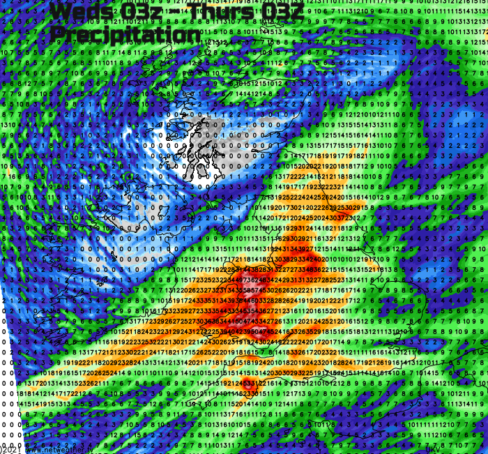
The precarious flood situation continues with saturated ground and plenty of rainfall over the hills working its way into already high rivers. More rain then strong winds and snow as the colder air takes hold.
More rain today and so the flood risk continues. It's colder in the north and there has been snow overnight, leaving an icy start. River levels are high. Any rain or flow down from the hills in the Amber warning area could be an issue. Wind and more snow as Storm Christoph cranks up.
All of England and Wales are now under a yellow Rain warning. There is mild air but quite a wind. The main boundary rainband has been over Scotland and Northern Ireland during the night, hitting the cold air and resulting in snow but this band is edging back southwards, so the rain/wintry mix is easing for the Central Belt and Northern Ireland already. This large temperature contrast will help drive the development of Christoph’s low centre later on, bringing the strong winds.
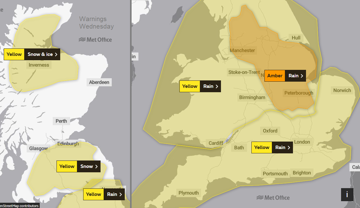
This Amber warning
Parts of NW England, Yorkshire and the East Midlands had been highlighted with an Amber warning. Looking at the rainfall totals this week it was Wales and Cumbria which saw the highest totals with 50 to 125mm of rain, 2 to 5” falling. Some areas in the Amber warning hardly saw any rain on Tuesday but there has been some overnight.
The key thing here is that the Met Office warning system looks at impacts. So how much rain is important, but what happens when it hits the ground also matters and for this, they consult with the Environment Agency and sometimes local authorities.
Imagine two bowls, one large and deep (for north Wales) half full of water. Then another, smaller and nearly full of water (eastern England). You can pour a glass of water into the Wales bowl and it is accommodated. So, a yellow warning for the heavy rain, poor conditions on the roads and still flood warnings. However, the eastern England one overflows, it floods because the existing conditions can’t take any more water at this time, it was precarious anyway. That is why the Amber warning is there. When the rain does come, flooding is likely, “is probable” from the Env. Agency 5-day outlook.
There is more rain to come today and the Environment Agency staff have been busy clearing waterways and putting up extra flood defences. There are numerous flood warnings and alerts, many more than yesterday morning.
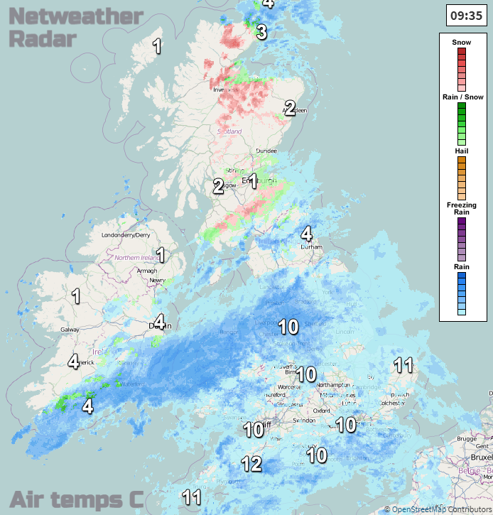
Top temperatures vary from 11 or 12 for southern England and the Midlands, very mild but with a fresh wind, to only 3C for Edinburgh and Glasgow. It depends which side of the main frontal band you are and Belfast, into the cold side will only reach 5C. Yesterday the frontal band was stretched east/west, slightly further north than forecast but today it will begin to pivot SW/NE as the dig of cold air pushes down over Ireland. There will be more heavy rain for Wales and NW England. Once more there could be some variation in reach for the band as it swings north/south. Watch the radar rather than just relying on a weather app symbols.
To the south of this, there are areas of rain heading in from the SW and through the day we’ll see the main rain band shift up over more of northern England into SE Scotland and again as this hits the cold air there will be snow. Mainly for the hills of the Scottish Borders, the Southern Uplands and Cumbria, Snowdonia.
To the north, it is cold and icy with lying snow from last night. There have already been snow showers off the Moray Firth this morning and these continue to push over Caithness and Sutherland this afternoon.
Tonight
By this evening and tonight, we will see the cold front part of the rain band digging down across Wales and England, the low centre deepens and in the trough, there will be a band of heavy rain and strong, gusty winds. Gales around the coasts.
This will be troublesome. It brings heavy rain to the saturated regions, many already on flood alert. The back edge will see snow, mainly over the hills from SE Scotland, through northern England, Wales, North York moors and Peak District and the southerly winds will strengthen over eastern England.
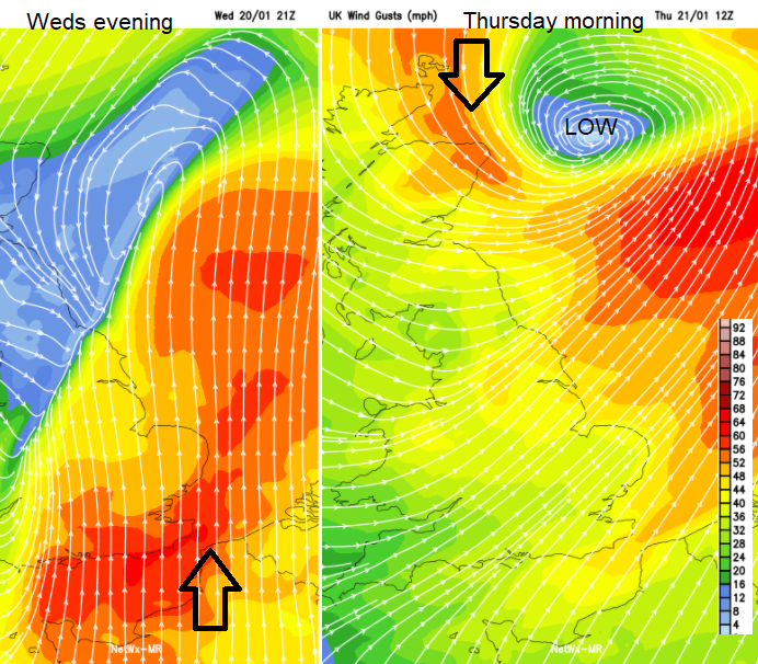
During Wednesday night and early on Thursday we see the low centre of Storm Christoph deepening as it heads off over the North Sea. The winds veer to a westerly and with the UK then in colder air, eastern Britain turns wintry. Snow showers for northern Scotland, also SE Scotland and NE England but possible further down the east coast of England
As long as the low has cleared away, it will leave much of England drier and sunny but cold. Wales, Northern Ireland and western England will be cold and bright but with plenty of showers, icy rain even flurries of snow. As Storm Christoph edges towards southern Norway on Thursday it could continue to affect NE Scotland with strong cold winds down the east coast of Britain and bands of snow working right down through Scotland into northern Britain.
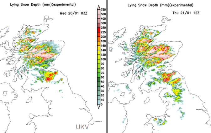
Existing snow and forecast snow coverage by Thursday midday.
There is a snow warning over northern Scotland throughout Thursday. 5cms of snow to low levels, 10-40cm of snow over the hills and mountains of Grampian. Conditions will be tricky as the strong north winds back to the NW, gales for exposed parts.
“Heavy snow and strong winds will bring blizzard conditions in places leading to travel disruption on Thursday.” Met Office
Still very windy for NE Scotland by Thursday evening. The snow in the far north should be easing by Friday morning.
However, a drier picture for Wales and England after all the recent rain. Just keeping an eye on a low which sneaks past northern France later on Thursday and again at the weekend. Much colder everywhere this coming weekend with frost and ice.
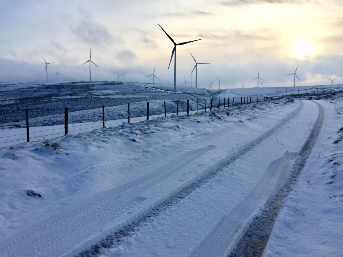
Top image thanks to @emmataylor12 East Lothian
More chat and discussion in the Netweather Forum Storm Christoph thread or Flood watch