Storm Christoph - Heavy midweek rain brings the risk of flooding for Wales and England, mild and blustery but colder to the north. Then UK gales and snow into Thursday.
Quite a week of UK weather coming up. Heavy and persistent rain bringing the risk of flooding with particular concerns for northern England and Wales. Then a significant deepening low looks to produce gales, and snow for the north as it moves over the UK during Wednesday night and Thursday. The contrast north-south of cold to mild air will bring wild conditions across the UK by early Thursday.
Update- This week's severe weather event has now been named Storm Christoph by the UK Met Office
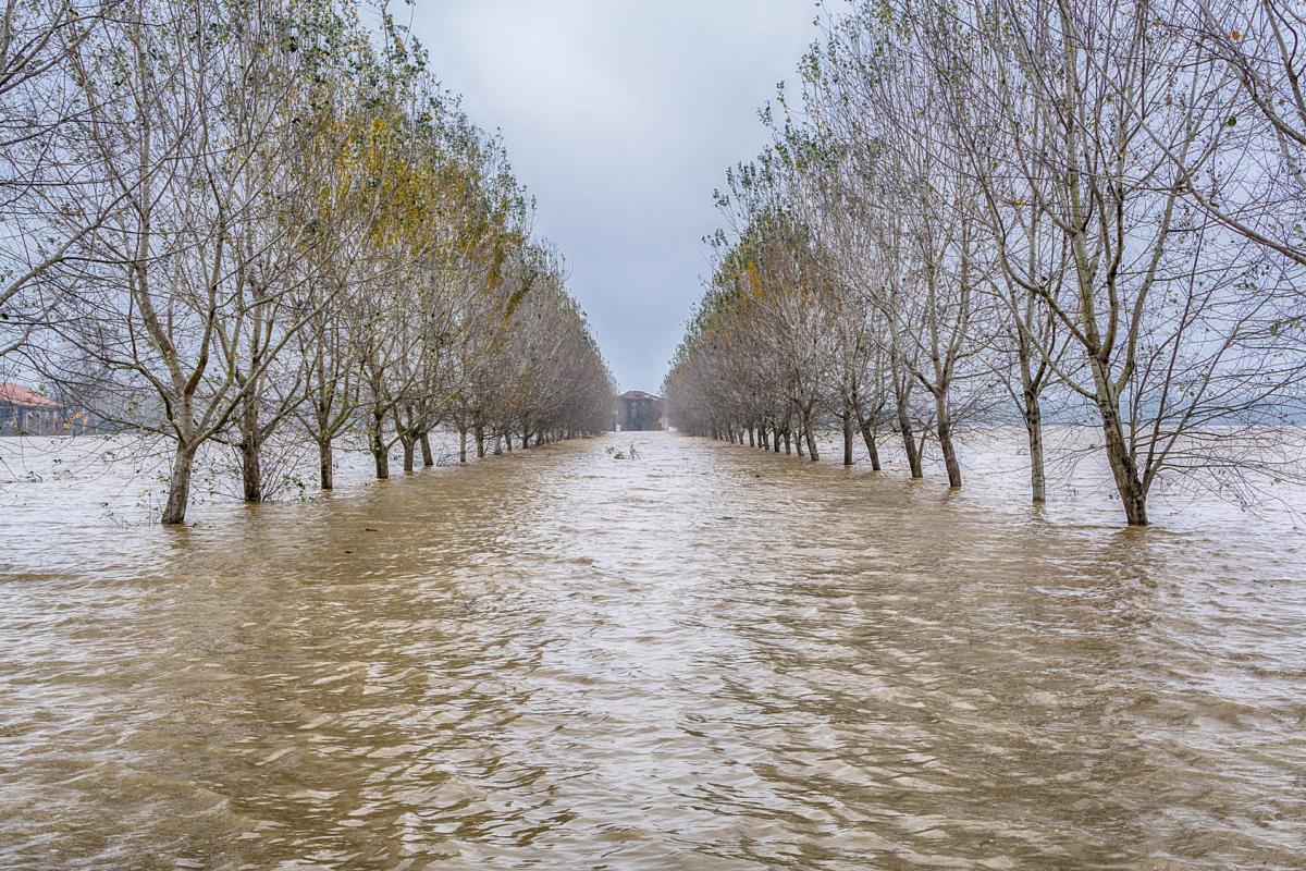
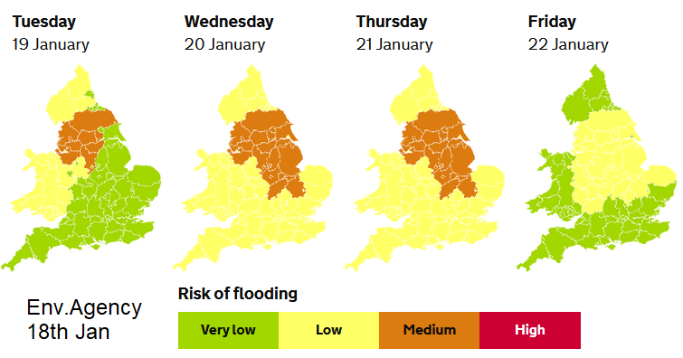
The Environment Agencies are warning of local river and surface water flooding for northern England and Wales during Tuesday and then expanding the risk more widely across England for Wednesday and Thursday. People making essential journeys should take note as there could be travel disruption.
Today
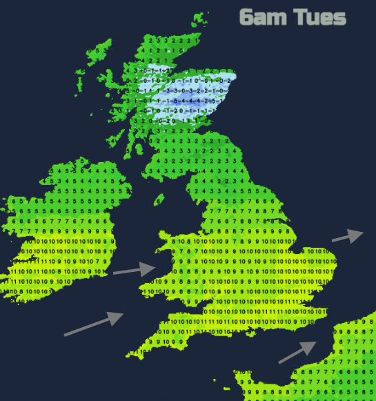
Temperatures today range from 5 to 9C. Feeling colder for coasts exposed to the westerly breeze but milder for southern and SW England. The day is a bit mixed although many areas start off fair and bright even sunny in the NE. There is a feed of showers into western Scotland, an old frontal band over NW England bringing more cloud and some damp weather. A new band of frontal rain is approaching SW Britain this morning with cloud and patchy light rain already over Wales and southern England. In the westerly flow, there will be rain from the front over Wales and SW England from lunchtime into the afternoon. This shouldn’t reach Northern Ireland until this evening so a fair day here with the odd shower in the far north. Quiet across the rest of England and eastern Scotland but the showers keep going particularly for NW Scotland with snow over the mountains.
A heavier cluster of showers will move in for western Scotland and Strathclyde by teatime, wintry for inland hills but clear skies in-between so temperatures fall for Scotland tonight, with light winds and a frost. The warm front rain spreads over Northern Ireland, particularly for southern counties. This extends and stays over north Wales and northern England, particularly NW England into the Pennines and Peaks with a spell of rain further south with mild air.
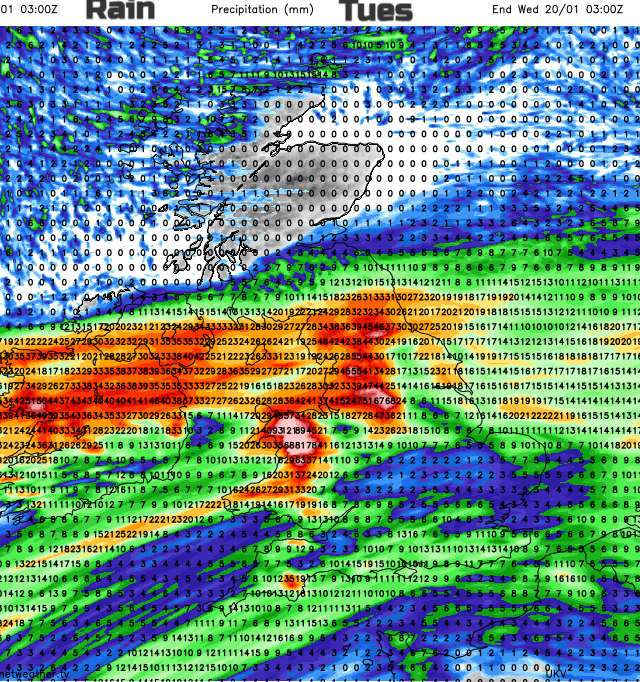
An amber warning for heavy rain is already in place for northern England “Heavy rainfall combined with some snowmelt across the hills is likely to lead to some flooding.” Met Office. Conditions over the hills look difficult with 50 to over 100mm of rain forecast and additional snowmelt.
You could cut the UK in half with blustery west to SW winds and mild air, temperatures around 10C and this band of persistent rain. To the north, it will be colder with hardly any wind and for much of Scotland, (away from the far south) and for the northern swathe of Co. Derry and Co. Antrim it will be fine and mostly dry. Later in the day, there could be snow settling for the southern Uplands, Cheviots and northern Pennines also the hills of Northern Ireland, although wet snow looks more likely here.
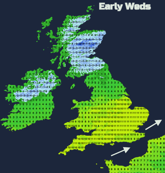
The frontal band edges southwards during Tuesday night with more heavy rain for Wales, NW and SW England. It turns colder in the north with ice, still mild and blustery in the south and the yellow warnings extend over all of England, still for Wales and the Amber warning continues.
There could be isolated rain totals of 200mm in this midweek episode, there really will be a lot of rain. Grampian could see rain with snow on Wednesday as the low pressure beings to deepen over the Irish Sea and the wet weather begins to pivot NE SW intruding into the colder air.
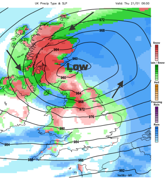
By the end of Wednesday into Thursday, the weather will be atrocious. Gales, even severe gales, more rain and snow. Already sodden ground and the low looks to keep deepening over the North Sea into Thursday afternoon. We await more warnings and possibly a name although there is still some uncertainty about the rate of development of this low. 'Christoph' would be next if the UK Met Office decide to name it. Then much colder for next weekend.