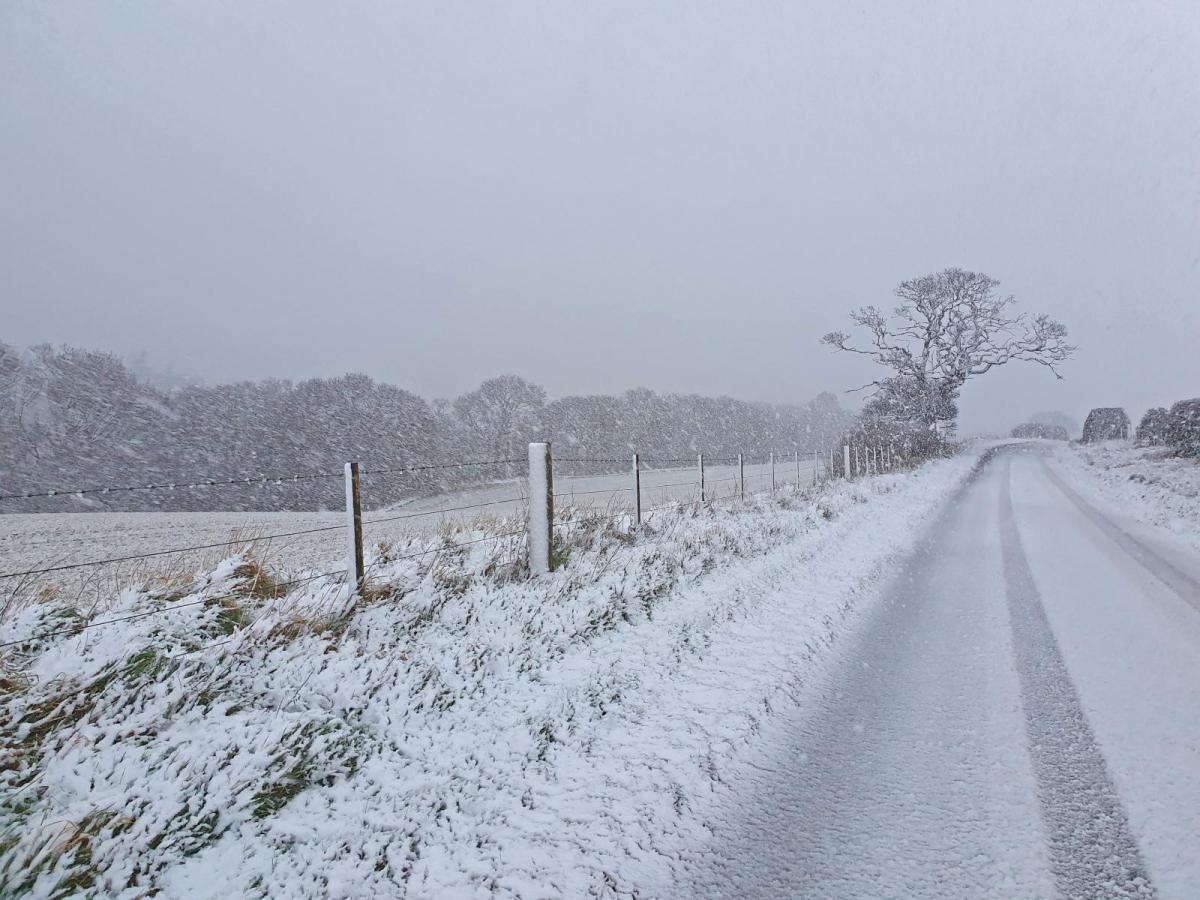
Some of you maybe wondering why it's failed to snow so far this week, despite yellow warnings for snow and ice issued for your area or mentions of a risk of snow in your area on the TV forecasts a few days in advance only for it stay dry with nothing falling out the sky. Or why there's been no warnings, despite snow falling and creating hazardous conditions. With regards to warnings issued but no snow forthcoming, nowhere has this been no more noticeable than across parts of southern England.
On Sunday, a yellow snow and ice warning was issued for Wales, central, southern and western areas of England for outbreaks of sleet and snow that were expected to spread southeast. Parts of the Midlands, the West Country and central southern England saw snow, settling over hills over SW England and south Wales but to lower levels further north.
But the snow never fell across large parts of SE England, including London and the Home Counties west of Kent and Essex - which were under the yellow warning in force. Though parts of Hampshire and Berkshire saw some snow. This is because the area of rain, sleet and snow moved southeast further west than models had originally indicated on Sunday, when the warning was issued,
Then on Monday, a large area, covering southern half of Wales, parts of the Midlands, southern England and much of East Anglia was issued a yellow warning fow snow and ice for 10am yesterday until 6am today. This was for a small area of low pressure modelled moving southeast off the Atlantic then east across southern Ireland, Wales and southern half of England
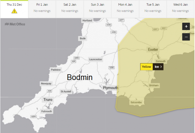
The ECMWF and UKMO models on Monday were certainly highlighting this happening, but, other models on Monday, such as GFS and ICON, took the low southeast further south across SW England then across the English Channel and on into France - this solution proved more correct in the end, with the snow and ice warning area shrunk southwards on Tuesday a day before, as the models continued to show a more southerly track of the low moving from southern Ireland southeast across the far southwest and south of England. Then yesterday the warning was shrunk further to just an ice warning along southern England coastal areas.
The Met Office in their update warning above even mention that detail had been tricky to forecast for yesterday's precipitation in the south. There were other yellow warnings for snow and ice issued this week for the north and west, but generally these have been more close to the mark for where snow fell and settled. Though this morning their were issues of snow and ice closing the A30 over Bodmin in Cornwall, the road shut eastbound, with some stranded lorries. But there was no Met Office warning in place. There was one for ice further east over Devon.
One of the main issues in accurately predicting the track of the small lows and associated fronts bringing the rain, sleet and snow is that, in the example of yesterday's tricky to track low, is that it is not being steared by the jet stream, which is well away from the UK,. Because the steering flow directing these low tends to be lighter and more meandering - there is greater margin for error from models with the track of these lows a few days or more out.
Also, some places saw rain or sleet rather than snow falling, while 5 or 10 miles up the road it was snowing. The airmass this week is rather marginal for snow to fall at lower levels, so localised changes in surface flow, dew point or temperature, i.e. less cold flow developing from the sea, or heavy precipitation leading to cooling of the air (evaporative cooling) lowering the snow level, can make the difference between rain or snow falling.
In such a marginal cold airmass for snow, the further inland a location is from the warming influence of the sea is, the more chance for snow to fall and settle too. Coastal areas tending to see rain or sleet while 10 miles inland it could be snowing. Elevation in these marginal situations can make a difference too. When the air is dry, the temperature, when there is no inversion, generally decreases 1 degree C per 100m height gain. When wet, the rate is 1 degree C per 200m. So an average of say 1 degree C per 150m.
Colder polar air, which swept in from the northwest behind Storm Bella Boxing Day night, will linger for the rest of this week and it looks to stay cold well into early January, certainly through much of next week and perhaps beyond. This is because the UK will be stuck in a trough in the jet stream - the trough covering much of Europe acting like a sump for cold air from the north and northeast to sink into.
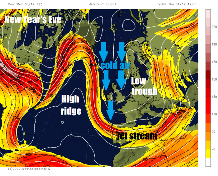
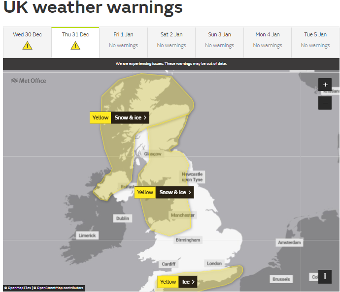
The jet stream this week is highly amplified and loops north from NE Canada over Greenland, before dropping south to west of Ireland before swinging east across Iberia and the Mediterranean. A blocking ridge of high pressure over the North Atlantic inside the loop of the jet stream to the west of the UK, while the trough of low pressure is close to the east of the UK - this will bring a northerly flow today and tomorrow. An occuded frontal system moving south will bring rain, sleet and snow south across northern areas today, while wintry showers continue across western areas, any snow increasingly becoming confined to hills, with Met Office warnings in force for snow and ice. Showers of rain, sleet and hill snow continuing south on New Year's Day, though tending to turn lighter when they reach the south.
Over the weekend, some changes in the jet stream loop to the west, which will buckle northeast towards northern Scandinavia, allowing a ridge of high prressure to build northeast between Scotland, Iceland and Norway. This means winds will veer more northeasterly over the weekend, So this will change the distribution of showers, so showers over the weekend becoming more concentrated to eastern coastal areas, but some getting further west on Sunday too. Showers mostly of rain near eastern coasts, but perhaps a wintry mix inland with snow mostly over hills.
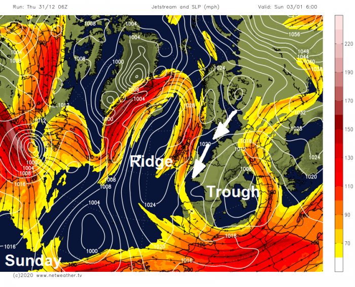
Winds veering easterly next week, often a cold or very cold wind direction this time of year, it will be a cold wind, but not as cold as the Beast From The East we saw in early March 2018, due to less cold air from SE Europe mixing with the colder air over eastern Europe where the easterly is sourced next week.
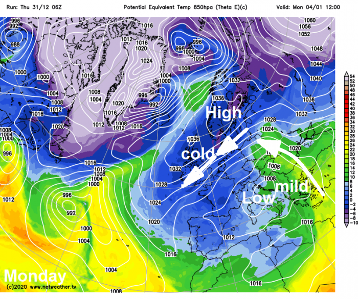
The cold and dry easterly flow will pick up moisture over the North Sea and generate showers which look to affect eastern coastal areas, for now these showers look to be mostly of rain, as the air will not be quite as cold after it's journey over the relatively warmer North Sea, which is around 2C warmer than average. However, over high ground, more particularly in the north, showers may fall as snow.
Loading recent activity...