


A look back at October, which was dull and wet for many, with over 200% the average rainfall in parts of the east. Looking forward too to the prospect of drier weather next week.

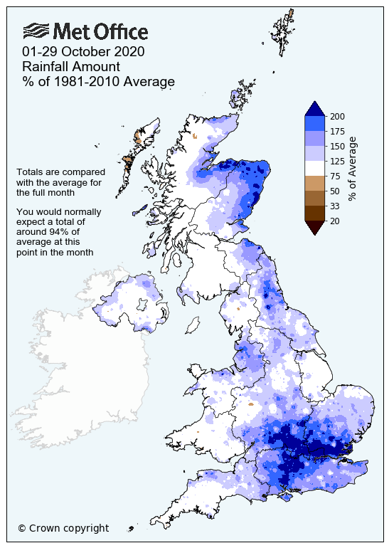
October was generally a dull and wet month across the UK. By the end of the month, southeast England had received over 200% of the long-term average rainfall for October, this compared to only around 50% of the LTA in September – which was a dry month across many areas. In October, central and eastern England received over 170% of the long-term average rainfall. Also parts of eastern Scotland saw over 200% of the average October rainfall, particularly Aberdeenshire and Moray. Western areas of the UK have been average or slightly above the average, but eastern areas seeing well above average. However, given October is one of the wettest months of the year, it has still been very wet in the west too, just that the usually drier east has seen much more than normal for October.
01-29 October rainfall amount % of 1981 - 2010 average - source: Met Office
Saturday October 3rd was the wettest day over the UK as a whole, in fact it was wettest day on record since records began in 1891 for UK-wide rainfall. Rainfall that day was widespread across the UK, with average rainfall for the entire UK that day of 31.7mm. It’s quite unusual to have such a high average rainfall falling across the whole of the UK.
However, the good news is, after a few more days of wet and windy weather to come as we head into the new week, it looks like high pressure will arrive from mid-week and stick around until the weekend. Monday and Tuesday will feature a strong westerly flow, which will blow through showers or longer spells of rain across most areas, while turning preogressively cooler too.
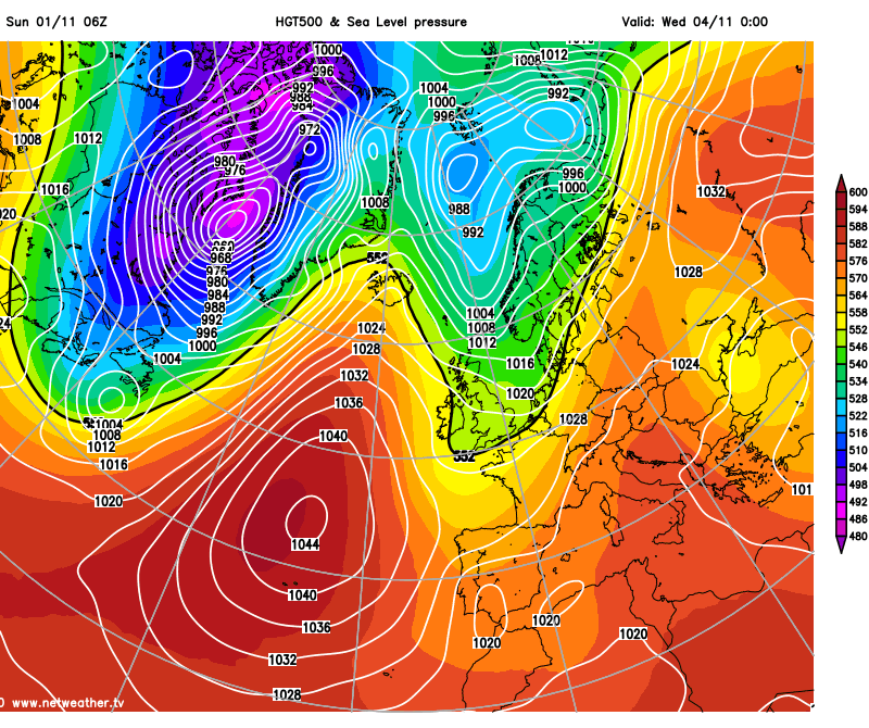
Watch high pressure build in across the UK from Wednesday before retreating east by the weekend:
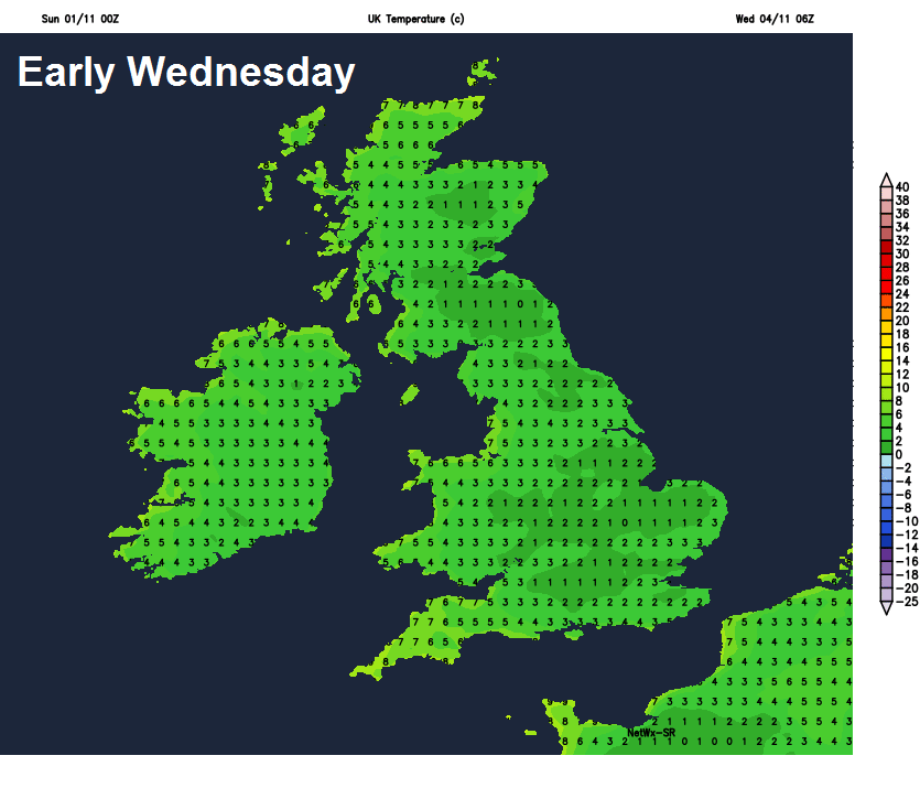
However, on Wednesday, high pressure will start to build from the west, killing of the showers by the afternoon, while becoming drier, sunnier and less windy. Mainly dry, bright and calm conditions, as high pressure builds across the UK from the west, look to prevail on Thursday and Friday. As skies remain clear at night, it could turn quite chilly, with a frost in places. So perhaps need to wrap up for the family bonfires or fireworks. But at least it’ll be dry.
Chilly mornings, with risk of frost, from Wednesday
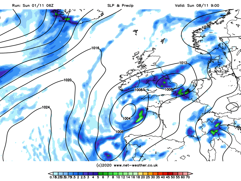
There is uncertainty how long high pressure will hold on. For now model guidance suggests the ridge of high pressure lying over the UK late in the week retreating east to allow an upper trough moving out of Canada across the North Atlantic to merge with an upper low off SW Europe to join forces and push low pressure northeast into the Bay of Biscay then towards southwest Britain next weekend. This could bring a return of unsettled conditions to England and Wales, with areas of rain or showers pushing up from the south. But it will also be rather mild for early November, with the flow from the south. However, this return to unsettled conditions is not set in stone yet, high pressure may hang on for longer, keeping low pressure and its rain bearing fronts at bay to the southwest.
Turning unsettled again next weekend?
But, a welcome respite next week from all the rain and wind we’ve seen recently, but it may not last more than a couple of days for some.


