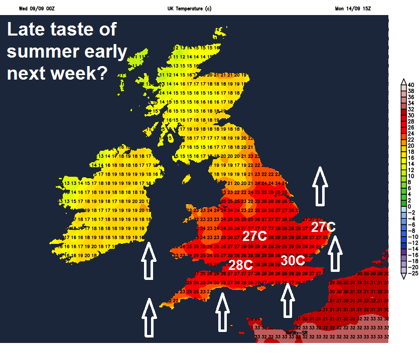
The weather will remain changeable in the north, mostly dry in the south, turning cooler for all for a time too, but signs of very warm weather returning to the south early next week.
The weather will remain changeable across northern areas for the rest of the week, with a risk of showers towards the west today and tomorrow, followed on Friday by a spell of wet and windy weather. Southern areas will see a band of cloud and patchy mainly light rain pass through today, but for the rest of the week it’s looking mostly dry and bright, but joining northern areas in turning cooler and fresher after today. The weekend will remain unsettled across the north, will spells of wet and windy weather, particularly later on Saturday and overnight into Sunday morning. Southern areas remaining dry and bright, increasingly warm and sunny on Sunday, as high pressure builds. Warmer still early next week, as southerly flow develops, temperatures perhaps reaching the mid to high 20s Celsius across southern areas, perhaps 30C in the southeast. So a late taste of summer returning for some.
Yesterday was a warm and muggy day in the south, particularly where the sun came out, with 26C reached in Cambridgeshire. The warm and humid air will hang on across southern England today, ahead of a weakening cold front moving southeast across England and Wales, currently bringing some patchy light rain or drizzle across Wales and northern England – which will continue southeast across SW England, Midlands and eastern England this morning, then southern areas of England through the afternoon. Some sunshine for SE England ahead of this cloud and dampness, but clouding over later this morning.
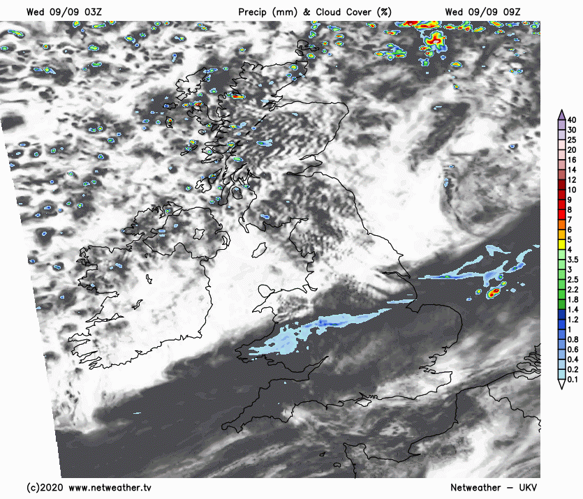
Brighter, cooler and fresher conditions across Scotland, N. Ireland today, though with showers across western Scotland. These brighter but cooler conditions feeding down across northern England and north Wales through the morning, then the rest of Wales, Midlands and East Anglia through the afternoon, as that cold front clears the cloud and dampness into southern England. Cloud and patchy drizzle not clearing SE England until the evening.
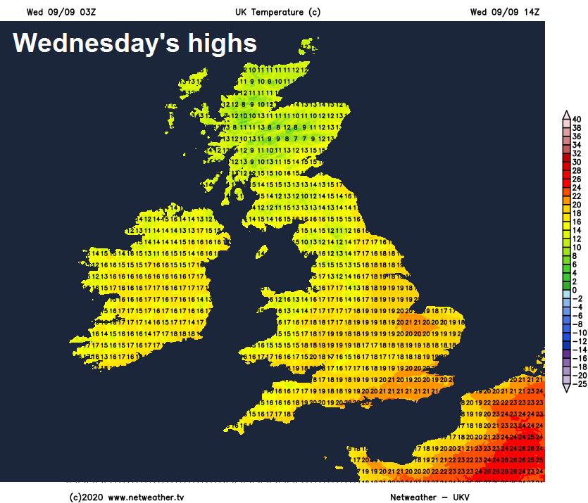
Temperatures this afternoon reaching 21-24C across southern England and East Anglia in the warm and humid air hanging on here until this evening. Temperatures will reach 16-19C elsewhere, as the cold front clears south and introduces cooler and fresher conditions from the northwest.
Showers across the northwest will generally die out overnight, though perhaps a few continuing around coasts and islands of western Scotland, with most areas having a dry night with clear spells. Turning chilly by dawn as a result, with a few mist patches forming in rural areas.
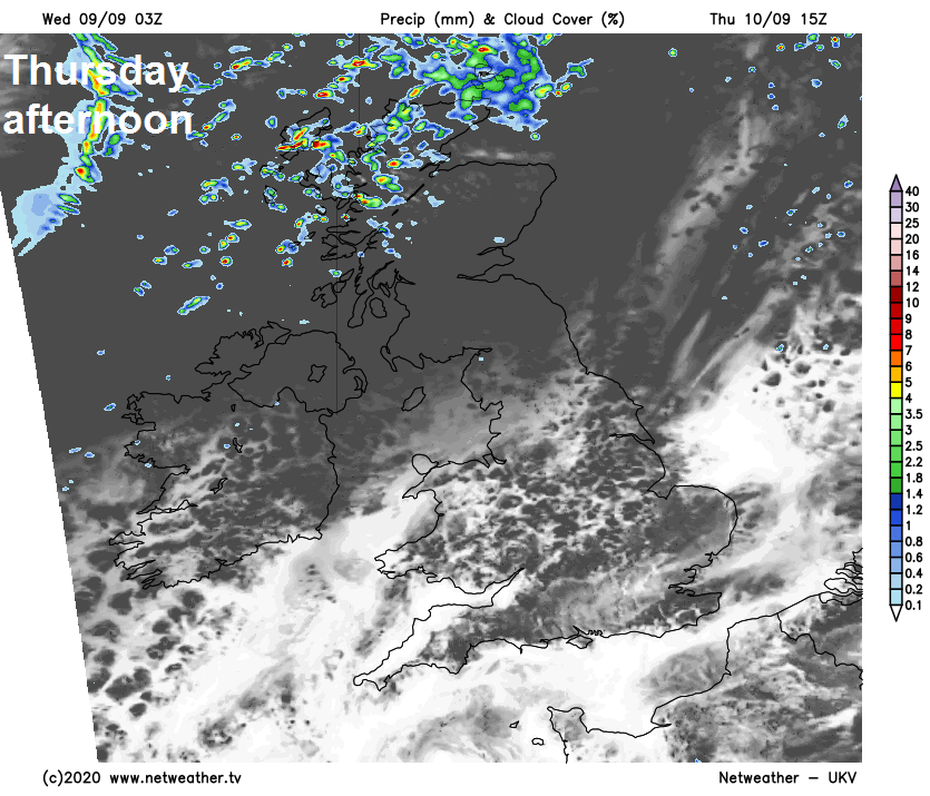
Cloud thickening and turning breezy from the west through the morning across northern areas on Thursday, with showery bursts of rain developing across Scotland and Northern Ireland, drizzle across NW England, perhaps merging into longer spells of rain across NW Scotland. Elsewhere across England and Wales, mostly dry with high pressure building, with variable amounts of cloud and sunny spells, though perhaps turning cloudier in the west later. Cooler and fresher for all, afternoon highs reaching 14-16C in the north, 16-19C in the south.
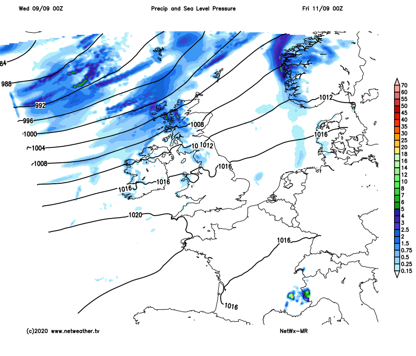
Then Friday will see a deepening area of low pressure move in near Iceland push a band of heavy rain and strong winds along a cold front southeast across northern areas through the day, clearer but windy conditions following, with blustery showers in the northwest. Southern areas staying mostly dry, after a sunny start, generally clouding over from the west, perhaps with some drizzle over western hills, sunny spells hanging on longest across SE England. Temperatures reaching 14-17C in the north, 17-20C in the south.
Weekend dry and bright or sunny across the south, best of the sunshine on Sunday when it will be a little warmer too, perhaps locally mid-20s Celsius in the southeast. Northern areas unsettled and windy, showers at first in the west on Saturday giving way to a spell of more persistent rain from the west through the afternoon and evening, as an area of low pressure moves northeast close to northern Scotland. Rain heavy across western Scotland. Cloudy at first across the north on Sunday with further spells of rain in the far north and northwest, before easing to drier and brighter conditions from the southwest through the afternoon.