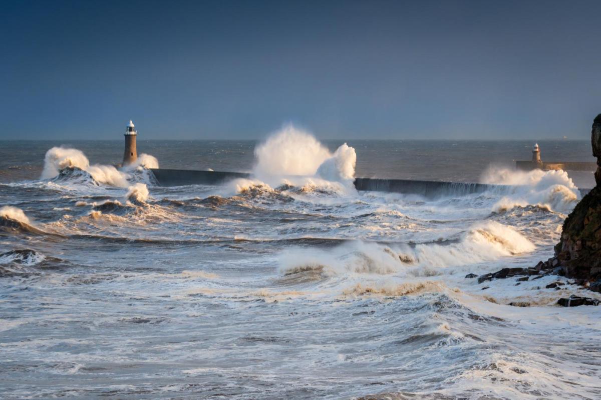
Lovely summer's day out there. Plenty of rain and strengthening winds with sudden gusts. This is Storm Francis, clearing eastwards on Wednesday but do take care in the wind and rain today.
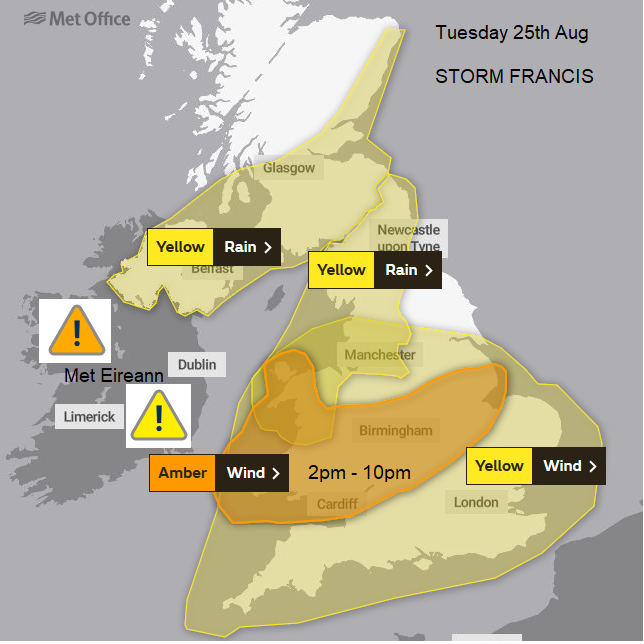
Update to include Amber wind warning.
Tuesday is starting off wet and blustery for many parts of the UK after a wet night for Ireland where there was heavy rain. A deepening Atlantic low has been named Storm Francis and it will continue to bring heavy and persistent rain along with strong winds and gusts swirling around the low centre.
For some, this will be about the rain and so flood risk and for others the wind, unusually strong winds for the time of year and the risk of falling trees as they are in full leaf and soggy. A rainstorm or a windstorm, these names are used to highlight an event, to bring severe weather to the publics attention and create an information topic - #StormFrancis.
The wind warning is over England and Wales, but not the far north of England. The low centre will move across here and so winds will be lighter. The strong and gusty winds continue all day and overnight. The SW winds strength first for SW England and Wales, along the English Channel coasts this morning. By this afternoon it will be windy across southern Britain with strong westerly winds battering west Wales with large swell and waves. There are already warnings and alerts for the south coast of Wales and the winds will run right along the Bristol Channel as they veer today.
Do take care if you are at the coast or in the hills and mountains, the weather will be much improved tomorrow. Cardiff will feel fresher once the rain clears at 18C this afternoon. London will feel quite warm for a time, even with the rain and wind up to 22C. The main rain band continues to push eastwards this morning, out into the North Sea. Behind this it stays unsettled with a fair amount of cloud, a few showers for southern and eastern England and the gusty winds. Heavier showers swirl in for Wales, the Midlands and northern England, especially the NW as the strong and gusty winds continue into the night for the southern half of Britain, veering slightly further.
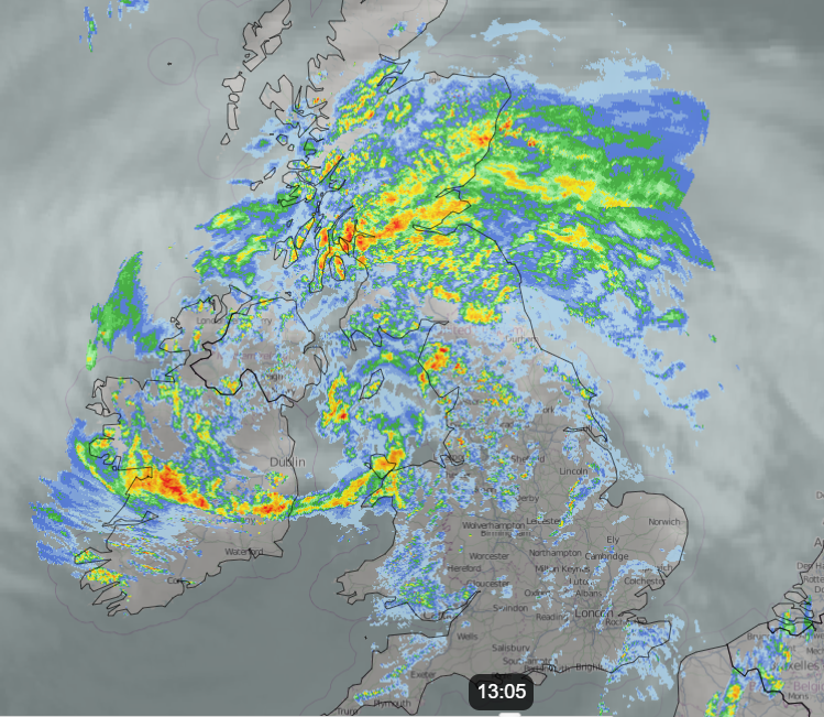
So, the rain. The frontal band of heavy rain has worked its way over Ireland and Wales last night into Northern Ireland, northern England and southern Scotland, over the Isle of Man and draping down over central and eastern England, continuing to pivot eastwards. The northward motion is slowing down but not stopping. So, there will be several hours of heavy and persistent rain which is why there are flooding concerns. Farmers who have started harvesting will be waiting, glad for what has been done but wondering about what hasn’t.
Northern Ireland starts the day with heavy rain and blustery winds, gusty through the North Channel and Irish Sea. The worst of the rain sets in for southern Scotland as the easterly winds pick up and become gusty. An unusual direction through the Central Belt.
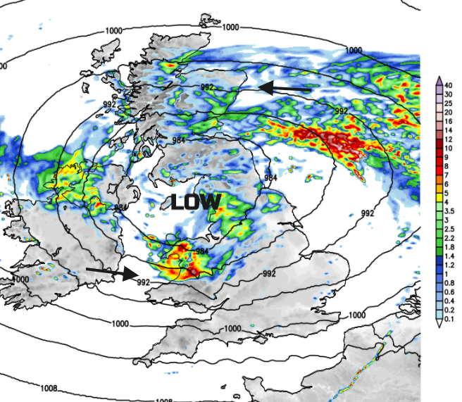
The low centre is going to creep from Northern Ireland across to the far north of England and south of Scotland, here there will be lighter winds. The rain band rotates up the east coast of Scotland into Grampian and things turn showery in the centre of the low and in the northerly flow which follows.
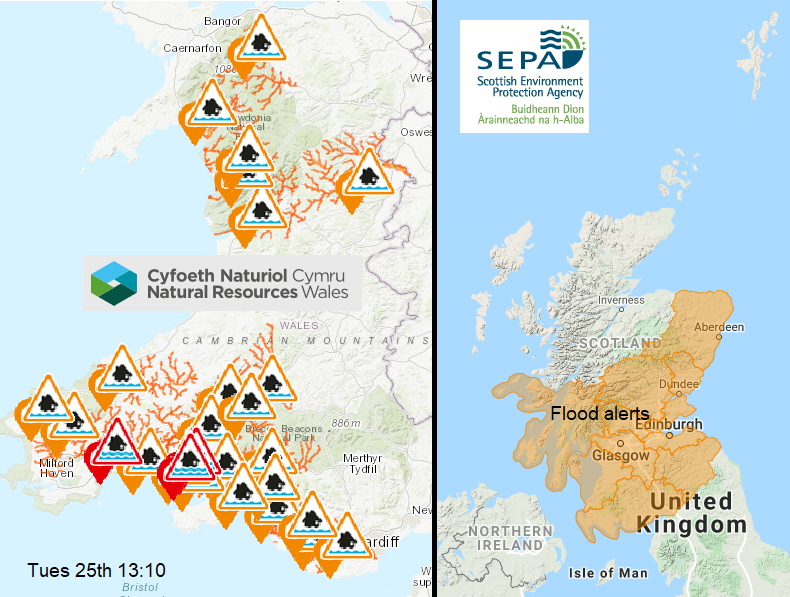
All of this has led to flooding concerns from the various Environment Agencies. Southern and eastern Scotland, Wales and NW England through the Pennines into Northumberland looking particularly at risk.
Gradually the winds back to a more northerly direction during Tuesday night and rain moves from Northern Ireland to NW England, the flow along the east coast of Scotland will be gusty as lingering rain moves down into NE England for Wednesday morning. The winds will ease as the low clears but first thing on Wednesday it will be windy for North Sea coasts, drier for most of UK but still outbreaks of rain for far north of England and southern Scotland. Better by the afternoon with temperatures in mid-teens in north, lows 20sC in south.
A brief respite then more unsettled weather on Thursday which could linger for eastern England into Friday evening. Then signs of high pressure and more settled conditions for the weekend, a long weekend for some.