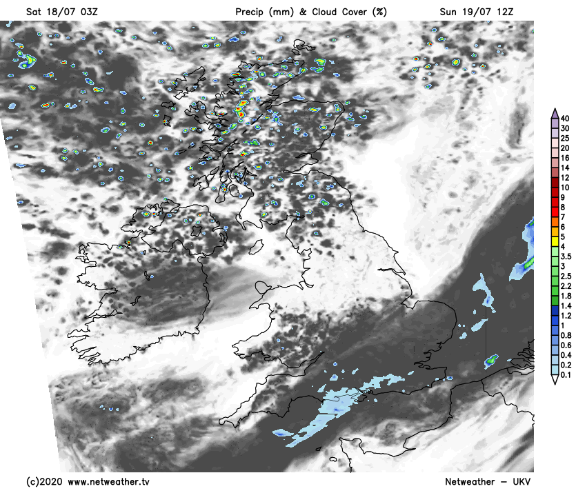
A front bringing a band of cloud and generally patchy rain is moving south across the country this weekend. It's warmer and sunnier of it, fresher with sunshine and scattered showers behind it.
As a cold front gradually slides south across the country this weekend, it's just the south and East Anglia left with the very warm air on Saturday. The front itself has just about cleared Scotland and will affect Wales, Northern England, and the Midlands during the day.
By Sunday, it'll be the turn of southern and particularly southeast England to see the cloudier skies and outbreaks of rain, as other parts see fresher air, sunny spells, and a scattering of showers, which will chiefly affect the north and west.
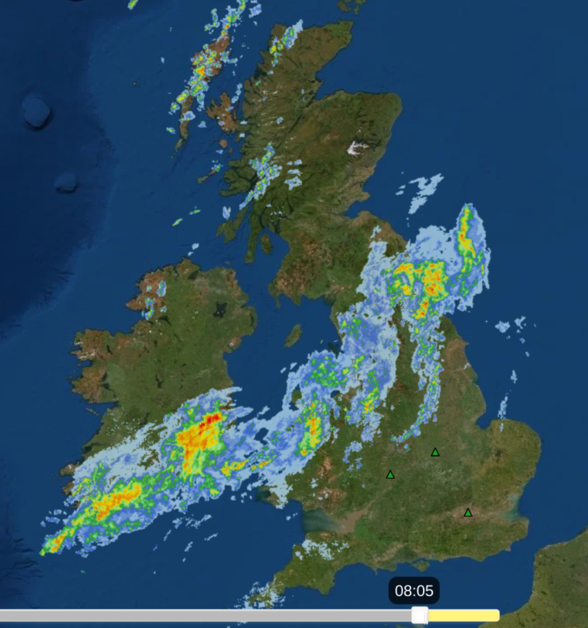 The rain on Saturday morning - check the live radar here.
The rain today will become patchier and lighter as the day wears on, although there could still be some heavier bursts around into the afternoon. Overnight, as it moves through the Midlands and East Anglia, and into southern England it's likely to perk up for a time again with some thundery downpours likely. Then, into the start of Sunday, it'll ease back again for a time, with a threat of some sharp downpours in the southeast during the afternoon.
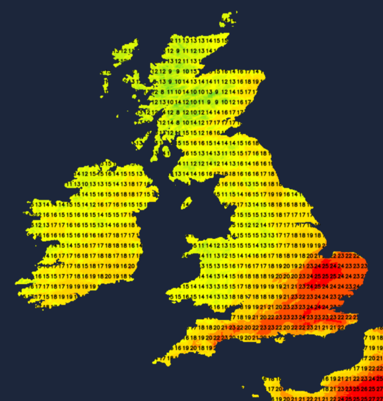
Temperatures on Saturday will peak at 24-27c across southern and southeast England, including East Anglia. 15-19c will be typical elsewhere, with the lower end of that scale in western parts of Wales and Northern England under the thicker cloud. Overnight, it stays muggy in the southeast but cooler and fresher elsewhere with lows dipping into single figures from northern England northwards.
By Sunday, a good part of England and Wales will see highs rise to 18-21c under often sunny skies. The southeast, with more cloud, will be cooler, as will Scotland and Northern Ireland with the mid-high teens more likely. The sunshine will be interrupted by showers at times across the northern half of the UK though, and that southeast corner will stay under the front with patchy, showery rain coming and go through much of the day.
Looking ahead to the start of next week, the friend of UK summers; the Azores high will ridge in from the southwest, so there'll be plenty of fine, dry and warm weather. It'll struggle to exert its influence to northern Britain at times though, with weather fronts bringing some rain in from the northwest on Tuesday and into midweek.