


The rainfall radar across southeastern England yesterday showed an interesting motion of the rainfall - with an east to west movement generally across southern England, Midlands and East Anglia, but southern counties of England showing brighter rainfall echoes moving northeast or east.
The rainfall radar across southeastern England yesterday showed an interesting motion of the rainfall – with an east to west movement generally across southern England, Midlands and East Anglia, but southern counties of England showing brighter rainfall echoes moving northeast or east.
The broadscale motion of rainfall appeared to be east to west, the synoptic rainfall created by dynamic lift along the occluded front lying east-west across central areas and also wrapping around the low across the west. This dynamic rainfall likely falling from mid-level stratiform / nimbostratus rain-bearing clouds between 700-500 hpa, but with some embedded elevated convection, and moving with the east to west with easterly mid-level flow across much of central and southern England.
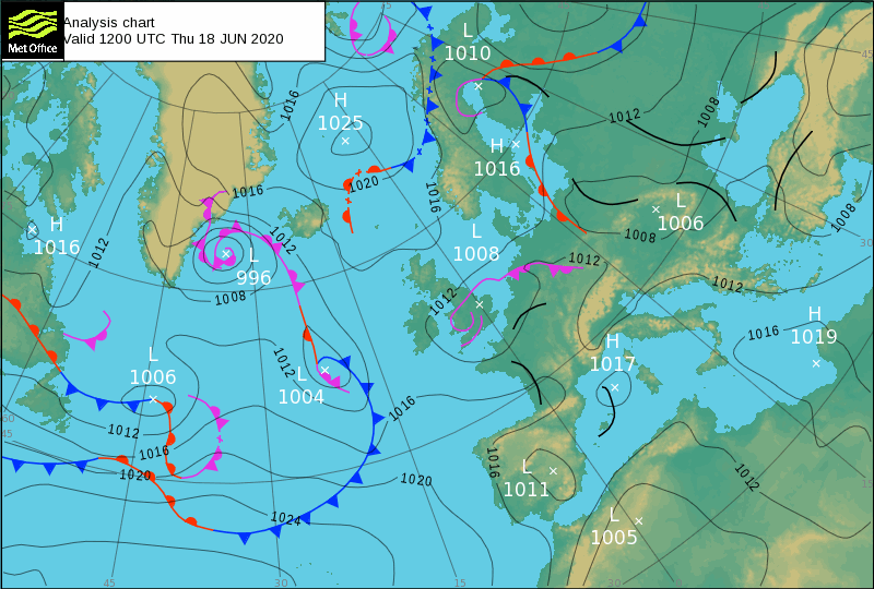
Met Office synoptic analysis for 12z Thursday 19 June 2020
However, across southern England, mainly M4 corridor / North London southwards – there are pockets of stronger rainfall moving northeastwards.
One explanation for this could be surface-based deeper convection feeding off moist and unstable low-level southerly flow across southern counties being forced to rise as it encountered opposing surface easterly flow further north, creating surface lift along a surface breeze convergence zone, thus supporting cumulonimbus clouds to grow deep up into the nimbostratus cloud deck above but these deep convective clouds and its rainfall moving with southwesterly winds between 950 hPa and 700 hPa.
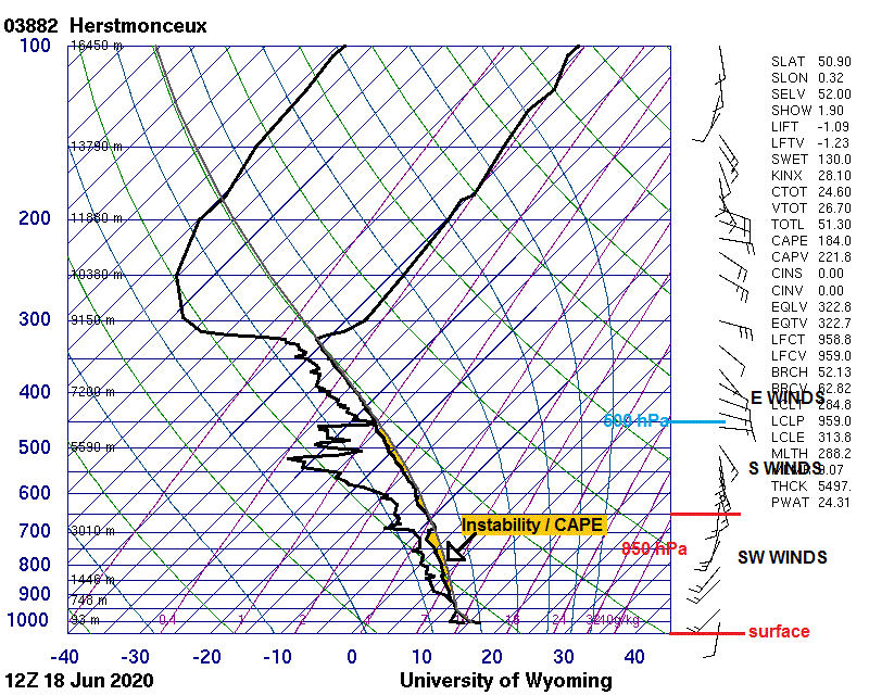
Winds from the surface to around 700 hPa from the southwest yesterday morning to early afternoon on noon Herstmonceux radiosonde ascent (below) - but up around 500mb winds from the east. This indicating clouds at different heights moving different directions, and thus rainfall falling at different heights similarly moving different directions
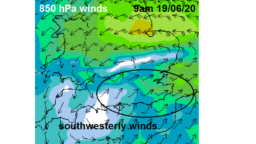
GFS 850mb winds for 9am Thursday morning show southwesterly winds at this height across southern counties where surface based convection developed and moved northeast.
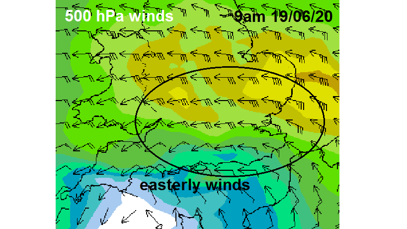
GFS 500mb winds for 9am Thursday morning show easterly at this height widely across England including southern counties
So in essence, different steering winds at different levels can lead to rainfall falling at different levels moving in different directions. In yesterday’s case highlighted, heavier rainfall of deep surface-based convection was being picked up by the radar falling at lower levels and spreading northeast out the bottom of low-based towering cumulus moving in the same direction. While rain out of mid-level mostly nimbostratus cloud base higher up (with shallow convection embedded) was moving west. The radar across southern England picking out light to moderate rainfall moving west in between the heavier convective bursts of rain lower down moving northeast, giving the perception of heavier bursts of rain with brighter echoes on the radar moving different direction to wide-scale lighter rainfall moving west.


