The weather is now into an unsettled spell with showery rain for many today, turning heavy & thundery across the southwest later. Thundery showers continue for many thereafter, with warmer and more humid continental air arriving into the weekend.
It will be unsettled at times over the next few days, with a chance of some rain for most. An area of low pressure will drop south close to the west of Britain today, bringing a rather cloudy day for many, with most seeing some showery rain at some point, rain turning heavy and thundery later across SW England and Wales. The same low will continue to drop down into the Bay of Biscay tomorrow, deepening as it does so, before swinging back north by the end of the week. Fronts and troughs rotating around this low will bring further thundery showers or longer spells of rain from the east on Thursday and Friday, along with a strengthening easterly wind, though Scotland and N.Ireland will stay mostly dry. However, the wind will ease as we head into the weekend, while it will turn warmer and more humid, though there will still be heavy and thundery showers around, especially on Saturday.
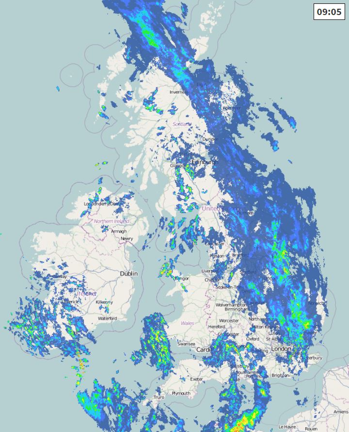
For now, a cloudy and damp morning for many, with two weather fronts, one bringing outbreaks of rain across southern and eastern areas, the other front bringing showers in across the west. Perhaps some drier conditions and some brightness in between these two fronts.
As we head into the afternoon, some increasingly heavy and perhaps thundery downpours developing across SW Scotland, N. Ireland, Cumbria, Wales and down to SW England, as the slowing front moving in from the west re-activates. Some localised flooding is possible from the heavier downpours. Further east across eastern Scotland and eastern England – a slow-moving front here too will continue to bringing showery outbreaks of rain here, turning heavy locally across eastern and southeastern England, perhaps with the odd rumble of thunder. Parts of the Midlands and central southern England along with the far north of Scotland could stay dry and bright.
Temperatures today rather disappointing for early June, below average across many parts, highs this afternoon reaching 11-14C across Scotland and N. Ireland, 14-17C across England and Wales.
Outbreaks of heavy rain with embedded thunder spreading south across Wales and SW England this evening and overnight, with a continued risk of localised flooding in these areas. Elsewhere across England a generally cloudy night with further showers likely almost anywhere, these turning heavy towards the east by the end of the night. Becoming mostly dry with clear spells across Scotland, N. Ireland and the far north of England.
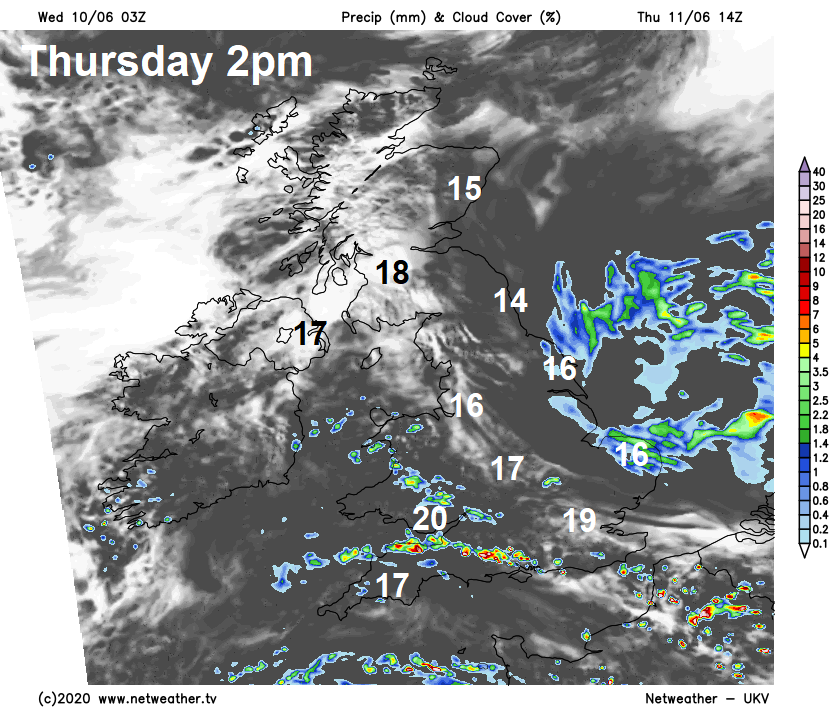
Mostly dry across Scotland, N. Ireland and NW England on Thursday, the best of the sunshine towards the west. Cloudier with showers spreading west at times across Wales, the Midlands, southern and eastern England, accompanied by a strengthening northeasterly wind, showers turning increasingly heavy into the afternoon, with thunder locally. Some bright or sunny spells possible between the showers. A little warmer today, more especially towards the west, temperatures reaching 14-18C across Scotland and N. Ireland, 17-20C across England and Wales away from North Sea coasts where the brisk wind will mean temperatures will reach 13-15C at best.
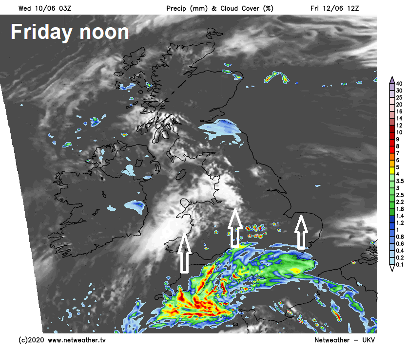
The low west of France tomorrow starts to move back north on Friday, pushing a band of heavy and thundery rain north across southern England, Wales, Midlands and East Anglia from mid-morning, before reaching northern England in the evening. A weather front lying across southern Scotland and NE England will bring outbreaks of rain here, in between these two areas of rain some sunshine but also a few showers possible. Windy but warmer and more humid, temperatures reaching 15-19C across Scotland and N. Ireland, 19-22C across England and Wales, though low to mid-teens along North Sea coasts with onshore wind.
It will remain warm and humid through the weekend, as we import very warm and moist air from the near continent. This and sunny spells will be the fuel for further heavy and thundery to develop on Saturday, especially across Wales and southern England, many places staying dry and sunny though. Further showers possible again on Sunday, mostly in the west, where they could be heavy locally, but many places staying dry and sunny. Temperatures both days reaching 17-20C across Scotland, N. Ireland and NE England, further south reaching 19-24C generally.