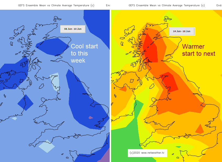
A quieter start to the weather this week before heavy, thundery showers return from midweek, bringing a risk of surface water flooding. More humid by next weekend.
The first week of June has certainly been different from most of the UK spring. It's been cooler, more unsettled and there has been rain. Downpours and thunderstorms in places over the weekend. There are further shifts this week with a more settled start as high pressure noses in, then a more showery picture by midweek, again with the risk of heavy thundery downpours. By next weekend we should be in a warmer more humid flow from the continent.
A cool start for Monday morning especially for the northern half of the UK, after a touch of frost inland for Scotland. The north wind over East Anglia and SE England will continue to clear away the overnight cloud and showers leaving a fair morning across the UK. One or two showers will still appear along North Sea coasts. A scattering of showers is forecast for SW England and south Wales but otherwise, it will be a quiet day with bright or sunny spells. With very light winds, you could still appreciate the sun’s June warmth, but air temperatures are subdued around the mid-teens. Inland, SW Britain could see higher with Cardiff at 18 and Bristol 19C. Norwich will only reach 14C as the north breeze continues.
Overnight it will be cool again with variable amounts of cloud, and temperatures dipping away under the clear spells with very light winds. As a low pressure moves towards Iceland, its weather fronts will spill cloud and then patchy rain into the Western Isles to start Tuesday.
A fair start with just more cloud about tomorrow and still very light winds. The day becomes more grey and even damp from the west. The frontal rain will move over the NW Highlands with a few showery bits ahead reaching eastern Scotland and NE England by late afternoon. The Met Office surface pressure chart shows this as an upper warm front. Eastern and SE England will be fine and bright with London up to 20C.
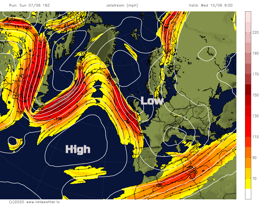
The fronts struggle to make much progress across the UK only clearing the Western Isles by late evening. As a stronger jet nears the UK, it will invigorate a low pressure and the weather becomes more unsettled. With an upper cold pool moving down over the UK, the jet stream guides the low southwards with more lively showers and heavy, possibly slow-moving showers with hail and thunder.
Wednesday will be a cool unsettled day with outbreaks of rain. Early in the day, these will be sharp over Scotland. A dig of cool north to NW air will keep temperatures down for Northern Ireland with plenty of showers in the breeze. These same frontal bands from the Iceland low will now move southwards over the UK as the low deepens once more. There will be brightness with temperatures up to 17 or 18C over England but then heavy showers.
During Wednesday night the low centre moves down to the Brest peninsula and the winds become brisk from the east or NE.
During Thursday the heavy showers will continue for England and Wales, becoming concentrated further south for a time. There will be a fresh NE Wind for England and Wales, light to moderate for Northern Ireland and Scotland where the weather will be more settled and drier.
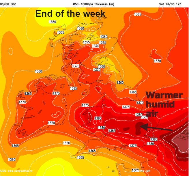
Cool again overnight as the winds back to the north. There is some uncertainty about the rain in the south as the low continues to churn west of France. It could throw more heavy downpours over southern Britain but whilst the cool upper pool remains to the SW of the UK, much warmer and more humid air will be pulled our way from Europe. This will bring some low cloud but could also result in heavy showers and thunderstorms. The warm, humid air shifts northwards through the UK during the weekend.