There's a significant change in the UK's weather on the way as the fine, warm weather is replaced by much cooler and less settled conditions.
Meteorological Summer has begun, and for a couple more days, it's more of the same with blue skies, sunshine and warmth. But, a significant change is on the way with less settled and much cooler weather, with temperatures dipping below normal from Wednesday onwards. There is even some rain in the forecast, remember that?
To start the week though, barring some early mist and fog in the east and some fair weather cloud popping up during the afternoon today, it's virtually blue skies and sunshine all the way. Temperatures will be warmest in southern, central and western parts again today, with an onshore breeze off of the North Sea in the east keeping it a touch cooler. Away from those eastern regions, maxes will be into the twenties very widely, with maxes of 25-27c.
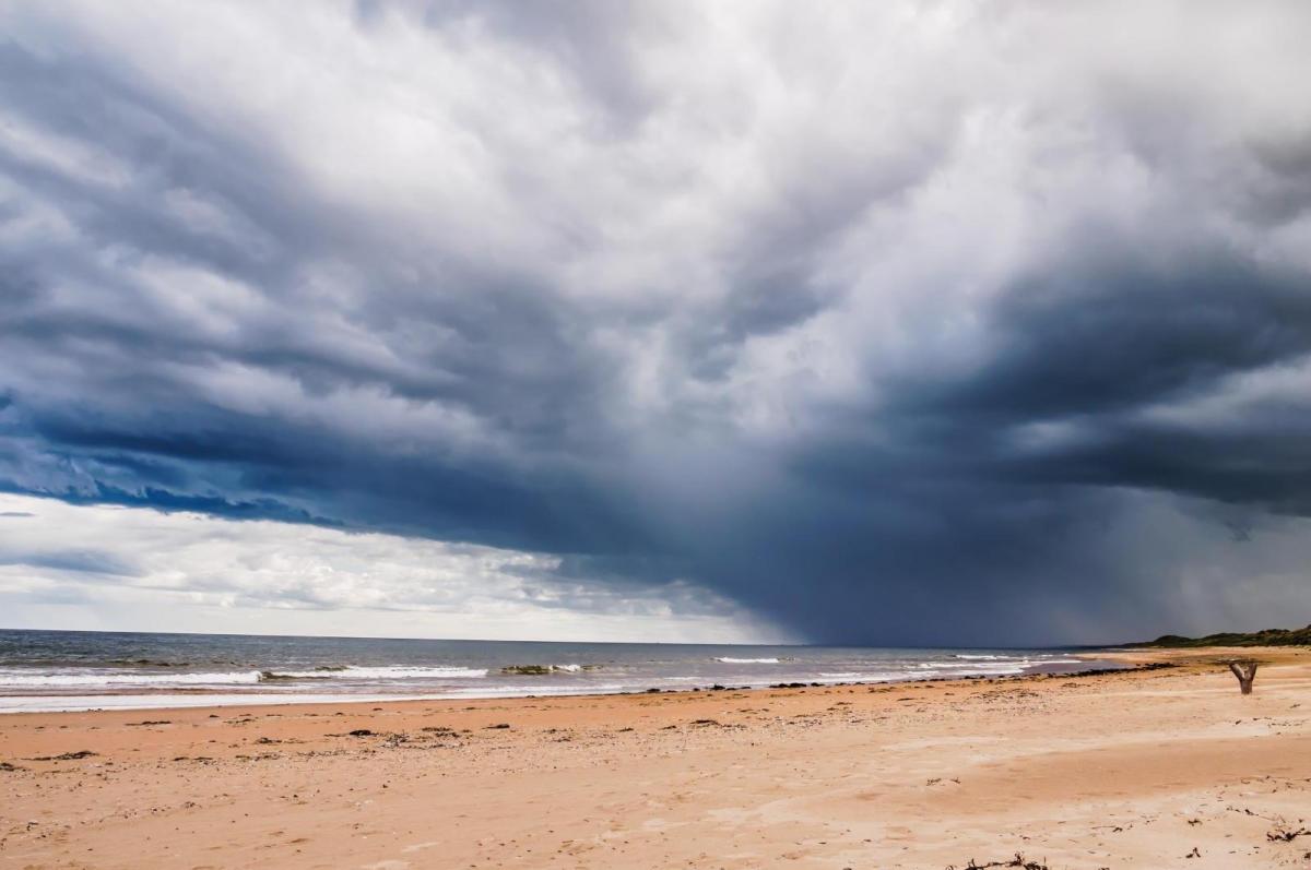
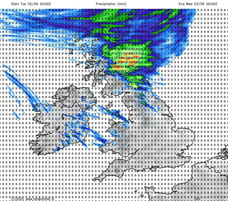
Tuesday will be the first day in a while where there is a bit more variety in the weather across the UK, with some rain and showers moving into Scotland as the breakdown begins. It'll be the north of Scotland seeing that wet weather first, before it spreads south and east during the day. There'll be some heavy bursts in amongst it, with some thundery showers also breaking out in the southeast and perhaps down into the northeast of England as well. The southwest of Scotland should stay out of it in the main and stay dry though. These are the rainfall totals for Tuesday - some parts of eastern Scotland could see 25mm or so.
For England and Wales, there'll be none of that sort of complication, with one final day of warm sunshine with highs again well into the twenties.
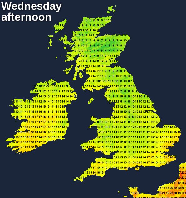
Overnight, the rain in Scotland continues south, moving deeper into Northern England. Ahead of it, showers will break out in parts of southern and central England, along with Wales. So, it'll be cloudier skies than we've been used to which greet us on Wednesday morning. There'll also be some heavy outbreaks of rain and showers, which'll be moving southeast through the day. Winds will have switched from warm, mostly gentle easterlies to much cooler and blustery northeasterlies, and that's going to make for a very different feel. Temperatures may just scrape the twenties in the far south of the country, but for most 12-16c will be about it, some 10c or so down on the day before.
The rain may take most of the night and maybe into Thursday morning to clear the southeast corner. Beyond that, it's another cool day, with sunny spells and showers. The same can be said for Friday as well, although by this point the showers may be more limited to eastern regions, with the driest, sunnier and warmest weather in the west. Although, even here it won't be anywhere near as warm as it has been, with maxes in the teens.
If you're wondering how long this cooler, less settled pattern may last - currently it's looking likely to carry on into next week. But beyond that, high pressure may start to make a re-appearance to settle the weather down and start to warm things up again. More on this in the month ahead forecast.