


Another week with high pressure in control in control of the UK's weather. Warm and sunny for most, with little or no rain.
It’s going to be a glorious Bank Holiday for many, with high pressure firmly in control allowing for a fine day with warm sunshine for most. The exception will be across the far northwest, which will turn cloudier with some rain later. High pressure will remain strong and centred over the UK throughout this week, with plenty of warm sunshine for many, any weather fronts moving in off the Atlantic weakening with little or no rain likely for most away from the far northwest.
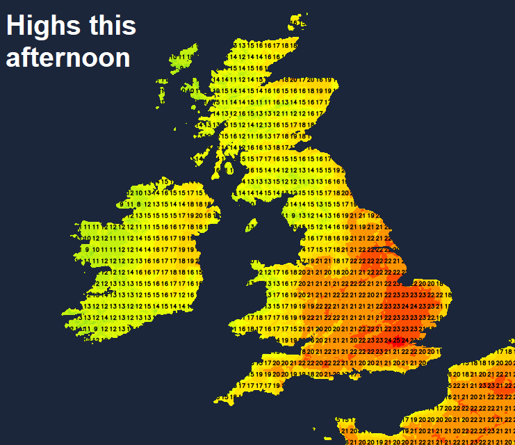
For now, it’s a sunny start for many, any early mist and fog patches quickly burning away. We will keep the sunshine across England and Wales, wall-to-wall blue skies for many, with temperatures this afternoon reaching 20-26C, the highest temperatures towards SE England. Cooler around coasts where there’ll be onshore breezes.
After a sunny morning, cloud will increase from the west across Northern Ireland, northern and western Scotland, with some rain and strengthening winds arriving across western Scotland, the north and west of N. Ireland this afternoon. Southern and eastern Scotland hanging on to some sunshine this afternoon. Temperatures here reaching 14-19C.
The cold front introducing cloud and rain to the far northwest this afternoon will continue to slide southeast across northern and western areas tonight, but weakening as it moves into high pressure centred towards the south. So cloudier skies spreading from Scotland and N. Ireland southeast across northern England and Wales through the night, with patchy light rain or drizzle in places. Staying dry with clear skies further south.
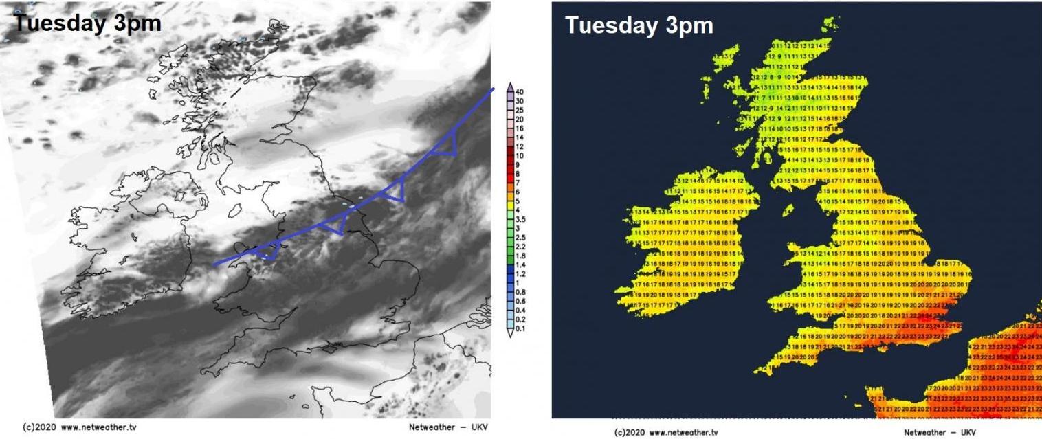
More in the way of cloud on Tuesday, especially across central areas, as a weak weather front stalls here, with some patchy drizzle and fog over western hills and coasts. The best of the sunshine across SE England, Scotland and N. Ireland. Very warm again across southern and eastern England – where temperatures will reach 23-26C, elsewhere across England and Wales reaching 17-21C. Scotland and N. Ireland fresher and cooler with highs reaching 14-17C.
High pressure slap bang on top of the UK on Wednesday, so dry with plenty of sunshine for many. Cloudier across N. Ireland and northwest Scotland – with rain arriving in the far northwest of Scotland later. Very warm across south Wales and southern England – with temperatures reaching 25-26C, elsewhere across England and Wales reaching 20-24C, but an onshore breeze along North Sea coasts keeping temperatures in the teens. Cooler and fresher for Scotland and N. Ireland – with highs between 14-18C.
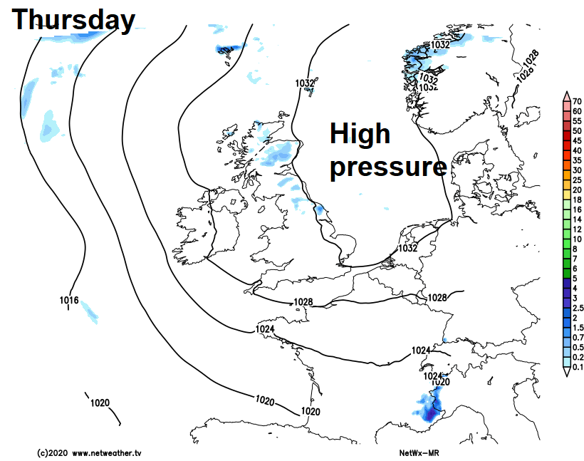
Little change as we head through Thursday – dry, sunny and warm for many – the exception perhaps across northern and eastern Scotland – where we may see a few showers. High pressure retreating to the east by Friday, but still close enough for dry, sunny and warm conditions to continue for most, temperatures by Friday afternoon widely in the low to mid-twenties as winds turn southerly. Perhaps a few afternoon showers possible in the north.
With warm southerly breeze continuing next weekend, we could see temperatures reach the high twenties Celsius across the south – where we will see the best of the sunshine. Perhaps more in the way of cloud across the north, with some showers possible.


